Welcome to David and Janet Ribbans blog

We live in Adelaide, South Australia and enjoy travel in the Australian outback in our Oka 4WD motorhome, hence the blog title.


To quickly locate any of our more than 80 travel and technical articles, use the drop down menus below or scroll down the lists in the right hand sidebar. But please read the disclaimer first, we've tried to be accurate and current but things can change...
You can also visit the official Oka 4WD website here.

Pandora Web Archive


We're now honoured to have our blogs archived
on the National Library of Australia's Pandora Web Archive.
Bookmark this link to the archived version in case anything ever goes wrong with Google, or I accidentally hit "Delete All" in a fit of pique. The drop down menus above might not work in the archived version but everything else should...

Friday, 7 November 2014

Anna Plains Track to the Sandfire Roadhouse on the Coastal Highway

The Anna Plains Track.

The APT turned out to be more difficult than expected and was not going to give in easily, it took us another 3 days and 200km to reach the NW Coastal Highway near Sandfire Roadhouse.

10 Aug (Would have been my mum’s 103rd birthday today).

The first 2 days were very slow going and we only managed 37 km today.

We passed by a small gravel scrape filled with water. I didn’t have to go up the hill but I fetched a pail of water, but only to wash the windscreens with, it would not have been good enough to drink. Even after boiling, surface water is almost always contaminated by animal droppings.

IMG_5938-2014-07-21-17-33.JPG-2014-07-21-19-03.jpg

Here are the footprints of a large camel as he (or she) shuffled his (or her) feet to make a neat arrangement of droppings.

IMG_5953Cameldroppingsandfootprints-2014-07-21-17-33.JPG

The going was getting slightly easier but there were still very difficult sections requiring significant deviations from the track and knocking down small trees up to 3 cm thick where they became impenetrable.


This deviation was needed around a seemingly straight and easy track section where we were confronted by a major thicket of Grevillia bushes and had to back up a few hundred meters and retreat to the slopes of a nearby sand dune where the bushes had thinned out.

There was no evidence of a major obstruction on the most recent Google Earth image:


Burnt Holly Grevillea are the worst to push though, their black, stiff and scratchy branches tear at the outside of the Okas and their sharp hard roots are potentially very dangerous to tyres. Green living bushes, spinifex and trees were fairly easy to run over and polished the bottom of the Okas removing all oil drips, dirt, grime, wires, pipes and anything not securely bolted on or made of steel.

The most difficult terrain was irregular clumps of spinifex or tussock grass which covered the ground whenever we had to deviate around impenetrable thickets of small trees and often hid small termite mounds. They caused the Okas to bounce and roll alarmingly at even low speeds and put a tremendous strain on springs and suspension components, not to mention cupboards doors.

IMG_5981-2014-07-21-17-33.JPG-2014-07-21-19-03.jpg

At the campsite that night, the full moon rose pink in the east just as the red sun was setting in the west. Spectacular, but we couldn’t work out how to get both in the one photo.

IMG_5957Fullmooninthedesert-2014-07-21-17-33.JPG-2014-07-21-19-03.jpg

IMG_5959-2014-07-21-17-33.JPG-2014-07-21-19-03.jpg

Except with a bit of trick photography:


We were approaching the end of our desert crossing now and achieved 57km today. So for our final campsite on the track, Kaye cooked a superb roast lamb for all of us which we had with mint sauce.

Us enjoying Kaye’s roast lamb and mint sauce. We might have been running low on fuel and water, but we certainly had plenty of good food and wine left:


And I made a contemporary minimalist arrangement for our dinner table centrepiece tonight, of spinifex flowers in an empty Flashlube bottle:

IMG_5968-2014-07-21-17-33-2014-07-21-19-03.jpg

At the campsite that night bread was cooked on the campfire with mixed results. This one was fine…


11 Aug

Nice sunrise this morning for those up early enough (before 6am):

IMG_5969-2014-07-21-17-33.JPG-2014-07-21-19-03.jpg

A brightly camouflaged moth had taken up residence in our kitchen.

IMG_5970Mothinthekitchen-Version2-2014-07-21-19-03.JPG

Compare if you will with the same moth (a Spirana Revolvens) spreadeagled and pinned behind a glass case in the MAGNT (Museum and Art Gallery of the NT) in Darwin a few weeks later:

IMG_6547_1-2014-07-21-19-03.PNG-2014-07-21-19-03.png

Eventually the going did get a bit easier as we headed west and we managed 133 km today to reached the NW Coastal Highway.

IMG_5975-2014-07-21-19-03.JPG

Finally the end of the desert track and into pastoral country, but we still had another 60km to go to the highway.

IMG_5983Theendofthetrek-2014-07-21-17-33.JPG-2014-07-21-19-03.jpg


IMG_5984-2014-07-21-17-33-2014-07-21-19-03.jpg

Fortunately, track conditions improved somewhat as we approached the highway and all Okas made it with a bit of fuel to spare, in our case we were down to our last 10-15 litres after setting off with 300 litres. To do this we drained one tank and transferred it to the other side rather than have 2 tanks with only a few litres each. We had used over 95% of our fuel which was cutting things a bit fine.

So with water and fuel tanks bordering on empty and only 1 useable spare tyre left between us, we arrived at Sandfire Roadhouse late in the afternoon, rather keen to locate their showers, washing machines and somewhere to eat. We had plenty of food left but after such a long arduous trek we just couldn’t be buggered to cook.

IMG_5992-2014-07-21-17-33.JPG-2014-07-21-19-03.jpg

After the essentials were done we ate out at the roadhouse “restaurant” and had rather a good dinner with wine to wash it down.

However the work wasn’t quite done, Dave still had to arrange for 2 new tyres to be freighted up from Perth, which took a bit of organising seeing as we were around 2000km north of Perth.
Several phone calls later and he had tracked some down and they would be on the next available truck. That gave us a day or so to wait so we took a lay day at Sandfire and did a lot of maintenance and repair.

12 Aug

The lay day at Sandfire wasn’t as lazy as it could have been, there were tyres to fit and swap around, greasing to be done, various repairs to be completed as we all still had a very long way to go.

And we took time to reflect on where we had been and what we had achieved.
We had covered 700km of mostly trackless desert, but those 700km had taken 13 days, during which time we had met no one else, the 1969 Apollo 11 Moon Mission didn't take that long (only 9 days) and they didn't meet anyone else either.
We had covered 700km of desert since leaving the highway near Fitzroy Crossing and reaching the coastal highway near Sandfire. Our average distance per day was only 48km at less than 10kph which was a lot slower than expected and made worse by the rocketing fuel consumption which averaged more than twice the normal rate, and was often higher.

We also only found 2 sources of water in this distance so some frugality was necessary. Next time we will learn from this experience.

But we had successfully achieved our 2 main objectives and were subsequently cheered(?) by the news that another similar expedition using smaller, nimbler 4WD vehicles had suffered even worse tyre problems than we did.

We had suffered no major mechanical failures and after a tough desert crossing, all three Okas arrived at their home paddocks many thousands of km further on, and spread across the country, with no subsequent problems. Our Okas had proved once again their strength and endurance, plus our travels had been in the relative comfort and security of larger vehicles.

That evening we ate out again for the last supper in our best attire (comparatively).

IMG_5993-2014-07-21-17-33.JPG-2014-07-21-19-03.jpg

IMG_5996-2014-07-21-17-33.JPG-2014-07-21-19-03.jpg

13 Aug

In mid morning we sadly said our good-byes to Dave, Pauline, Deano and Kaye at Sandfire to await the arrival of the new tyres, fuelled up with just enough expensive fuel to get to Broome and headed up the highway into a fierce headwind.

We camped at the Goldwire Rest Area near Barn Hill and had a quiet evening, the first for more than 2 weeks.

Thus we had successfully completed a crossing of the Great Sandy Desert, definitely our most difficult trek yet and one that not many people have done [we were aware of only 4 or 5 similar small expeditions in recent years], but our 2014 journey did not start or end here, and other sections of our 2014 outback adventures can be seen here:

Adelaide to Halls Creek
Broome to Darwin
Darwin to Adelaide

Dragon Tree Soak to the Anna Plains Track

South to the Anna Plains Track.

The route south was nominally following a old cut line but that petered out quickly or became overgrown and it was easier for us to make our own way over the sand dunes following the rough direction of the cut line. It was tough and slow going as we had to recce most sand dunes on foot first first to ensure a) that we could get over them and b) that the steeper southern side wasn’t too steep or blocked by vegetation. The southern side was often steeper than the approach side and covered in different foliage. With no previous wheel tracks to follow, we also had to beware of potential soft patches which could have caused a roll over.

With only the benefit of ground based topographical assessments, on the 7th we did 21.4km but on the 8th we managed 24.8km. It was very slow going over spinifex clumps and pushing through thickets of small but sharp shrubs.

Heading towards another dune:

IMG_5879-2014-07-21-19-03.JPG

But over the top, the swale between sand dunes had almost park-like qualities with tall, white barked trees in a grassland environment. Hard to believe were in a very remote desert location.

Compared with a swale on the next day which was more desert-like spinifex and small shrubs. It’s as if each swale has it’s own micro climate and plant community.

Sometimes we could make out a former exploration cut line which helped with navigation and sometimes made progress a bit easier but mostly they were overgrown after 30 years of non-use.

IMG_5889-2014-07-21-17-33.JPG-2014-07-21-19-03.jpg

Occasionally we came across survey markers from a bygone age.

IMG_5933-2014-07-21-19-03.JPG

Deano powering over a sand dune:

An alternate approach?

About that time, an idea was forming in my mind. Seeing the terrain from ground level or even the top of a sand dune can be difficult and deceptive. What we needed was a local form of Google Earth, but in real time and closer to the ground. Like a quadcopter drone with a live TV camera fitted underneath and Wi-Fi connection to a display on the ground.

61x8yJcesfL._SL1500_-2014-07-21-19-03.jpg

Such devices are becoming common place in search and rescue situations and for surveillance requirements. Serious devices are becoming affordable (less than $1000) and for our next outback trip I’ll look into the practicalities of such a system, like this one. It would have saved us a lot of time and energy by being able to see the lie of the land from within our Okas: assessing potential routes over sand dunes or around thickets of vegetation, and locating potential campsites.

A near disaster:

On the morning of the 7th, one member of the group set off on foot, alone and unnoticed, to locate a route over the next sand dune, but he became disoriented which is very easy to do in thick scrub. His distant calls could be heard and he could hear us but couldn’t easily determine the direction of our calls, so the remainder of the team set off towards his calls, keeping in contact but not knowing if he was OK or injured.

After 10 minutes of worrisome scrambling though the scrub we located him safe and well, but feeling a bit abashed that he hadn’t taken a hand-held CB with him. It was a salutary lesson for all of us, not to roam too far from the camp alone or without a reliable means of communication.

Cork Bark trees in flower:

IMG_5898-2014-07-21-17-33.JPG-2014-07-21-19-03.jpg

Oka 148 on the top of a sand dune:

IMG_5887-2014-07-21-17-33.JPG-2014-07-21-19-03.jpg

Sharp, hard branches and roots like these were often hidden in the small bushes and spinifex to attract the unwary. The flag on the top of our sand flag subsequently got torn off in heavy going.

A couple of Okas about to pounce on an unsuspecting sand dune:

IMG_5897-2014-07-21-17-33.JPG-2014-07-21-19-03.jpg

But first Dave had to remove a small but prominently positioned tree from our path. Most we simply pushed over but some, like this, one had thick sharp roots on our chosen route with the potential to damage our already reducing tyre stocks:

IMG_5885Daveremovingasmalltreeinourpath-2014-07-21-17-33.JPG-2014-07-21-19-03.jpg

Dave crossing a heavily vegetated sand dune:

Us descending a sand dune:

Most of our tyre troubles stemmed from small sharp pencils of dry timber which penetrated the tread of the tyre and went unnoticed until it was flat and running on the rim, destroying the sidewall.

Between us we had 5 tyres which were staked and separated from the rims, one of which we found before the sidewall was damaged and could be plugged, but 4 where the sidewalls were destroyed, including one which came off the rim completely. Many smaller stakes were noticed in the treads and removed before they could cause any damage.

Punctures it would seem, only happen in the most difficult locations, in soft sand, or on spinifex and on the sunny side of the vehicle. It required hot heavy team work to safely lift an Oka in soft sandy conditions to change wheels. First we had to clear a large area of spinifex and bushes around the wheel before we could start work. Then the jacks would sink into the sand without large base plates, and holes dug under wheels would quickly fill in with dry sand or undermine the jacks. However the benefit of having 3 similar vehicles certainly paid off in terms of experience and equipment, for various jobs we collectively used 2 hydraulic jacks, 2 high lift jacks, 2 hub lifters, axle stands, various jacking blocks and a screw jack.

We had one flat tyre which had broken the seal but fortunately it hadn’t come off the wheel and we were able to plug the leak with 2 plugs and reseat the tyre on the rim. But I still had to replace the wheel subsequently in Broome as the plugs worked loose.

This was our flat tyre, fortunately it hadn't run off the rim:

Janet holding the parasol while we plugged the tyre:

Later I also found this stake in the rear right tyre, fortunately it was in diagonally and hadn’t penetrated the cords:

IMG_5895-2014-07-21-17-33.JPG-2014-07-21-19-03.jpg

Progress had been slower than anticipated and was starting to cause concerns over fuel consumption which dropped to less than 2km per litre at times as we pushed though soft sandy terrain and over around 40 sand dunes in low ratio second gear for most of the day. If things became critical we made tentative plans for one vehicle to proceed with sufficient fuel to make it to Sandfire, and then return with enough fuel for the remaining Okas.

Some sand dunes became very soft after the first vehicle had crossed them and broken though the surface sand and needed a second attempt:

Our route today was nominally on an existing dead straight cut line but you can see from this track plot, our actual track was far from straight as we had to circumnavigate overgrown sections and difficult sand dunes.

ScreenShot2014-09-21at12.21.20pm-2014-07-21-19-03.png

A typical desert campsite:

IMG_5900-2014-07-21-17-33.JPG

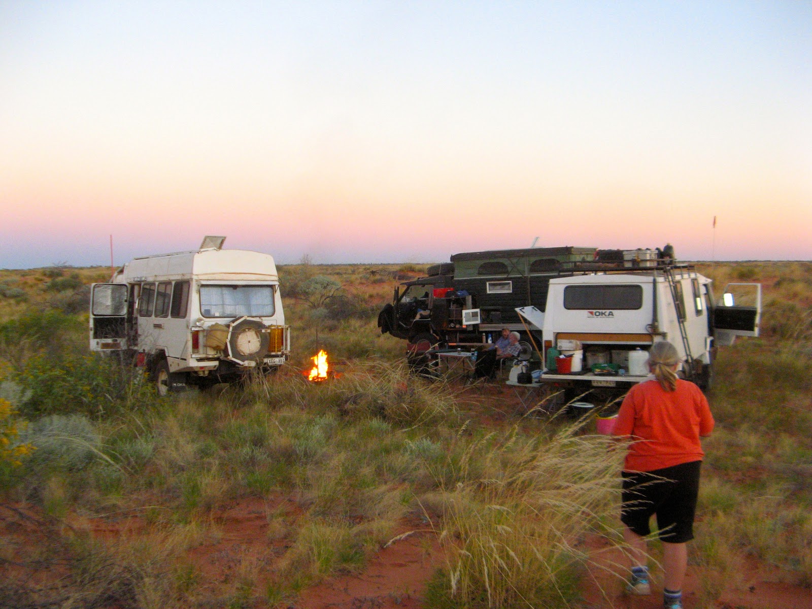
Shade provided by an Oka for the late afternoon and a campfire for when it cooled down. We collected firewood when we could and cleared the spinifex and scrub to make things a bit more comfortable.

9 Aug

During the night, clouds rolled in making a spectacular sunrise, but as I pointed out at the time, “they’re only bloody photons”. But they were very attractive photons.

IMG_5904-5905-2014-07-21-17-33.jpg

Reaching the Anna Plains Track

Today, only 4km from our campsite but over around a dozen sand dunes, we completed the southward trek from the Dragon Tree Soak to the Anna Plains Track (APT) after making our own way over 50 or more sand dunes in 3 days.

In fact we ran straight across the APT without noticing it due to a mix up in the number of sand dunes we had actually crossed, you can clearly see our wheel tracks in this photo crossing the APT:

.

How did we miss something so obvious and anticipated? Well, from our GPS mapping system we knew we were very close to the APT (within 10 metres or so), but we were focused on finding the least difficult route forward rather than looking sideways, and in my defence, some dunes were double or triple headers so a bit of confusion over numbers was not unexpected.

Anyway it was me who actually found the track, and this is it, Janet standing on the real Anna Plains Track. In this area the track looked in quite good condition, if only it had remained this good we would have been laughing…

Dean and Kaye were following last today and as the rest of us were getting mixed up over the location of the APT, they sat on top of the last sand dune watching the confusion.

Then the CB crackled and Dean said he could see an old Land Rover through his binoculars to the right of us, up the track a bit. Well “a bit” turned out to be about 400m but sure enough, near the APT junction were the remains of a old Land Rover and trailer. They belonged to a couple of prospectors and were burnt out in a spinifex fire in 2007. Fortunately the occupants recovered their sat phone as they escaped so they were able to call for help and were rescued by helicopter.

Vehicles broken down or stranded in remote areas normally have no realistic chance of recovery and abandoned vehicles are very quickly stripped of anything useful. But in this very remote location with no more than a handful of visitors a decade, the vehicle remains are still left pretty much as they were 8 years ago.

IMG_5918-2014-07-21-17-33.JPG-2014-07-21-19-03.jpg

IMG_5922-2014-07-21-17-33.JPG-2014-07-21-19-03.jpg

IMG_5924-2014-07-21-17-33.JPG-2014-07-21-19-03.jpg

We drove around the world in a Land Rover a bit like this:

IMG_5929-2014-07-21-17-33.JPG

A small lizard, probably a Ridged Tail Monitor, had taken up residence in the radiator:

IMG_5927-2014-07-21-17-33.JPG-2014-07-21-19-03.jpg

Internet photos of a Ridge-Tail Monitor for reference:

Ackie-2014-07-21-19-03-2014-07-21-19-03.jpg

Sadly, our early optimism from the condition of the Anna Plains Track in this area didn’t last and it was not going to give in easily, it took us another 200km and 3 days of difficult driving to reach the NW Coastal Highway near Sandfire Roadhouse. See “Anna Plains Track to Sandfire Roadhouse”.

McLarty Hills to the Dragon Tree Soak

West towards the Dragon Tree Soak

Heading west from the McLarty Hills towards the Dragon Tree Soak there are no established tracks and we thought that traveling between and parallel to the sand dunes might be easier, but we were wrong. There was a lot more vegetation in the swales and travelling was often a lot easier up nearer the dune slopes:

ScreenShot2014-10-09at5.59.04pm-2014-07-21-19-03.jpg

The terrain between the sand dunes was anything but flat, as this video shows as we try to follow Deano’s wheel tracks:

The springs and suspension got a real work out on this section and quite a few small trees and bushes had to be pushed out of the way:

A Convoy of Okas:

IMG_5803-2014-07-21-17-33.JPG-2014-07-21-19-03.jpg

We weren’t usually that close together in a convoy, we were often a km or more apart, sometimes trying different routes and communicating via CB radio, but we tried to remain in visible range, just in case…

That evening we made a superb garden campsite by clearing all the spinifex off a square between the Okas in a slight sheltered depression in a sand dune.

IMG_5811-2014-07-21-19-03.JPG

We called it the Milk Powder campsite since the rough ride this afternoon had shaken a cupboard door open and a container of milk powder (that someone other than me had failed to secure the top of) had fallen out and spread itself liberally over the floor of the Oka.

Kaye cooked a superb silverside beef in the camp oven for all of us to share, with a committee of other cooks contributing the veggies and gravy, very nice. We even had chocolate cake and custard for afters.

Later, after a few ales and celebratory glasses of wine around a roaring campfire, over a discussion of “trucks we have owned”, Dave reckoned his Kenworth A/C system wasn’t worth “2 knobs of goat shit”. Hadn’t heard that expression before but the meaning was plain enough.

The moon was shining brightly by the time we had polished off the port but it started waxing soon after. (Waxing, shining, polished? Get it?)

6 Aug

The same camp site in the bright glare of the morning sun, after all the silly puns had gone away:

IMG_5816-2014-07-21-17-33.JPG-2014-07-21-19-03.jpg

We left our “superb” garden campsite and turned south towards the Dragon Tree Soak. It was only 25km but took all morning to navigate the sandy and overgrown terrain.

We traversed several sand dunes but only after walking up and holding a conference on the crests to determine the best approach:

IMG_5828-2014-07-21-19-03.JPG

The decision is made:

IMG_5821-2014-07-21-17-33.JPG-2014-07-21-19-03.jpg

Dave crossing the sand dune fairly easily once we’d decided on the best approach:

Dragon Tree Soak

After a couple of hours of sand duning, the terrain turned from sand into into dry salt marsh and a green smudge started appearing on the horizon. This was Dragon Tree Soak emerging, or at least the Dragon Trees were. It was flatter than expected but then water features often are flat.

ScreenShot2014-10-10at5.19.31pm-2014-07-21-19-03.jpg

Finally, when we reached the Dragon Tree Soak there was plenty of water and a few access beaches and it looked almost like the location we had seen from the photos, maybe a bit greener even.

IMG_5839-5841-2014-07-21-19-03.jpg

The flowering Dragon Trees, the waving reeds and whirling flocks of finches made it a welcome sight, an oasis in an otherwise dry desert.

IMG_5869-5870-2014-07-21-19-03.jpg

However, when we got a bit closer, we were disappointed, but not really surprised, to find that camels had fouled the water so we couldn’t use it. Luckily (or rather through good planning) we had not counted on getting good water from here, but it would have been a bonus.

This is not what you’d expect to find in the middle of a desert:

IMG_5848-2014-07-21-17-33.JPG-2014-07-21-19-03.jpg

Dave and Pauline who was having to hold her hat on in the strong breeze:

IMG_5852-2014-07-21-17-33.JPG-2014-07-21-19-03.jpg

Dean photographing Kaye at one of the Dragon Tree Soak’s “beaches”:

IMG_5836-2014-07-21-17-33.JPG-2014-07-21-19-03.jpg

A group photo on the beach at the Dragon Tree Soak:

Dragon trees and a dragon tree flower:

IMG_5832-2014-07-21-17-33.PNG-2014-07-21-19-03.png

IMG_5834-2014-07-21-17-33.PNG-2014-07-21-19-03.png

IMG_5835DragonTreeFlower-2014-07-21-17-33.PNG-2014-07-21-19-03.png

After lunch we set out to find Elizabeth Soak, only 1km south of the Dragon Tree Soak. We had been expecting it to be surrounded by a thicket of acacias but after forcing our way though the tangle of sharp scrub it is was completely dry. We tried the other side of the soak but it was much the same:

IMG_5864-5866-2014-07-21-19-03.jpg

This is supposed to be a lush blue lake of fresh water protected from camels by an impenetrable thicket of acacias. The acacia was certainly impenetrable, it took me quite a while to get through for a photo, but there has obviously been no substantial rain in this area for a couple of years and the green grass was turning brown.

Janet disturbed a couple of the aforementioned camels coming for their afternoon drink:

Whilst we were a bit disappointed about the quality of the water in the Dragon Tree Soak, it had taken us 8 days of difficult desert crossing to reach this isolated spot, and beneath it all we were really quite proud of achieving our major objective, it had not been easy, neither would the exit route.

The whole areas looked drier than previous photos had suggested, presumably due to intervening less wet wet seasons. This clay pan on the way to Elizabeth Soak was quite dry whereas earlier photos show it filled with water:

ScreenShot2014-10-10at5.42.02pm-2014-07-21-19-03.jpg

Analysing our trip on Google Earth after we arrived home revealed some interesting information about this area.

Looking at the track altitude profile for this section shows that Dragon Tree and Elizabeth Soaks are actually on top of a rise amongst the sand dunes, whereas you would expect them to be a the lowest point between dunes.

The area containing the soaks is roughly 15m above the low points in the surrounding dunes (with Elizabeth Soak being higher than the Dragon Tree Soak), so I infer from this that they are true springs, not just lakes formed from the collection of rain water, with water pressure from a larger catchment area (maybe the nearby McLarty Hills area, which is higher), forcing water upwards and maintaining some of the springs at least during dry seasons.

[I also checked the altitude profile around Joanna Springs, which we didn’t visit, about 100km east of Dragon Tree Soak and it’s generally true in that area too although the variation in altitude is much less pronounced, presumably accounting for the smaller springs there].

There were a number of other potential soaks or springs marked on the maps but the general dryness of the countryside suggests less than average recent wet season rains. That would have made finding any good water seem somewhat chancy, so together with our increasing concerns over fuel usage, we made the sensible decision to head west rather than expend fuel on further searches.

Looking back now, it would have seemed reasonable to do more exploration in the area but at the time we saw things differently, so after our failure to find water at Elizabeth Soak and since we weren’t keen to return to the rather polluted Dragon Tree Soak, we turned west and headed towards a cut line which would take us theoretically down towards the Anna Plains Track.

There were no tracks in this area so we made our way cautiously across salt marsh country and camped in the next sand dune area about 10km west of Dragon Tree Soak where the terrain was certainly not boggy, if not firm and flat (Campsite #9).

ScreenShot2014-09-21at12.22.33pm-2014-07-21-19-03.png        

That evening around the campfire we made a short video for Serge and Eli while we drank some of Serge’s home made wine to mark the occasion, we really had achieved our major trek objective but it took quite a while to sink in:

ScreenShot2014-08-15at9.31.05pm-2014-07-21-17-33-2014-07-21-19-03.jpg

7 and 8 Aug

The next 2 days were a repeat of previous travels, forging our way over dozens of sand dunes and through thick scrub as we turned south from the Dragon Tree Soak swale and headed towards the APT, but we had some good campsites and spectacular sunsets. See “Dragon Tree Soak to the Anna Plains Track”.