


This year's trek has been delayed and curtailed through a number of problems, but we are now on the road and will be until mid-October. Our plan was to travel to WA and up some Len Beadell tracks emerging eventually, 3000 km later, at 80 Mile Beach on the north west coast. But due to delays we have had to reduce the scope of this years travel and do the full trek next year.
Starting in 24 Aug we first went down to Melbourne to visit Scott and Tash for a long weekend.

Scott in the early morning
With Scott and Tash (and Vinka) we had several good meals out and at home. They took us to the Queen Victoria Markets and a trip to Dandenong to pick up some more freewheeling hubs (after one just fell off on the way down) and thence onto Mornington for lunch.
I fitted the hubs the next day and did some Oka maintenance, like tightening the freewheeling hub bolts. It was a bit cool and cloudy.

Janet and I went into Melbourne and had a tour of Federation Square and Captain Cooks cottage, although he never actually lived there, it was built by his father. There are lots of quirky restaurants and shops down little alley ways and J bought some more ear rings, as is usual at these times.

The sign is bigger than the cottage

Is that a telescope you have in your pocket?
On our last day we went to a artistic glass exhibition in Prahran, and the South Melbourne Markets, after Janet was assaulted by a rough bloke carrying a computer under his arm. He thrust her out of his way and into a pillar causing a bruise on her arm. Not much we could do after the event, he might have been straight out of Underbelly and showed no remorse at all.
Apart from that (and the flu which Vinka caught) it was a really good 5 days, but we then had to continue on.
After leaving Melbourne we backtracked across inland Victoria to Port Augusta and headed west on the Eyre Highway.

A carpet of Wild Flowers in the Murray National Park at Renmark. We had to park on them, there was no choice.
Our plan this year is to "do" the bottom end of the Connie Sue Highway and explore the Plumridge Lakes and Yeo Lakes areas of WA before returning. We had seen these marked on the maps when we did the Anne Beadell Highway across the Great Victoria Desert 3 years ago and made then a mental note to go back someday and explore them more fully.
Sun 4th Sept
Last night we stayed along the side of a track near Nectar Brook in the mid north of SA. If the name sounds enticing, the campsite was even more so. It was a short gravel road with full views of the Flinders ranges on one side and the Spencer Gulf on the other. And no one came past for the 18 hours we were parked there. Magic.
We heard on the radio that Jamestown, where we were the day before, was hit by an earthquake over night, 3 on the Richter Scale. Rattled houses and windows but no damage. Even had 2 aftershocks, it's getting like New Zealand. Our Oka must be earthquake proof since we didn't hear a thing.
Mon. 5th Sept.
Right now, after fuelling and stocking up in Port Augusta, we are camped alongside Lake Gilles, a small series of salt lakes near Kimba on the Eyre Peninsular. There shouldn't be a phone service here but with an external antenna, we can communicate and access the internet quite well.

Hard at work in the office alongside Lake Gilles, near Kimba on the Eyre Peninsular
Before leaving home I modified our HF radio so that we can pick up Radio Australia, the BBC World Service and indeed any other shortwave broadcasts, as well as communicate using our normal 4WD Network Radio channels. That's all working fine and I now know the problems of logging in Indonesian forests and what Tony Abbot is going to say "No" to next.
But on a more serious note, it also gives us more opportunities to make emergency calls if necessary. Janet has been undertaking heavy training sessions in case she's the one who has to do it.

Camped alongside Lake Gilles
Tues 6th Sept.
This morning we woke up to a couple of issues heard on the HF radio sked, "dramas in pyjamas" you might say. A motorcyclist is possibly missing on the Simpson Desert after an incident. He was apparently OK but hasn't yet checked in to the Birdsville Police. And another motorist is stranded on the side of the road, but otherwise OK, awaiting help.
Later that day: Just heard that the motorcyclist hasn't been heard from and Leigh Creek Police have instigated a search. It's possible he has rejoined his support group and headed in another direction but the police need to know.
We did a quick tour of Kimba which is a larger town than it looks. We topped up with water but not until after we discovered that our tap connector is still connected to a tap, but that tap is in Jamestown where we last filled up, 400 km away. So we had to buy another one.
Seen lots of emus today including a dad with 7 or 8 young ones. Obviously the female brain of an emu is larger than that of the male since after laying the eggs she just abandons all care and responsibility to the father, who might not even be the father of his brood, and he does all the hard upkeep work.
We are camped just past Wirrrulla in a nice shady off-road clearing which was the site of a former school, and tomorrow is a big day for me, my 66th. Can't believe it, I feel sooooo young. Might even stay up til 9 pm.
Wed 7th Sept, a day that will live in infamy.
Got woken up early, before sun-up by 3, yes THREE messages of happy birthday wishes, also a call from Alan, an email from Charles and messages from Woolies, Exploroz, the Ford Forum and Austec, and I've no idea who Austec are.
Had a slap up breakfast of bacon and eggs, and baked beans on toast, but without the bacon because we don't have any.
Did a bit of shopping in Ceduna for things we had forgotten to bring and headed for Penong for lunch. It rained most of the way thus justifying our claim to be the driest state in the driest continent.
Lunched at Penong, notable for it's high tech wind farm and remote general store:

High Tech Wind Farm at Penong which predates the electric version by more than 100 years

They're not joking either, the next town west with a shop is Norseman nearly 1100 km away
Diesel out here is 148/l but it's a lot cheaper than ULP at 159/l, but it will get more expensive the further west we travel, so we keep the 250 l tanks filled. We also topped up the water tank at $1 per 10 l.
Camped tonight in a large rest area, full of big white 2WD motorhomes with their satellite TV antenna's up, about 20 km west of Yalata, an Aboriginal community at the head of the Bight. There shouldn't be any phone reception here but through the magic of an expensive external antenna and a cheap Telstra phone, we have a very useable signal.
Got a nice birthday call from Scott, actually while I was on-line which kind of buggers up both, but we sorted it out and had a good chat.
Janet constructed a superb birthday dinner of freshly caught trout (well when it was caught it was fresh), freshly steamed veggies and mashed potatoes drizzled over with a thick creamy sauce. For afters we had freshly stewed fruit and custard and a dessert wine served in an ambiance of warm candleLED. The emphasis on fresh fruit and veggies had less to do with nutrition however, than to the quarantine checkpoint down the road that will take away all our fresh fruit and veggies if we don't eat them, and we're not having that!
Checking my email I find I now have about 20 computer generated Happy Birthday messages from almost every on-line website I have ever joined plus somes nice human scribble on my Facebook wall by cousin Lissa, and Lesley, both in New Zealand, who's a distant relie we met when we visited NZ in Feb.
And so to bed. Tomorrow the Nullarbor Plain and Whale Space Watching, since the whales themselves have long since departed for cooler waters. Then the SA/WA border which is more secure than the Berlin wall ever was.
Thu 8 Sept
Well what a mixed day. Yes it was bright and sunny followed by cloudy and raining and all the time very windy.
We started off with a spooky event, even spookier than being able to communicate from the middle of the Nullarbor Plain.
We were a few km down the road when the alternator light came on, the rev counter dropped to zero and all battery charging stopped. Nothing spooky there, just a normal day in the life of an Oka owner.
The problem was traced to the wire from the alternator warning light to the alternator. Somehow that wire had become grounded (probably a throwback to last year when we had a cable burn out in the alternator/starter motor cable area). That cut off the seed supply to the alternator which stopped it generating any output.
Rather than hunt out the short circuit on the side of the road, I connected a separate wire from the alternator light direct to the input on the alternator and everything was back to normal.

Now the spooky bit. It was my birthday yesterday (66, but I usually print that in a small font size) and the odometer reading when the fault occurred? 660,000. What are the chances of that happening? Are aliens involved?

Once we had that problem fixed we set out again and visited the Head of the Bight. After getting over the $20 it cost to visit the Whale Watching Centre, we walked down kms of walkways to the windiest point on the planet and lo and behold there were still whales there.

Cool and windy but a beautiful coastline
At least 3 sets of mothers with calves frolicking in the calm blue waters of the bight. There was almost more whale than space. It seems they have mislaid their calendars and are on the October departure list.

Mother and calf

Taking a deep breath

Some were only a few metres off the coast

Just having a look around

Janet holding her hair on
So with all today's excitement we never made it to the WA border. We are camped amongst some rare trees just west of Nullarbor and Janet is cooking up all our left over veggies so we won't lose them at the quarantine station.
Fri 9 Sept
Probleme Du Jour
We did get though the border quarantine station OK, we only lost a small amount of honey that I couldn't finish (I tried hard), but we didn't get much further,
We stopped at Eucla Roadhouse to use their facilities and afterwards the Oka refused to start. The solenoid on top of the starter motor has developed an intermittent fault in its windings and try as I may I could not fix it reliably. It's not a repairable item and of course we have no spare. So we've ordered a new one which will be delivered 1400km from Perth in the next day or so.
I suppose we are lucky it happened on a public highway, not on a lonely outback track but removing a heavy starter motor in a busy car park is a frustrating, dirty job and a bit embarrassing. In a worse situation I would modify the solenoid so I can emulate its functions manually using string, sealing wax and a pair of jumper leads. When the new one arrives I will dismantle the old one, with an axe if necessary, to determine the cause of the fault and record it in my memory bank for next time.
Meanwhile we are cooling our heels in the car park outside the Eucla Motel. However, before this happened, we did stop to visit several outstanding parts of the SA coastline along the way, where Australia ends in a hundreds of km of high cliffs called the Bunda Cliffs. The Nullarbor Plain just falls into the sea.

Bunda Cliffs along the Nullarbor

Someone with a Texta has added the VB bottle

An old gentleman traveling alone took this photo for us. He said he'd waited 35 years to do this journey.

I'm glad I didn't park any closer to the edge...

West of the cliffs, the coastline subsides to a loooong beach, 700km from Eucla to Esperance.
Sat 10th Sept
We are stuck in Eucla today with no starter motor but a new solenoid is on its way from Perth, should arrive tomorrow.
In the meantime we've sampled the delights of Eucla, both of them, the museum of old telegraph equipments and whaling memorabilia, and the lookout down to the coast. If we had a working car we'd have driven the 4km down to the beach to see if any of the old telegraph station remains above the sand.

The old Eucla Telegraph Station is now covered in a sand dune down by the coast

Eucla is a long way from anywhere

The Eucla Roadhouse does have a nice bush garden
Water supplies are getting low and there is very little available here, except to motel guests. Showers are $1 for 5mins. All water comes from rainwater tanks or desalination plants.
Since Port Augusta there have been no rivers, freshwater lakes or water courses of any kind, and we are still only half way across. The Nullarbor Plain is a very dry place, despite the rain we've had. There are a number of Aboriginal rock holes dotted about the plains but they are not large or near this road.
The time difference here is very confusing. It gets dark at 5pm and light at 5am. 1 1/2 hours difference between SA and WA is too big a step. We don't usually change our clocks and watches, I don't need one to tell me if I'm tired or hungry.
Sun 11th Sept
We are expecting the solenoid to arrive after lunch courtesy of a truck driver who has brought it from Norseman. People around hear are extremely obliging. The company in Perth could only get it as far as Norseman but their agent there arranged for it to be shipped on to Eucla (700 km) at no cost, by a passing truckie, and over the weekend too. His name is Blue and he's driving a wide load semi trailer. That's all we know.
It could have been mailed to us, but Eucla only has mail deliveries on Wednesdays and Fridays. And they had no diesel for 2 days until the BP truck arrived yesterday afternoon. Ah, the relaxing pace of outback life, but some people get very toe-y if they can't get instant service.
We've also noticed a price inversion in the country. Out here, produce, fuel and supplies are expensive but services (eg caravan parks, washing machines) are cheap and spacious. In big towns it's the other way around.
Mon 12 Sept
Well we got the new solenoid and fitted it with high expectations, but when I fired up the engine all we got was a "click". All the right voltages are there but the motor refused to turn. That was still better than the previous silence, but obviously there is something else wrong as well. So frustrated, I took the motor off again and disassembled it. The solenoid is fine but the brushes and commutator were pretty oily and dirty. I cleaned it all up with degreaser and electrical switch cleaner and rubbed down the commutator with emery cloth. But before reinstalling it I thought I'd do a bench test using jumper leads. No Good. The motor either didn't turn or turned very slowly and when I flicked the gear to get it going it crushed my finger. However if it won't turn with no load it's hardly likely to start the Oka.
There is a big problem with one of the windings. I did it all agin this morning even more carefully but with the same result. I checked for burnt or shorted windings on the stator and armature. A shorted turn would cause this kind of problem but why has it been intermittent? And can the 2 faults have been there together? It's a conundrum.
The old solenoid was definitely US and the new one works fine so it's all in pieces now waiting for some inspiration.
Either way we are still stuck in downtown Eucla for a while yet. Catch-22 if we could get to an auto electrician we could get it checked or fixed. I'll make some calls tomorrow and see if I can track down a fix, failing that another starter, but I'm not yet convinced this one is stuffed. They don't just fail that easily.
But what is really annoying is hearing all the vehicles around us starting their engines when we can't start ours.
So tomorrow we are getting a tow start and we'll drive to Coolgadie without switching off, where my Oka man Robin will get it fixed/replaced.
On the lighter side we did a walk to the "town centre" and startled a flock of Major Mitchell pink cockatoos. We've only ever seen them in single pairs before and they are not that common anyway.

A pair of Major Mitchell cockatoos
Tues 13 Sept
We were up early, since WA time is so silly, light at 5am, dark at 5pm, and waited for the towing man to arrive.
He fetched his truck and a thick tow rope and we rolled the Oka back from it's 4 day parking spot right outside the Eucla Motel reception. It was a slight down hill run across the car park so I tried bumping it in reverse and to my surprise the Oka burst into life. No need for trucks or tow ropes.
We reversed up and bought some diesel (at $1.78/l) primarily because the folks at the roadhouse had been so friendly and not charged us anything for being stuck there for 4 days. I thought that was expensive until we reached Cocklebiddy and Caiguna where it was $1.98/l.
Without switching off the engine ever again, we drove down to the camping area and stole 30 litres of drinking water, since all our tanks were nearly dry, and headed west. The Eyre Highway is very long, quite smooth and with very little traffic, and what there is is mostly caravans, camper trailers, some motorhomes plus a few road trains, far less freight traffic than we had expected and almost nothing at night. Considering that this is the only major east west highway in the country, it's almost devoid of traffic other than grey and greying nomads. It emphasises the isolation or possibly the self-sufficiency of Western Australia from the rest of the country.
From Eucla the highway descends to the floor of an ancient sea and follows what used to be the beach for nearly 200 km although it's now covered with saltbush and small shrubs. It was 65 km to Mundrabilla and a further 120 to Madura where the road ascends the Madura Pass onto the Hampton Tablelands. There it crosses the Nullarbor Plain which I always thought was in South Australia but apparently it's in WA too. The cliffs through which the pass ascends are the cliffs from the Great Australian Bight which were left miles inland (40 km at their innermost), when the ancient sea receded. They finally reach the sea again 300 km later in the Nuytsland Nature Reserve south of Cocklebiddy.
Cocklebiddy itself was a further 100 km from Madura across a wide limestone plateau which hides huge caves systems and microwave towers but not much else. It was at Cocklebiddy that we had originally planned to turn north and head inland up the Connie Sue desert highway built by Led Beadell in 1962 and seldom used since, and the Plumridge Lakes desert area of WA. However, problems with the starter motor and my spectacular failure to fix it have made a change of plans necessary. My spectacular failure to fix the starter motor can best be summed by by paraphrasing Thomas Edison, "I have not failed, I have successfully discovered 10 ways of repairing the starter motor which don't work".
So instead we'll now head west to get the starter motor fixed/replaced and head for the Plumridge Lakes from the north instead of the south and return to Cocklebiddy from the other direction. This also makes more sense since there are no shops or supplies available on the Eyre Highway from Ceduna to Norseman, a distance of more than 1200 km, so turning north into a waterless desert with nothing more than a packet of dried peas and a couple of tea bags does not constitute sound planning.
At Caiguna, 85 km further on from Cocklebiddy, the scenery starts to be come more bush-like. It also signals the start of the longest straight section of road in Australia, 146.6 km, dead straight on a bearing of 262º. But although it's straight, it's not flat, and runs from ridge to ridge about 10km apart. After nearly 2 hours of straight road, a slight bend is reached followed by more straightness until at last trees appear and Balladonia hoves into view. 500 km from Eucla in one day, and all without switching off the engine.

Start of the 147km long dead straight section of the Eyre Highway
The Oka engine may be capable of running all day, but I'm not
Well, the Oka engine may be capable of running all day, but I'm not, so we careful selected a parking area alongside the road which had a slight slope to it. We reversed the Oka onto our levelling wedges (and I'm surprised that plastic wedges can support the weight of an Oka but they do), and levelled the inside using the airbag suspension. Now we should be able to run it down the wedges and along the sloping bitumen to bump start the engine tomorrow morning. If not, we are only a few metres from the road and can hail a passing truck to give us a tow start.

The starter-less Oka perched on wedges ready for a quick getaway
Tomorrow just the final 400 km hop to Coolgardie where Robin will be able to get our starter motor repaired/replaced.
The Eyre Highway drive through WA hasn't been all boring bitumen though. We've seen lizards sunning themselves on the road, a big black snake which slithered on to and quickly off the road as we approached, several flocks of budgies and a wedgie helping him/herself to fresh roadkill.
At several locations along the road, there are RFDS emergency airstrips marked on the bitumen by what appears to be pedestrian crossings. There are also tattered windsocks and gravel aircraft parking bays. These airstrips are occasionally used by the RFDS after traffic accidents but most outback stations have their own strips.

No, not a pedestrian crossing, the start of an RFDS emergency airstrip on the Eyre Highway
Janet's navigation today has been spectacularly concise and accurate. "Turn left" she said and how true that was. There's only one road for 2000 km and if you're on it, that's all the navigation you need.

Tricky navigation this, on the Eyre Highway (about 90 km shown on the screen. We're the blue arrow and the outer blue rings are 10km across)
Sadly however, Eucla was the last place that had any phone coverage so this blog will have to posted retrospectively.
Wed 14th Sept
The last leg from Balladonia to Coolgardie was quite easy and the Oka bump started quite easily off the wedges. We had lunch In Norseman, notable only for the fact that we had a FRESH tomato with our lunch, the first shop we had seen for 6 days. The previous shop was in Penong where they did warn that it was the last shop for 1000 km and they were almost right, it's actually nearer 1100 km.

Two cyclists struggle though the previously burn out Eucalypt forest, but at least they don't need starter motors!
We arrived at Robin's Oka yard just after lunch and found him and his girl Friday, Alysha, having afternoon tea in the restaurant across the road. We joined them, as did the local Pastor. The Pastor came over later brandishing a high powered rifle. Obviously no animal is safe from his preachings. "Shoot first and ask questions later?" I ventured, to which he replied "Shoot first and there's no need to ask questions".
This is a strange town.
Anyway, Robin had a old, failed starter motor of almost the same type as ours and showed me a space on his workbench and a battery and said "Here you go, build a working one from all these parts". And so I did. It appears the armature (the rotor with the electrical windings that goes around and rotates the engine) was the problem and after replacing it with the one from Robin's starter, which fortunately was OK, and we had a working motor. Tomorrow I'll fit the new solenoid, bench test it and refit it to the Oka. Then hopefully we'll have the Oka starting under it's own steam for the first time in nearly a week.
Thu 15th Sept
The reworked starter motor was reinstalled successfully this morning and is now working well.
So today we drove the 40 km to Kalgoorlie to do some shopping for the next phase of the trip. Janet bought some new clothes while I went to the dump point, and to further improve our enjoyment, Janet did the washing and I filled up with diesel and refilled a gas bottle.
On the way we stopped at Jim Carins campsite. He was a gold prospector from the early 1900's and lived in this shanty until 1971.

Jim Carin's Shanty, lived in until 1971
Kalgoorlie has become a very busy, hectic place with more mining utes to the m2 than anywhere else we've seen, and plenty of gold nuggets to be had for about $100 per gram (about twice the current gold price). But whilst the supermarkets and shopping streets in Kalgoorlie are very good, back in Coolgardie which has only 1 shop, things are very much calmer and more pleasant. The streets are so wide you need to take a packed lunch to cross them and a road train can be seen coming 5 km away.

Small delivery van passing a ute on a narrow Coolgardie street
The area is steeped (which is something I thought you only did to tea) in gold mining history and we got up to Historical Plaque #90 before giving up and returning to the Oka for dinner. The past opulence and affluence of Coolgardie during it's short gold rush days can be judged by the opulence and affluence of the few remaining solid stone structures.

The Opulent and Affluent Mining Registra's Building at sunset

Rush hour traffic passing the Opulent and Affluent Courthouse Complex in Coolgardie
But regrettably all 26 pubs and 8 daily newspapers have now gone. The population which reached 20,000 at the height of the gold rush, dwindled to a mere 200 at one stage but now, through the careful use of selective breeding programs, its numbers have recovered to over 1200 which finally exceeds the number of historical plaques around the town. The plaque to resident ratio has now reached sustainable levels, which is something I think we should all applaud.
With mining all around, the 1pm and 5pm blasts from the SuperPit have become welcome reminders of the riches lurking just under the gelignite. And of course safety is paramount:

Have you removed yours today?

Vehicles under 5 tonnes will be run over and squashed without warning or remorse.
Tomorrow we start inland though Ora Banda to Menzies and Laverton and then out into the desert lakes, are which is what we set out to see in the first place.
Fri 16th Sept.
Today we left Coolgardie after calling in to the caravan park to do some washing. We asked permission to use their facilities, but only after the manager had finished having a standup row with a Telstra agent on the phone. Strange that someone should be having troubles with the Telstra service on their mobile/internet. Never heard of that before.
North from Coolgardie is the small former mining town of Ora Banda. Perhaps small is an overstatement for it comprises just a pub, nothing more. We stopped for the obligatory cool drink and discovered that the name Ora Banda originates from the Spanish Ora or Au for gold and Banda for sash or belt ie Band of Gold. Easy when you think of it but I've no idea where the Spanish influence came from.

But if that was easy, just up the road is Siberia, another former gold mining town and even smaller than Ora Banda. It has no buildings at all, just a few old graves marked with white quartz rock, the basis for gold exploration. Its name came from the miners saying "find or freeze" meaning that they either found gold or didn't. Presumably the freezers outnumbered the finders here, hence Siberia.


There are a huge number of new gold mining facilities that have been established in this part of WA to use modern technology to reclaim gold formerly unrecoverable. At $1400 an ounce, well you would wouldn't you. However it also means that small outback tracks are fast becoming super highways for their road trains and heavy haulage trucks. Being Friday we didn't see any of them (?) but they have dreadfully upset the terrain mapping and small roads on the map, even those which didn't previously exist, are now large ones, still gravel though, and dissect the countryside.

And so it was that we came to our current campsite. It's in the Credo Nature Reserve, which does not exist on any map but which encompasses a large area of beautiful heathlands, and with the rain this year, the countryside has been transformed into a continuous garden of blue, pink, red and white flowering shrubs and wildflowers. And we are camped in the middle of this beautiful garden setting all alone and out of phone range.
To find this spot is simple, you just take the road from Siberia to Davyhurst and then make a wrong turn towards Menzies
To find this spot is simple, you just take the road from Siberia to Davyhurst and then make a wrong turn towards Menzies instead of Riverina (because the roads on our maps are all buggered up). That's how we found it.


Tomorrow we'll visit Lake Ballard, the site for some very strange metallic statues scattered across 10km of the dry (sloshy) salt lake bed. We visited here once before and were amazed that anyone would embark on such a weird undertaking, especially an artist of international repute. And stranger still, someone actually paid him to do it. But most strange of all is that the population of Menzies actually posed for the artist to make hideous metallic "likenesses" of them for public display, men and women showing off all their protuberances. Although I should say that the remoteness of the display site makes the likelihood of a rellie visiting and recognising someone from his metallic dick seem pretty doubtful.
And in case you've noticed, I just love starting sentences with prepositions "and" and "but". It makes them sound so much more meaningful, don't you think?
Sat 17th Sept
WA is closed for the weekend. We are now in Sandstone, a small town about 400 km NW of Kalgoorlie and it's so quiet here we found ourselves whispering reverently as we walked around the town.
But we've had another interesting and dramatic day. We nearly had our first kanga, we saw weird statues, got eaten by flying piranhas, saw 1 car, lots of dust and a huge perentie.
Leaving our garden campsite behind us we continued north amongst bushland covered in colour towards Lake Ballard.
Before long we had the first of our daily encounters with wildlife and nearly collected our first kanga. We were moving at about 60kph on a wide gravel road when 3 of them shot out from the left right in front of us, if you see what I mean.
The first one shot straight across the road and disappeared into the scrub. The third one did a quick U-turn and scurried back where he came from (only a "he" would be so quick witted), but the third did a left turn and bounded down the road in front of us. Luckily for him we were only doing about 40 kph by then and he accelerated away from us for a couple of hundred metres before diving off the road. I think all 5 of us had a bit of a scare that time. (When J reads the "he" jibe, I shall be in for another scare).

Lake Ballard from the Lookout
And so on to Lake Ballard. Warning: History lesson follows.
In 1990 the WA Tourism Commission commissioned (as their name suggests) a work of art to commemorate their 50th anniversary from UK sculptor Anthony Gormley. It comprises 51 steel statues (why not 50 for their 50th? Who knows, maybe a spare), purported to be laser scanned likenesses of the residents of Menzies. These (the statues, not the residents) are scattered over 10 Sq km of sloshy lake bed, a few hundred metres apart. They are rusting a bit now, and one has been burnt at the stake (the statues, not the residents), but they still have all their parts easily recognisable.

The tiny squiggles on the lake are not people, they're statues

Ditto
But they are so far apart that I'll bet no one has ever trudged around all 51 of them. The best we could do was the first half dozen or so, but not due to the heat, or glare of the sun or the sticky, sloshy, salty mud. It was the ferocious march flies which I named "flying piranhas" for their ability to land on a fast moving surface and take a bite out of an unsuspecting arm or leg, even through socks or tee-shirt.
Bruised and bloodied, we beat a retreat to the car for a cool drink. The photos were the only time we stood still.

J with a gentleman friend

Me with a lady friend
From there we amended our plans to go towards Leonora and turned instead in completely the opposite direction up the Menzies to Sandstone Road, which as you can guess goes from Menzies to Sandstone. It's about 300 km of dusty gravel road but we saw but only 1 car today (plus a couple parked at Lake Ballard but they don't count).
Part way down we turned off this busy highway where there was no traffic, onto a small track which was even less busy for lunch. There were zillions of wildflowers but I managed to save one.

This one is at risk...

...but I saved it

Closer to Sandstone we crossed a small dry creek with the stunningly clever name of Concrete Crossing Creek. Sure enough it was a concrete crossing, but in a spectacularly pretty area of mauve Mulla Mulla's.


Wild flowers by the shirt load
Just a bit later we had our final wildlife encounter of the day. I saw a log on the side of the road up ahead, but logs don't generally move by themselves, so we stopped to investigate. It was a large perentie that very much didn't want an encounter with me.


I circled around it taking photos and carefully watching what I was treading on, lest any other logs were moving, until it couldn't stand the suspense any more and shot off across the road with amazing speed. In 2 photo times, it was across the wide road and gone.

Gone like a shot across the road
And so it was that we arrived in sleepy Sandstone. We don't usually stay in caravan parks as they offer nothing that we need (unless we need to steal water), but having to make some phone calls we checked out the town park and it was only $10/night for the 2 of us, which was too good a bargain to miss. So here are at the Alice Atkinson Caravan Park in pretty but quiet and remote Sandstone. For a town of 1 shop plus a kiddies playground, the 17 page glossy brochure (I kid you not) on what to do here will make interesting reading.
There is one serious side to Sandstone however, a long standing member of our 4WD radio network, Snowy Lewis, ran a base from Sandstone for many years until his death at 80 something in 2008. We first heard him and logged in with him on our Pilbara trip in 2002. He was a long term resident of the town and is recognised with a memorial in the local park.

The Snowy Lewis memorial in Sandstone
On returning to the Oka I noticed a small pool of oil under the front hub which had run out of the front differential. I chose to ignore it for the time being, there's plenty more where that came from.
Sun 18th Sept
It started as a beautiful, clear, blue sky day but a bit blowy. Later we had a dust storm, a short sharp rain storm followed by a bright cloudy afternoon.

Hard to believe that this idyllic scene was soon to turn into a wind swept dust storm with pelting rain.
In between the weather extremes, we drove the Sandstone Heritage Trail (every small town has one) which included:
a 100 year old brewery store hewn out of a rock face,
another London Bridge albeit a bit smaller than the one now in Las Vegas,
the usual gold battery, and
a 100 meter well sunk 100 years ago by the government as a service to the local residents.
Try getting your local council to do that for you these days. Imagine all the EPA feasibility studies, the Sacred Site reviews, the Funding Approvals process, the Return On Investment calculations, the competitive impact on local water supply companies, public health and safety issues, the tender review process, contract management principles, should it involve overseas investors, the list goes on, when all you want is a drink.

The brewery idea was a good one. A cold store cut into the southern side of a granite cliff where it remained cool all year round, until someone had the even better idea of shipping in cold beer from a neighbouring town and the basis of its business plan collapsed immediately.

The brewery cold storage facility
The attractive London Bridge arch is made of 3.5 billion year old granite but is apparently due to fall down any day now. In the olden days, carts and camel trains plodded over it but now that would be environmental vandalism, and you are no longer allowed to take your camel train across it.


London Bridge, which is soon due to fall down. Would you drive your camel train over it?
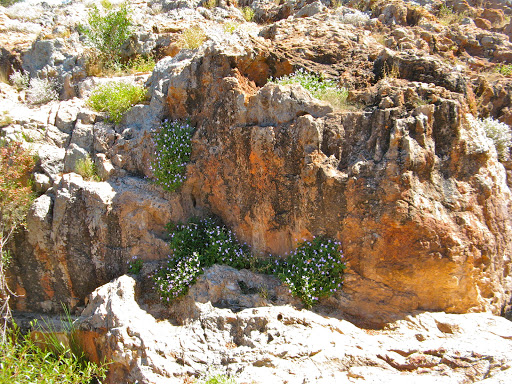
The state gold battery isn't as old as it looks. It was still operating until 1982 but has since deteriorated somewhat into a jumble of twisted rusty iron and pipework. It is surrounded though by a wonderful display of wild flowers.

The old battery is in there somewhere

No, she's just checking out some Mulla Mullas next to the battery
The Government well (called the Contradiction Well, and doesn't that conjure up heated debate in parliament over the scheme), was renovated as a Bicentennial Project funded by State and Commonwealth Governments. Must be one of the few collaborative ventures that they both agreed on, an old well that no one will ever use again obviously deserves priority government funding.

The Contradiction Well
After recovering from that severe bout of cynicism, we headed north on the Meekathara road to look for Lake Mason for lunch. We never found it but we did find some superb flowering ground covering plants alongside a dry creek bed. We had lunch there instead and then the dust storm hit us, the wind threatened to roll the Oka over and it pelted with rain.


A beautiful carpet of ground cover, before the rains came
Since we were on a gravel road and we knew not how much rain we were in for, we headed back to Sandstone and safety of the caravan park. Then it was indoor sports for a couple of hours while I fixed a failed LED light and wired the roof vent shut where the wind had lifted it off its hinges.
Eventually the rain clobbered the dust, the wind blew away the clouds leaving a breezy, cool but sunny late afternoon. And that was our day, no wildlife encounters of any kind, except for a couple having breakfast in front of London Bridge, with cereal, tea, toast and 2 types of jam, all in the open and in the face of a developing wind storm.
Tomorrow we'll set off sort of east towards Leinster.
Mon 19 Sept
The weather has subsided to a cloudy bright day as we headed "sort of east" towards Leinster.


The wildflowers continue to be amazing and today we saw several huge flocks of budgies wheeling around the Oka, each of them over a thousand strong (I counted them). We also saw 2 bustards (I counted them too) and lots of emus (I lost interest in counting at this point).


But instead of going to Leinster we diverted off south on the Old Agnew Road towards Leonora though some old deserted mining towns and past some brand new ones. At Agnew there is a pub which is open every evening. However no one lives there anymore so where do their patrons come from?

We saw the biggest gold stamper we have ever seen at Lawlers and found a BBQ concreted into the top of a lookout.

A huge 20 head gold stamper circa 1900

J in bewilderment over an upside down horse sculpture

The lonely BBQ cemented on to the top of a look out. But why?
A bit further on we had a feast of birdlife at Poison Creek, so named because of the poisonous plants that lived alongside it. We resisted testing that theory and walked along the dry creek bed until we came to a water hole buzzing with finches, budgies, parrots and a crimson chat.

J marching off down Poison Creek

The waterhole which attracted so much wildlife, including us

Self portrait of self and the waterhole

J had hysterics over this creature until I located the "Made In China" label on it's underside. It was a plastic toy.


2 budgies in their natural state. No sandpaper, mirrors or cuttlefish to be seen.
We spent several hours there, since the birds weren't afraid of us, and used tons of "film" so we have camped here for the night alongside the creek. We've seen no one again all afternoon and only 3 road trains this morning.

A bright pink Galah, pinker than the ones we get at home
One of the videos I took is of a budgie feeding it's mate who was sitting on the nest. He regurgitated seeds and fed them to her one by one. I'll post that later when we have a better signal.

A budgie feeding its mate who was on the nest in a crack in the tree

A crimson chat reflected in the water

Budgies and finches drinking and bathing
The rough weather has gone and now it's just a brilliant calm clear evening. Moon rise is at 3 am which is pretty useless for sitting out in the evening.
We are totally out of phone range here, almost. "No Service" is what the phone says, even with my external antenna up, but I have an ace up my sleeve. Before leaving home I built a hi-gain Yagi antenna for the Telstra NextG service. This looks like a UHF TV antenna with lots of short elements. And when I connected it up and hoisted it as high as I can, we have a useable signal. And in case you are the slightest bit interested, it's pointed at Leinster, the nearest town, which is nearly 40 km away and should be out of reach.

The Yagi Nextg antenna next to our 9 m HF radio antenna
It's the first time I've used it and it's working well. This is a picture of the antenna in use while it's sending a picture of the antenna in use. Sounds a bit incestuous to me, but it works.
Tomorrow we go to Leonora for shopping and fuel for the next leg of our trip.
Tues 20 Sept
Woken up early today. The sun may have been up but we weren't. What sounded like a flock of parrots landed on the roof of the Oka and screeched at us through the roof vent. Then they proceeded to tramp up and down the roof in their hobnailed boots before flying away. They probably left their deposit before leaving as well.

It might have been some of these but was probably some galahs
A final look at Poison Creek where the birdlife was still plentiful but not drinking or bathing, obviously the baths were not yet open for business. (Note there was deliberately no verb in the last sentence, just in case the grammar police are reading this). There were cockatiels today, which was new, and a pair of hawks hunting each other as a precursor to making more hawks.

Cockatiels at Poison Creek
Down the Old Agnew Road there were a succession of old wells and disappeared mining towns with short but vibrant histories, mainly centred around the number of hotels they could build.

A pretty well

Another roadside well, or it might be the same one from a different angle

A disappeared mining town with a steel plated lady
Leonora was reached at lunchtime. We filled with fuel and refilled a gas bottle from a back street gas refiller whose yard was stuffed full with gas bottles, large and small, broken or working. Luckily neither of us smoked or there would be another open cut mine in the centre of town.
But before leaving we had to visit the Centrelink office there to clear up a reporting matter. This was the most decrepit government building we've ever seen with falling plaster and cobwebs all round the ceiling. And they couldn't help us anyway, they were only a Centrelink Agent not a Centrelink Office, as if there was a difference. They did however point us at the Laverton Office, 130 km east and in the direction we were going anyway.
Although Laverton is much smaller than Leonora, the Centrelink facilities there were much grander (and customer-free), and the young man there Patrick was very helpful and fixed our problem immediately.
We headed back up the road to the tourist office-cum-café for a cup of tea and Patrick was already there having a drink. How did he do that? While there, Patrick (no, another one) showed us how to get out of town. Quite often the most difficult part of outback travel is finding the tracks out of a town. Major destinations are usually sign posted but never minor tracks. But Partick (this one) had done them all as a surveyor for a mining company and knew every track, road junction and wrong turn it was possible to make. We'll probably make some of them ourselves.

A well camouflaged parentie on the Laverton road
We chose to stay at the Laverton Caravan park tonight to legally steal water and because I have to change some wheels around and do some maintenance and that's a lot easier to do in a sheltered environment than on the roadside.
Tomorrow, Birtville and the track to Lake Rason. However this might be the last post for some days, unless you can read minds, as phone service will not be resumed until further notice.
Wed 21 Sept
Hooray, the equinox is with us. I thought that was a horse.
I changed around all 6 wheels this morning, it's back-breaking work, 4 jackings with a full load and 32 big wheel nuts undone and retightened. Now we have 4 identical tyres on the ground which ensures that in 4WD the transmission won't wind up with different diameter wheels front and back.

I also check the font diff breather and it did seem to be blocked, hence the oil leakage.
But we really are off the air now for a few days.
29 Sept.
Back in Laverton now after 8 days gone bush. Blog text is below for the missing days and photos will be added progressively.
Thu 22 Sept.
Last night saw Dave's round boulders off to the south but there were no apparent tracks. Did he carve his own? Too early anyway so we went 10 km further on and camped just off the track.
We deferred our morning showers today pending the search for water.
A car came past around 7.40 am (where had he been camped?) and stopped to confirm we were OK.
Lots of morse code birds heard before arising but could see not one.
3 dead camels and a dead dingo seen alongside the track today. Obviously someone's been along here with a gun.
Track straight and fairly good with a few rough patches and sandy patches and a some boggy but dry sections which have side tracks.
Mallee Hen Rocks couldn't be reached, track only went about 10 m when there was a tree in the middle of the track, obviously it hasn't been used for a while. Apparently the track is no longer navigable to ordinary mortals only dog hunters who access it from the south, although write ups on the area suggest the track is quite useable. It pays to do wide research.

J hugged black boy which was apparently a bit prickly.

Carpets of blue everlasting daisies appeared interspersed with pink and yellow carpets, but seldom all together.

A carpet of yellow and blue

We stopped at Point Bott and Mt Luck for a look around.
Made Crow Cave Camp for lunch, a flat area south of an escarpment, and marked as a 'good' camp site, but it's really just a flat patch of sand.
We came across 2 signs saying that the Lake Rason Road will be closed to all traffic on 27 Sept. for a motorsport event. Why aren't these signs put at the start of the track, rather than 200 km along them?
Then suddenly we saw a sign "Warning: Fork Lift in Use". That was unexpected. Then a mail box with a "No Junk Mail" sign, then a "Slow, School Ahead" sign. What is going on? We are 200 km out into the GVD on a single lane desert track and have seen only one vehicle in 2 days. The signs have plainly been liberated from their original positions.

A surprising sign on a desert track
The reason became apparent as we turned up towards Lake Rason and saw a small corrugated iron shack built on a rise close to the lake edge. A couple blokes, Darryl and his mate Colin, came out to meet and greet us. They welcomed us into their shack world where they live for months at a time. They have marvellous shanty lifestyle with a $million view out across the lake.

Daryl's shack at Lake Rason
Daryl first built the shack in 1991 and previous versions of the shack have been destroyed variously by wind, white ants and fire but it's now constructed of welded steel, anchored by 7 ft star droppers rammed 6.999 ft into the rock so they'll never come out. The building is 'approved' by the Laverton Shire Council by the fact that its photo takes pride of place in the council offices, and the shire engineer often spends weekends out there with his family. They claim a shire engineer "certified" the building (she'll be right mate) just before the last big blow which destroyed it.
Just last week a severe storm shredded the Aussie Flag flying proudly from a radio mast above the site.
The shack has BBQ, gas cooker, water tanks, shower and beds for several people and, when unoccupied, is available to anyone who wants to stay there on a "Use It But Don't Abuse It" basis and it's located at S 28º 45' 29", E 124º 2' 30". The verandah and large campfire makes an excellent place to relax, lower the blood pressure and watch nature at work. D and C do take insurance against mindless idiots who might use their water tanks for target practice though by burying drums of water around the property for emergencies.
We're the first visitors D and C had in a week and a half and they gave us a guided tour, tea and biccies and then we invited ourselves for a sunset happy hour and what will be an evening of Bundi and merriment around the campfire.

Daryl's own private island-cum-firing range
Being camel hunters (amongst many other things), they have a firing range out onto the lake with many perforated gas bottles and jerry cans as targets, and a golf range with a salt "green" and flag about 50 m out from the edge near a small island, albeit the flag is full of bullet holes.

Gas bottles and jerry cans on the firing range

The salty 'green' and flag with bullet holes
Darryl and his mates spend their time hunting camels, playing golf, of a sort, listening to Monty Python recordings and and relaxing in the spectacular surroundings. And when visitors arrive, they are regaled with tails of survival and stupidity (not their's) in the bush. They are both part time gold prospectors and have some good success with metal detectors. We saw some of their successes before we left, empty handed.
Fri 23 Sept
Well we had an uproarious evening with Daryl and Colin around the campfire. They had tales to tell of their lives in the outback, and before, when Daryl was in the Airforce and Colin was engineering manager of a power station. They also had copious amounts of Bundi and some superb rum liqueur that Daryl makes in his shed. Every bloke should have a still in their shed, according to Daryl.
We drank a bottle or 2 of wine and solved many of the worlds problems from water supplies to the southern cities to the Aboriginal question to the rampant growth of crocodile numbers, or was it the other way around?
So we slept well last night and managed to miss the sunrise. This morning D and C did a tour of inspection of the Oka and we all took photos. We read and added to their visitors book and I complemented D on his continuing faith in human nature by throwing open his shack to any visitors, even though they've had a few MBA's though in the past (Mindless Bloody A***holes) who stole tools and left rotting camel carcasses around to attract blowies. They also leave their rubbish around for D to clear up. Aluminium cans melt to small blobs in the campfire, and D and C bury steel cans in the salt lake where they rust to nothing in the saline environment in only a few days, but glass remains a real problem as it can't be safely disposed of and remains a hazard. What people bring out they should take away.
While J was out in the 'Mine Site' (where they dig holes for their ablutions), she saw 4 snakes, even though D claimed that they had relocated all snakes from the area. J wasn't phased and just moved her location instead. C said they're were definitely Western Taipans as they didn't get brown snakes out here, adding casually that they were only the most venomous snakes in the world, which is true. However no one else saw them so no corroborating evidence could be gained.
Daryl is a part time gold prospector and carries his finds around in a small but very valuable tin. He showed us some nuggets and J held a handful, worth about $15k and they were very heavy. No free samples here though.

Janet holding 15 grand's worth of gold nuggets. Also on show is her $20 wedding ring.
At D and C's insistence, we filled up our water tank from their full rain water tanks and sadly went our separate ways, us heading east towards the Plumridge Lakes, and D and C west to hunt for a small camel (they are tastier) to take back to the folks at home next week.

Memorial photo of us, Colin and Daryl in front of their $million view
Lake Rason is a long bow shaped shimmering salt lake and there are a couple of side tracks from where it can be seen.

Lake Rason
I turned around up one of these tracks and then went back to inspect the site and made a mental note to be more careful in future. I had done a check and the ground felt firm to walk on but I am not the weight of an Oka and it sank rather more than expected although we got out quite easily. We've seen no vehicles for 3 days (except D and C) and this is a remote part of the country to be stuck in.

Some idiot did a 3 point turn here and is fortunate not to still be there

Lake Rason shimmering in the sunlight
Before leaving D and C they told us of a fresh water lake just off the track which is not marked on any map. Officially this is a dry area with no fresh surface water or bores, an extension of the Nullarbor Plain. They had marked the turn off with a witches hat on a bush and we found it and explored the lake.
It was quite large, several 100 m long and was certainly fresh and good enough to drink (we tasted some) although we didn't need any more water. There were grey teal ducks, plovers and banded stilts (we've got our bird book) wading through the shallows of the lake, which is not named and which is only a 100 m from the salty Lake Rason, separated by only a sand dune.
Obviously rainwater runs towards the big lake but is stopped by an impermeable layer under the sand dune to form a fresh water catchment. It may not survive the summer season evaporation rate but during the winter tourist season it should certainly be marked on the map as there is no other water in this area, S 28º 49" 19', E 124º 26" 51'.

A freshwater lake only 100m from slaty Lake Rason (across the far sand dune)
Leaving the shores of Lake Rason we moved south along a wider but not smoother sandy gravel track. The track is quite navigable but has occasional sandy, rocky and mildly corrugated sections. The wild flowers vary considerably from huge profusions of blue and yellow, to carpets of pink, to areas of green spinifex with small mallee gums.

Profusions of colour
We are camped at the foot of Bartlett Bluff from where a wide vista of the western desert can be seen. It's deceptively green and lush looking although completely dry.

Camped at the foot of Bartlett Bluff with our 9m high antenna
J: "What would you like for dinner dear?". "Oh I think steak and salad and a glass of wine would be nice followed by fresh strawberries." "OK" she said, and that's exactly what we had. Perfectly grilled steak with a fresh green salad, onions and potato salad, the choice of red or white wine, and fresh strawberries for dessert marinated in sugar with custard or yoghurt as preferred. Hard to believe we are 300km into the GVD (Great Victoria Desert) and we haven't seen a vehicle or shop for nearly 4 days (except D and C).
The wind started blowing a bit so I lowered our 9m antenna, whereupon the wind dropped and didn't blow up again until after I re-erected it again the next morning.
Sat 24 Sept
Preliminary Final Day, WCE vs Geelong (we have to be WCE fans over here and Collingwood supporters are frowned upon)
Toast and eggs and beans for breakfast on a bright clear sunny day, but a bit cool to start with.
There are caves on the bluff, used by small animals judging from their contents, and 2 kangaroos visited us just after breakfast.

Visitors for breakfast

J on Bartlett Bluff

After the Tropicana mine turn off, the track dissolved into 2 rough wheel tracks, rocky limestone ledges at times alternating with deep sand, and all the time winding between close trees and bushes to scrape the sides of the Oka. Not impassible but fairly slow travelling.

A touch of humour from the local mine workers
We past the Plumridge Lakes Nature Park entry sign and suddenly nothing changed. We carried on laboriously across very pretty bush scenery to a junction of 2 tracks (actually the only tracks) for lunch. No one to be seen on this track for a 4th day. Apparently Ernest Giles the explorer crossed the track right here, but he was long gone by the time we got there.

A Sandalwood Cutter's rake. Not a good thing to drive over
I turned on the ABC but it's not good news for the WCE, 22 points behind at quarter time. Hopefully they will bounce back like their previous 2 matches. Later: Unfortunately they couldn't repeat their previous efforts but early in the 2nd quarter I thought they might. However they gave it a good shot. Now I don't know who to root for next week, I don't care for Geelong much but I care for Collingwood ever less so I guess it has to be Geelong.
Travelling further south into the nature reserve and the tracks got even more confusing at a 5 way junction so we went down each one in turn a for 1/2 km or so just to create a track log so we could see on our moving maps which ones went where.

About the only signs we found
Eventually we found the correct one and then came across a group of 6 camels standing on our track and refusing to get off, just waddling along in front of us. We took a video of their waddling and eventually they sauntered off to the right and we continued our journey.

6 camels blocking our path
Here's a video of the camels across the track, click on it to view.
|


The most prickly plant in the universe
Sun 25 Sept
Woken early at 5.25am by rolling thunder which sounded like a truck passing by, but not passing by. It's always some bloody thing waking us up early, if it's not bloody birds twittering, it's the bloody sun shining in, or as now bloody thunder. It's always bloody something. Only a few large blobs of rain but I had to lower the antenna to avoid a lightning strike but there wasn't any of that anyway, just bloody thunder.
Had a cup of tea and feel much better now. J went back to sleep and I'm quietly caressing the keys until breakfast time.
Later: I'm so sorry I got cranky, I'm sorry I swore. If I promise not to get cranky again will you please stop me staking any more tyres?
About 9.30 this morning, a mob of angry ants ate a large hole in my rear tyre. Either that or I staked it on a tree root that was sticking out of the ground which I avoided missing. Either way we had to change a tyre, the right rear. It had a 3 inch gash in the sidewall and all the air had gone. There were ants everywhere, some were helping jack up the Oka some were just getting in the way and some were attacking me just for lying on their nests.

Flat, but only at the bottom

A 3 inch gash caused by ants, or possibly a stake
Using the Hi-Lift jack plus the screw jack which I had to dig a hole for to get it under the axle, we replaced the non-functioning wheel. It took about 1 1/2 hours in total because the Oka is fully laden right now and very heavy. I also increased the pressures in all the tyres to raise and stiffen the side walls lest i did it again.
The track had become increasingly overgrown and all the external peripherals were getting severely battered by branches, including the wing mirrors (of course), the fly screens, 2 of which were ripped off, the radio aerial, now broken, the roof dented and the GPS module knocked off the sun visor. There are also branches jammed amongst the solar panels and the brake disks, and the windscreen wipers look like a garden fête.

A garden in the windscreen wipers
In view of the increasing difficulties in progressing and the fact that we had only 1 bite of the tyre cherry left, we decided to turn back and do some different tracks. We diverted across a track which is not on our maps but definitely exists and found it covered in Sturt Desert Peas. Some we moved off the track to protect them, but eventually there were so many that we just had to drive over them.

J moving Sturt Desert Peas from the track
We caught a glimpse of the Gwynne Creek, one of the lakes after which the Plumridge Lakes Nature Reserve is named but really this is just a nice colourful nature park containing some small salt lakes plus a few, very few, rough 4WD tracks in it.


Gwynne Creek from a paddock of Sturt Desert Peas
We had already decided not to do the Connie Sue this year in favour of returning to Laverton and then mosey on down towards Esperance for some seaside R and R before returning home.

A dead camel that got in the way of a hunter's bullet
Mon 26 Sept
After another night it in the Nature Park we set off back up the track, the highlight of which was a thorny devil which considered itself invincible and therefore impervious to attack, even from heavily laden 4WDs.


They might be small but Thorny Devils are worth stopping for

They won't move for anything, even for the prodding of a sharp stick or failing that a finger lifting their tails. They are such engaging little creatures, only the second one we've ever seen, that we couldn't run it over and eventually manhandled it under a spinifex bush where it would be safe.

Don't they have an adorable little face?

Eventually it moved after some rear persuasion
We stopped early for lunch at Bartlett Bluff and decided to stay for the rest of the day and have a campfire. It was quite warm, around 30º, and we had some rubbish to burn so we had a relaxing afternoon and ate dinner around the campfire, the first time it's been warm enough to do so.

Tues 27 Sept
Today is the day of the motorsport rally so we can't go west, the roads are closed. So we went east for around 30 km to seek out MacKay creek, which looks enticing on the map. In practice it, and related creeks, are bone dry, dusty and overgrown and the whole area has the look of a prospecting area. There are little piles of coloured dirt along the tracks, obviously core samples from diggings, and a myriad of small tracks and claim marker posts.
We stopped for lunch in very pretty paddock of pink flowers and I topped up the front diff which has been leaking oil for some days. The track is not corrugated at all but the surface is very lumpy dried clay and sand and makes for very slow progress, around 30 kph is the best we could achieve.

Maintenance in a pleasant but remote garden setting

We stopped to look at a lake with water in it, very rare in these parts, which looked like freshwater since there were water birds feeding on it. However, we shall never know since J got too close and got both her feet bogged, whereas I, the more sensible one, only got one foot bogged.

J's 2 bogged feet

My 1 bogged foot
More huge wheeling flocks of budgies seen today (and everyday), and one flock almost took out the windscreen of the Oka they wheeled so close. Budgies are the predominant species we've seen on this trip, many thousands of them.
There were a few rain showers this afternoon but the track is quite sandy so they posed no problem. We retuned to the freshwater lake that Daryl had told us about and set up camp. We were exploring around the edge of the lake when eagle-eared J said she could hear a vehicle. A few minutes later 2 great big 6 wheeled 4wd's came down our track and set up camp nearby, the first travellers we've seen in 5 days. They are heading into the Nature Park but going a different route, which is just as well as they would have difficulties with the overgrown tracks. As it is they might have difficulties when the current road deteriorates to a narrow 2 wheel desert track after the Tropicana mine site.

Camped by the freshwater lake

Hard to believe this beautiful freshwater lake is just 100m from a dry salt lake in a desert

This is the sign at an important road junction
Wed 28 Sept
A big 6 wheeled Canter. They staked a tyre too but with different wheels on the front and rear they needed different spares
Gave 4wd companions info on the tracks to the Nature Park. They appeared to have no HF radio (I didn't see an antenna) and that's a risk out here (see tomorrow's story below). They may have had a sat phone but I only saw a CB and mobile phone antennae.
We stopped of for lunch at Daryl's shack. He and Colin had already left and won't be back now until next year. It will soon start getting darned hot out there.

The beautiful view of Lake Rason from the front of Daryl's shack

Daryl's shack, deserted for now, but open to all visitors
We relaxed here for lunch and to soak up the view before moving on
Saw a dingo, lots of budgies and another perentie.

A pale coloured dingo sauntered across the track
Camping at foot of Mount Luck. Saw a red capped robin.

J on Mount Luck

A red capped robin, small but distinctive
Thu 29 Sept
When we awoke this morning and flicked on the HF radio, they were in the midst of a real life and death emergency.
A lady had made a distress call after her husband had had what appeared to be a serious stroke in their caravan in a national park north of Carnarvon in WA (semi-conscious, sweating and unable to communicate).
The VKS737 base operator called the emergency services who dispatched an ambulance while he maintained contact with her and lead her though the emergency medical procedure to ensure the patient was given the appropriate first aid.
After about 45 minutes, the ambulance arrived to take over and the base operator then called their daughter working on a mine site in the NT to give her what info he could.
During this period all other regular skeds were deferred and the operator maintained contact with the lady to provide reassurance and support. It was a clear demonstration of the benefits of HF radio in the outback and just how critical it is that all members of the party know how to use the radio, not just the blokes. J has been going though intensive training as well.
Whilst this process worked on this occasion, the lady didn't know how to use the Selcall system (a bit like making a phone call which rings on your radio to alert someone that they are being called). Between sked times the HF bases are not monitored so a Selcall is the only way to alert the operator of an incoming call.
All Flying Doctor bases are also accessible directly though the VKS737 network using the Selcall system so it's vital that all HF radios have this facility and all party members know how to use it. Emergencies don't only happen between 9 and 5.
Our radio is fitted with Sellcall and we've tested it, but never had to use it in an emergency yet.
After that emergency, today we carried on towards Laverton and found the small track to Mallee Hen Rocks which we'd missed on the way in. I had to do some track clearance and remove some overhead branches to get though but eventually we made it all the way around the rocks to a nice flat area.

Removing some overhead branches that impeded our progress

Mallee Hen Rocks from the rear
We climbed into the craggy rocks and J located a fairly deep rock hole buzzing with finches. In this environment a water hole like this would be crucial to wildlife survival and would have been known to the local indigenous people.

Water hole at Mallee Hen Rocks buzzing with bees and other flying things

Ferns and water plants growing in a desert environment

The desert environment in which the ferns and water plants were growing
Finished the 200 km to Laverton to do washing and collect water, emails etc. Fortunately nothing drastic has happened while we were away, unless you include the worst period of the share market for 3 years. Guess where our super is?
We did have to negotiate a road train on the way back though.

Road train sort of blocking our route
Fri 30 Sept
Drove the 130 km to Leonora where the shopping is immeasurably better than Laverton (actually it is measurable, they have two shops).
After lunch we took the back road to Kookynie, a former gold mining town (as they all are hereabouts), and had a drink in the hotel, the only building left standing, and only just at that, otherwise it's yet another ghost town with more heritage plaques than people.

Kookynie Hotel The bar man was grumpy
Just past Kookynie is the Niagara Dam, a project by the same engineer who built the Perth to Kalgoorlie pipeline in the early 1900's (I always say that when I don't actually know the real date).
It was an immense effort and all cement and supplies brought in by a 400 camel camel-train (obviously), and it was a great success, it filled with water and still is half full. Unfortunately, Niagara, the town, suffered a sudden decline as the gold ran out and the population moved to Kookynie 14 km up the road where they found a better source of underground water so the dam was never used.


Foreboding thunder clouds at our Niagara Dam campsite
Now the dam is a nature reserve and is a free picnic, swimming and camping area. It's a very pretty scene and not abused by campers so it's quite clean and tidy. We saw our fist Mulga parrots there last night.

Our first mulga parrot, late in the day so a bit dark
Sat 1 Oct (J's birthday)

The Birthday Girl at Niagara Dam looking glamourous for her LX111 years
After walking around the dam wall and marvelling at the work involved which was never used we headed towards Menzies, but took a detour intending to get to Kalgoorlie via an outback track, the Donkey Rocks Road. It started badly when we missed the first junction only about 1/2 km from the turn off. Once we fixed that problem, the track got progressively worse and very rocky, although a full width road, and was obviously hardly ever used, There were no tyre tracks and flowers were growing healthily right across the track, and the forecast was for possible thunderstorms. The first 6 km took us 1/2 an hour so we said "Sod this for a lark", and turned back. We still had 180 km to go so it would have taken us 2-3 days to do, even if the track actually went right through as per the map, or a 4 hour trip on the bitumen.

The flowers are still nice though
So here we are in Menzies, a microscopic town with a hotel, shop (closed because it's Saturday) and a 100 year old clock tower that only had it's first clock installed in 1999. Road trains rolling though the main street are the only evidence of life, except for a grader diver earning overtime rates by grading the same 50 m of track about 20 times.

The old and the new? No way, the microwave tower is much older than the clock
After failing to find signs of intelligent (or any) life in Menzies, we motored on down to Kalgoorlie, listening to the Grand Final along the way. Whilst I'm not a Geelong supporter, I am even less a Collongwood supporter (I support any team playing Collingwood), I'm glad the Cats won convincingly and that it was such a good game. So often GF's don't live up to the description.
Sun 2 Oct (Mollie's Birthday)
Set a photo/card to Mollie and J got a singing birthday message from Mark.
We changed around some wheels in a bush campsite near Kalgoorlie so we have the best ones on the front. J managed to stake her foot, but unlike my tyre, it will mend itself after the application of 'hurt-go-away-cream' and a plaster.

J's staked foot
Today some good luck. Yesterday we fell foul of the liquor laws here since they can't sell wine in 4 or 5 litre casks before 12.00 or after 4.00 pm and it was 4.30 when we went into the store.
Today, being Sunday, Woolies and their liquor outlet were shut but I found a hotel with a bottle department which was open, AND it was between 12 and 4pm AND their casks were as cheap as Woollies. So I bought a couple. That was good news, now for the better news. Janet had gone to the IGA supermarket which was open, and seeing the bottle store open also went in and bought 2 casks. So famine to feast in 5 minutes. Communications? What communications.
We visited the Kalgoorlie Superpit, the largest open cut mine in Australia at 3.5km long, 1.5km wide and 300m deep, although it will eventually be 3.9km x 1.6km x 500m deep. It's so big it even has it's own web site.
From this mine they produce 28 tonnes of gold each year. At $US1620 an ounce, thats worth lots, around $1.7bn a year. The 200 tonne ore trucks are filled with just 4 scoops of the 55 tonne loaders and look like Dinky toys crawling up the side tracks. Female drivers are preferred to men for these huge dump trucks since they are more gentle on them and leave them all clean and tidy for the next operator. One of our Oka members (Rowena) drives one.

Kalgoorlie Superpit, so big it dwarfs the huge machines working in it

Just to prove there are machines in there, here's a blow up of the "2 utes' section of the photo above.

2 utes, a 55 tonne loader and a coaster bus
It's not only holes in the ground that are big, also the equipment they use.

I wish I had a bow shackle as big as that
Compare my puny 3.75 tonne shackles with this one. Scaling up it must be a 1000 tonne shackle at least.
While camped near Kalgoorlie (there were a thousand motorhomes in town for a CMCA Rally) we came across a crime scene, a stolen safe which had been blown open. I didn't know they were made of reinforced concrete.

Blown safe, abandoned but empty
Mon 3 Oct
Went back to Coolgardie and saw Robin.

Robin NOT driving an Oka

Our Oka on a long line of others at Oka Coolgardie
Robin was busy with the police. Teenagers had rolled the above Toyota and police had impounded 2 bikes from a bikie gang and they had to be hidden away before the gang members mounted a recovery raid.

Coolgardie also has a railway station although this one is not going anywhere fast, with buffers fore and aft.
Went down the Victoria Rocks Road and climbed it, even the cairn on the top. It was a strenuous 30 m climb that took all of 20 minutes and the view from the top was stunning. Stunning, that is, in it's sameness. From all 360º of the compass the view was identical, as far as the eyes could see, eucalyptus forest.

On top of the cairn on top of Victoria Rock. I subsequently fell off it.

A rockhole part way up Victoria Rock

Now that's what you call a Long Drop


Returning from our mountaineering adventure, we collected up all of the flies in the whole of Australia and camped amongst them near a small salt lake.

There are always idiots that drive onto salt lakes, not me this time
Rainy, cool and cloudy but the outback roads were superb, flat, wide and as smooth as the proverbial baby's bum.
Tuesday 4 Oct
Following the Hyden-Norseman road, we crossed a large salt lake into Norseman from the west and sought expert advice on the tracks south. "Ooh, I dunno love, I'm not sure there are any".

The salt lake west of Norseman
Buoyed with this important information we headed south down the old Cobb and Co. coach track to the now non-existent town of Dundas. We passed by 10 important historical mining sites in 25 km, including a concrete cricket strip, built by miners in 1895, where I bowled a maiden over.
I also learned that one of the few sites in the world where Tantalum can be found, is right here in little old Norseman. For those of a non-electronics background, Tantalum (Atomic Number 73, from Tantalus, because of its frustrating insolubility in acids.) is used in many types of high quality semiconductors and capacitors. You've probably got some right next to you, in your iPod/Phone/Pad.

At one of the Cobb and Co historical sites there is a mine head held up by steel ropes.
I nearly sliced the roof off the Oka with this one (just below my red arrow)
Further south off the main Norseman-Esperance freeway, we headed to Peak Charles National Park. We had been lulled by the previous good roads and by contrast this one was as rough as guts. But lowering the tyre pressures to smooth things off, we eventually reached the towering impressive Charles Peak and more importantly, it's free campground.

Why didn't they tell us all this before we went?

Peak Charles from 20 km away.
It's unusual to see such mountains in Australia. It reminded us of volcanoes in NZ
We can't understand why everything tall is apparently called Charles. Why even "Everest" means Charles in the Nepalese dialect.
Wed 5 Oct
Today the weather was perfect and we walked a bit up the mountain to get some exercise and to see the views.

J contemplating whether to walk up the 650 m or sit and watch

This formation on the mountain reminds me of something, but I can't think what…
We walked up to the first ridge to get a look at the scenery behind us and it was quite stunning. Yesterday we had clouds and light rain. Today nothing but clear blus skies.

View from the ridge looking backwards
What amazed me the most that we had a full, 5 bar phone service here, more than 100 km from the nearest town of Norseman or 125 km from Esperance. I can only assume that the mountain was acting like some huge satellite dish and collecting all the signals from surrounding towns and focussing them down on to my phone.
So it was doubly annoying that I had trouble last night logging into our photo hosting service, Photobucket and hence couldn't update the blog with photos. After some hours of frustrated fiddling (everything else was working), Janet said just switch it off and leave it til the morning, and it's embarrassing to say that a full reboot from cold this morning resolved all the problems and all is now OK. I suspect it's something to do with VirtualBox which runs XP and Oziexplorer on my Mac. I downloaded a new version over night and all is now working.
On our walk, we found a bottlebrush plant which is endemic only to the Peak Charles National Park and is unique in that it's the only member of that family to have tuberous roots which store water.
We also heard, recorded, photographed and identified a noisy Golden Whistler, and a new candidate for the "Prickliest Plant in The Universe" competition.

A Golden Whistler. I've added a link to a sound file of this Golden Whistler's voice here sound file.

Very prickly bush. It looks soft and fluffy but was savagely sharp.

A beautiful grevillea along side the track out
We arrived in Esperance late this afternoon and are staying at a very nice (to us) Bushlands Caravan Park. We don't normally frequent such places but the beautiful bush setting and the threat of $100m fine for illegal camping changed our minds. And it's only $20. We expect to be awoken early by birds who don't realise yet that daylight saving has started (except in WA of course).
Thu 6 Oct
Today we did a tour of Esperance. It's as quiet and pleasant as we remember from 20 years ago except there has been a substantial amount of new development which is encroaching on the pristine bushland.

Twilight Bay though the Oka windscreen.Not a bad lunchstop view.
Fortunately the beaches are still as spectacular as ever and the infrastructure seems to have been improved as well. But most of the local taxes have been mainly spent on 'No Camping' signs.

Currents, Rocks, Waves, yeah yeah, but SNAKES? That unusual for a beach.

It's usually safer behind the camera but once in a while doesn't matter

J with her small 1 scoop ice cream. They also come in 2 and 3 scoop sizes.

Looking west from the lookout into the setting sun

YACV, Yet Another Coastal View


Sammy the Seal from Esperance Jetty
Fri 7 Oct
Did a bit of maintenance this morning, checked the gearbox, transfer box and rear diff oil and greased the prop shafts and steering rods. Completely forgot the clutch release bearing.
Then we topped up a partially empty gas bottle and filled with diesel and headed out to Cape Le Grand National Park. On the way we saw an exact replica of Stonehenge, built by a local madman out of huge sandstone blocks, just like the one on Salisbury Plain. Why? Who knows, and we didn't feel like spending $5 each to find out, having seen the original in all its tumbled down glory.

Exact replica of Stonehenge. Why?
We arrived in the NP in glorious sunshine and camped at Lucky bay, named by Matthew Flinders who felt lucky to find its sheltered cove in a summer storm in 1802, on Saturday 9th January actually. We headed for the beach, claimed to be one of the best in the world, and rightly so with its pure white sand and tricolour azure blue sea.

Lucky Bay, with the campground just in front of the trees, The stuff of travel brochures but much too cold to swim in.

We met a large goanna on the track to the beach but he (or she) wasn't at all concerned and just let us pass by before carrying on its never ending search for lunch.

3 kangaroos also came to lunch with the people opposite but feeding them is not allowed as they become demanding and a nuisance. The 3rd roo was waiting his turn.
After doing all the usual childish things like squeaking in the squeaky white sand and taking innumerable photos of the magnificent beach, clouds came across and ruined the whole darn thing. Still they did make for a colourful sunset at 5.30 pm on WA's silly time-zoning.

J playing on the beach

Me holding back the tide, unsuccessfully
Anyway it's a beautiful area and tomorrow we'll visit some other beaches and possibly stay at Le Grand Beach.
Sat 8 Oct
Rained for most of the night, not heavily but noisily on our roof. Sun trying to break though early this morning, but ultimately failed.

Lucky Bay from the Flinders memorial on a cloudy morn
We visited the other superb beaches around the park but none were as good as Lucky Bay with a bright blue sky. We did find the Flinders Memorial where, standing on a sloping rock, I accidentally did a Toulouse Lautrec impression.

A Toulouse Lautrec impression, the rock was sloping!!!

The Whistling Rock at Thistle Cove was interesting. A huge curved rock standing on end focused the sound of the sea on to any listeners ears, which sounded uncanny.

Whistling Rock at Thistle Cove, named after the Master of Flinders ship who died at this place.

J at Hellfire Bay
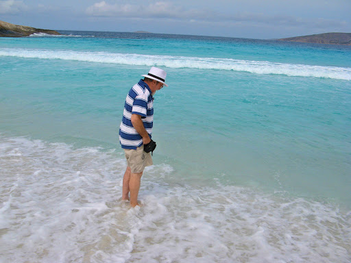
Me on the same beach

Curved surf at Hellfire Bay
After lunching at La Grand beach at 11.00 am, due to the silly WA time zones and the dull weather, we headed to Cape Arid National Park, about 50 km further east.

White snow-like sand at Seal Beach, Cape Arid

Along the way we saw a stick on the road that was moving.
This turned out to be a large black snake, probably a tiger snake, as they come in various disguises. I could have got out to take a closer look but discretion etc.etc.

Tiger snake, 3rd or 4th most deadly etc. etc.
We visited Wharton, a beautiful beach area but outside any national park boundaries and therefore subject to private restrictions. To enter their township you had to buy a pass to operate the boom gate. We chose to move on.

We are camped at the mouth of the Thomas River near Cape Arid (well within 20 km or so), where there are 2 (TWO) campsites within a few hundred meters of each other, one run by the Esperance Shire and one by the National Park. Prices in both were the same so where's the ACCC when you need them?
Sun 9 Oct
We spotted some whales just off the coast behind the breakers where the Thomas River meets the beach. Not as speccie as the Bight whales because we're much too close to the shore, but whales nevertheless, a flipper here, a blowoff there. But it was very cool, cloudy and windy, and threatening rain, but apart from that just fabulous.

Banksias growing along Thomas Beach

2 whales just off the shore at Thomas Beach. Well I can see them.
After checking about tracks with the Campground Host (the people who stop you leaving without paying), we set off towards Poison Creek along the Merivale Road. It looked OK on the map but soon became impassably narrow with huge banskia nuts clonking along the sides of the Oka, and then a large waterhole across the track which I wasn't prepared to risk. Soft sticky mud, and how many more were there likely to be? Who knows. So we backtracked and took another longer and much better route. And the sun came out a bit, the drizzly rain stopped and everything suddenly looked better.

J picking up a discarded bottle, tut, tut.
Poison Creek is almost as far as you can get in Cape Arid NP unless you are a 4WD beach junkie, so we are camped early at Seal Creek, just off the beach behind some pure white sand dunes. And the price is right, “Donations Welcome”.
Walked up and over miles of pure white sand dunes to the pure white beach. It looked like snow and crunched like snow underfoot, but a few degrees warmer (not many though).

Our sandals pointing the way back to the campsite
Walked a couple of km along the beach and back. We had to park our sandals at the appropriate spot where the track started to the campsite or we'd have lost our way. It was a bit cool and cloudy but the exercise did us good.

Looks like a snow-drift, felt a bit like one too

Since it looked like snow, we built a snowman and very realistic is was.

A close up to show the detail to which we went
It did occur to me while we were there that this could be the most remote beach in WA and no one knew we were there but all was well and we found our way back for a glass of wine.

Cuttlefish might make very good thongs

Seal Beach looking like an antarctic scene
Only one other vehicle at the campsite, a couple of blokes in a ute who were into fishing and had a genny going all day to power their expectant freezer.
Mon 10 Oct
MUCH better day today, the sun is shining and the birds is singing so we went back to the beach and redid our walk. Found a dead sting ray and a shoe.

Seal Beach on a sunny day

A morning stroll on Seal Beach
Discovered the small community of Condingup which had a store/tavern/fuel pump plus a few houses. They told us which was the best road to take to Balladonia since the maps were inconclusive and we kept seeing 4WD ONLY signs. Normally this wouldn't bother us except that after rain these tracks can become impassable for weeks and it has been very wet around Esperance for months. There is water standing alongside most of the roads, so we didn't want to test that theory. The alternative track from Cape Arid via Mt Ragged is just such a track.

We heeded the warning due to the preceding rain
So instead we took the Parmango Road which leads in similar direction to Balladonia from Condingup but is a more used road. It cuts around 300km off the round trip through Norseman if heading east, as well as being an interesting off road excursion. On the map it peters out to a minor track but in practice it's a fairly wide but very rough track with plenty of bull dust holes and corrugations, certainly not suitable for 2WDs but no problem for bigger 4WDs. After prolonged heavy rain this track would become impassable too but now, away from the coast, we are in an arid, semi desert environment so that's not a common occurrence.
We narrowly missed a large brown snake that shot across the road in front of us. I swerved to miss it and in the mirror it continued its way across the road so I guess it still had its head on.
We stopped to climb Breeboorinia Rock at 185 m high, but since the road was already at 178 m, it wasn't a difficult climb. However J had to retreat from the summit due to more 'flying piranhas' (March Flies) with gigantic appetites for human flesh.

A 'Flying Piranha'. Look at the length of it's stabbing device. This one won't be biting anyone else.
After seeing a big brown "h" sign, we stopped at the ruin of an old settlers cottage (Deralynia Homestead) circa 1890 (hence the 'h' for Heritage sign). It didn't look long deserted but we were surprised to find that people actually lived and survived in these remote areas. There's no gold here, you can't farm the land or raise animals on saltbush and mallee trees, there's no internet, so wood cutting was the only thing we could think off but there was nothing in the implement shed to suggest what industry flourished here.
Camped at Coragina Rock which is a small hill with a very pretty water hole on its summit and a more useful water source around its base.

Pretty waterhole on top of Caragina Rock
Tues 11 Oct
The track north got progressively worse as we left the Esperance shire and entered the Shire of Dundas, it was rocky, very corrugated for long sections and had previously been very boggy. That had dried up leaving dusty bog holes and long ridges left by vehicle wheels from which we slid sideways off.
We did come across an amusing gate, the 'Underwear Gate', adorned by tons of discarded items of under clothing, notably the torn Bonds jocks with the words 'too much curry' inscribed upon them.

The 'Underwear Gate'
We also came across the front A-frame end of a trailer or caravan which had obviously broken away and been abandoned. Don't know what happened to the rest of the trailer but we couldn't see how they moved the bit with wheels on without the draw bar.

The discarded trailer/caravan front end
Apart from a dead and flattened snake and a tree across the track, that was that until we found a nice lunchspot near a waterhole which is apparently the Balladonia water supply.

Balladonia's water supply?

A fallen tree blocks our way.
We could have pulled it off the track but it was much easier just to drive around it like everybody else, using the SEP concept, (Someone Else's Problem). We did pull a fallen tree off the Cape York road last year but that was OP, (Our Problem, we were stuck).
Eventually we reached the end of the track and the Eyre Highway. There was a sign indicating a load limit of 3 tonnes down the very track we had just come up, but there was no similar sign at the other end. Just a well or we might have missed out on an interesting although pretty rough 200 km short cut.

3 Tonnes? Our Oka is nearly twice that.
Back on the highway we met a huge wide mining truck with a police escort driving down the middle of the road. We stopped at the side to let them go past. The truck had hubs but no tyres, they'd been on a road train we had seen earlier and looked just like ours, except for being 100 times larger.

A wide load with police escort services
Camped at the Baxter 24 hour stopping area, half way along the 147 km straight section, more because I was knackered, rather than it being late in the day. Only 200 km covered today but half of that was quite demanding.
Wed 12 Oct
Mostly plodding though the kms on the Eyre Highway today, completing the 147 km (90 mile) dead straight section again.

Might have been true once, but nowadays there are rest areas every 50-60 km and road houses every 200 km or so. But it does give some scale of distances on the Eyre Highway
We did stop off to visit the Caiguna Blow Hole. It's one of a string of underground limestone caves with surface openings that the wind blows across and emits an eerie noise. We heard one last night at our campsite, a low moaning sound like a high flying plane that never moves or wind though power lines (there aren't any near here, and there was no wind anyway). If it hadn't been a full moon it would have been vary scary, in fact being a full moon made it even more scary.

The Caiguna Blow Hole, with no guard rails
There are also lots of sink holes in this area and J found one near last night's campsite. It's not a good thing to wander too far off the track, it was small but big enough to fall or reverse into.

An unmarked sink hole, around a meter across and big enough to fall into
We stopped at Madura Pass for a look out over what used to be the beach before the sea receded millions of years ago leaving the cliffs 40 km inland.

They've been smoothed off by time but these used to be the cliffs of an ancient sea
Camped tonight about 30 km east of Eucla, the scene of our starter motor problems which hopefully are now far behind us. Generally you don't pay any attention to a starter motor, until that awful day when you turn the key and only get a click.
Tomorrow Eucla and its telegraph station ruins and then on towards the SA border.
Thu 13 Oct
I added some oil to the Oka engine this morning, not because it needed any, (although it has done 2 months without complaint), but because after 7000 km I felt it deserved some.

Distant mirages approaching the Eucla Pass
Visited the Eucla Telegraph Station Ruins again, the first time was in 1975 and it hasn't changed that much except there is a lot more graffiti, most dating from 1976 onwards.

The old Eucla Pass leading down to the telegraph station ruins near the beach

100 years ago this was the height of telecommunications technology, 1 wire stretched across the continent with repeater stations like this every 20-30 miles

I must get myself a better tripod
We stopped at Eucla for more fuel and I switched off the engine. I'm not superstitious but I was certainly sweating just a bit when I turned the key again.
On the way east to Nullarbor we came across 2 cyclists. This is not so uncommon even though it must be one heck of a tough challenge to cycle 2000 km across a harsh, unforgiving desert, carrying only what you can pack into a knapsack.

2 tough cyclists. A bit blurry I'm afraid and who wouldn't be?
But yesterday we saw something stranger, so strange we didn't even have time for a photo. It was someone (gender unclear) walking across the Nullarbor. Even stranger still, he/she was dressed in a Darth Vader Storm Trooper black and white outfit, complete with helmet, and pushing a small 3 wheeled cart in front of them, probably concealing a laser sword, for protection no doubt against fierce wild animals like these:
Camels, Emu and Kangas for the next 150 km. We saw plenty of emu and roo's but no camels on this road, they are way too smart for that, but there were plenty up north.
Camped tonight 30 west of Nullarbor Roadhouse about half way across the Nullarbor watching the occasional road train roll across the highway, warm, dry and very windy, in fact a desiccating wind.
Fri 14 Oct
Called in to Fowlers Bay today. It's a pretty little seaside town but everything seemed to be for sale, possibly because the nearby sand dunes are encroaching on a town that has already had to move it's main street once.
Being very windy today, you can almost see the sand dunes moving as the tops get blown off. It also makes sightseeing difficult as the wind blown sand gets in your eyes, amongst other things.

Moving sand. Personally I use a wheelbarrow.
The local heritage committee have been very busy promoting the town's past, there are plaques everwhere on every subject from Matthew Flinders to the names of past school mistresses.

The 'Plaque-arium' at Fowlers Bay. 12 self-standing plaques plus 3 fixed on rocks.
After Fowlers bay we called into Cactus Beach and Point Sinclair south of Penong. It was very windy here too so the surf was very rough and there were no hardy surfer-boys (or girls) running up and down the sand.

Rough surf at Cactus Beach
But on the way in we crossed several large salt lakes, some pink, some green, some both.

A pink lake


A green and pink lake

The east coast at Pt Sinclair

Port Le Hunte at Pt Sinclair, beautiful and calm, where Mark and Scott caught their first leather jackets

From the jetty at Port Le Hunte and another plaque, about the wreck of the Cecella in 1946

All that's left of the wreck of the Cecella, beyond the shark net. The rest was souvenired, rusted away or eaten by jellyfish.
The shark net was put in place around the swimming area after an 11 year old boy was tragically killed by a white pointer shark off this beach in 1975.
Tomorrow back to Ceduna and the quarantine station, then we can stock up again on fresh fruit and veggies. Just in case they've added wine to the exclusion list, I've consumed as much as possible. Now I need a wizz.
Sat 15 Oct
Survived the Cedua quarantine inspection intact and went straight to the supermarket to restock. Just as well as the shops shut at noon on Saturdays, just like the old times.
Last night we had a computer hiccup so that our moving map system didn't work this morning. It's that darn Microsoft product again stuffing up my Mac, and I thought for a long time it was terminal, as it claimed my file was 'Inaccessible' and its only available option was to 'Delete all'.
J made a valiant effort to emulate the moving map system by sticking a paper map over the screen and used her finger to point out where we were (rather approximately). But rather than risk missing out on my shopping adventure, I delayed fixing it until lunchtime and instead just sobbed and swore and threw things.
But, being the brilliant and super modest person that I am, I found that by reloading the application (VirtualBox), rebuilding a new virtual machine and pointing it at the original pc virtual drive file, it mostly worked, and all I had then to do was repair file permissions and reconfigure the GPS communications port (why are pc ports so confusing? On a Mac you just plug things in, no set up, no port numbers, no drivers) and we were back on the air. Can't think why on earth such a trivial problem took me 2 hours and several brain cells to sort out.
[Made a mental note to take a proven clone of the entire start up disk with me next time all preconfigured with a working moving map system. Then I can just boot from the backup and carry on, albeit I would have to recover the backed up track plots files later].
After lunch we set forth for the Gawler Ranges northeast of Ceduna. Late in the day after miles of good gravel roads we crossed a huge section of mostly dry salt lakes and are camped near one. J tried to get both feet bogged again but was defeated by the firm surface.

The nice lake beside which we camped

Pretty nameless lake in the setting sun

J off to attempt the double bogging again

Shadowy figures on the crystal salt

Arty-farty photo of the Oka snagged on a branch
I tried levelling the Oka using the air bags but was concerned, nay shattered, to find that the air compressor wasn't working. Some milliseconds later I found that the wire from the pressure switch to the compressor clutch had been broken, presumably pulled apart when running over branches in rough country. A couple of wire terminals and 1/2 hour of frustratingly dirty work under the Oka and it will be as good as new.
Down by the salt lake I found an ancient fence with perfectly aligned and drilled old eucalypt posts, threaded with rusty wire and strained to perfection. Built in the days when fencemanship was still an art form and not a twisty or kink to be seen. Why, I could wax lyrical for pages on fence post design and maybe I will.

Page 1: Precision drilling

Page 2: Threading a fence like this with rusty wire is not easy
Sun 16 Oct
Next Morn: As expected, 40 minutes of dirt and dust because the compressor wire was actually broken in 2 places, it must have been really snagged on a branch. However, 4 terminals later and all is well, the compressor is compressing, but the rotten little gauge is not gauging. It's needle is very jumpy and and sticky and therefore buggered so that will need replacing.
Moved on from our beautiful fence-line campsite into the Gawler Ranges National Park. Not as spectacular as the Flinders but still quite scenic and empty, we had the place to ourselves again. Navigating was a bit tricky though...

Now you see it, now you don't. As we watched, the sign we needed just fell off.

I reinstalled the sign. I could have pointed it in any direction...

We've seen heaps of emu's today, including a dad with 12 youngsters. Gee, he must be a glutton for punishment.

Brainless but cute. No, not me, the emu youngsters. They ran off in a group with dad following along behind. What leadership!
We also saw hundreds of fat stumpy-tailed lizards, usually in pairs across the track but occasionally they actually make contact (it is spring) and then there's one big black lump on the track. Quite upsets them when we roar by, they have to start all over again.
For a change we saw a red long-tailed lizard.

This fellow is well camouflaged against the red rocks

We've saw several snakes as well, brown snakes in this part of the country. One was resting on the road and reared up as we past so I went back to ensure it was OK and it slid off the track.

I went back and reared up at him/her, from a safe distance and a telephoto lens
Another had been run over and was just lying there. A bit sad really, but while they can kill you, they are fully protected. Snakes are a bit like crocodiles, you want to see them but you really don't want to see them, if you see what I mean.

This one didn't make it, but be warned; Dead Snakes Can Bite. See my blog entry here.
(Snake jaws retain their biting instinct for several hours after death and their venom can stay lethal for many months).
Tomorrow Kimba and the rest of the known world, but tonight we are camped on the top of a hill at the Boscombe Rocks lookout. Very nice sunset and probably a nice sunrise as well.
Mon 17 Oct
Well it might have been a good sunrise but I was asleep. Very cool night with plenty of condensation on the windows so I thought it was foggy, but no, a bright blue sky morning.
Kimba to Port Augusta was a bit ho-hum but the white line was interesting (no really!) With the sun at a certain angle, its light shining on the centreline reflectors gave a really dazzling light show, brighter than car headlights.

Dazzling light show on the Eyre Highway
The journey into Port Augusta always provides stunning views of the Flinders Ranges, one of Australia's best kept secrets in our opinion.

The Flinders Ranges coming into Port Augusta from the west
In the Woolies car park in PA we met fellow Oka owners Peter and Rae from QLD with Oka 173 so obviously we stopped for a quick 2 hour chat. They are 1 month into a 6 month tour of the south western parts of Oz and Tassie.

Peter and Rae with Oka 173
Tonight we are camped in Horrocks Gorge, just south of PA and tomorrow the short run home. Yippee, I cant wait to get the lawn mower and chainsaw out to start clearing things up. I'm going to need several cans of 'Start-Ya-Bastard'.
Epilogue Tues 17 Oct
We arrived home at 3 pm this afternoon a bit weary after 9000 km across 3 states and about 17 time zones.
The drive down from Port Augusta via the inland route through Clare was a bit frustrating. Not as much traffic as the highway but what there was was urban and stupid. Plainly double white lines have a new meaning, you can now ignore them completely.
Anyway we're here safe and sound, the house is still standing and the garden is reasonably overgrown but not totally so. Mark reports a pair of Spotted Pardelote's have set up home in a fallen tree so I can't go near there with the chainsaw. Bugger.
Now to connect up the Telly and all is complete. Till next year.
I think it was called Bubble & Squeak when I was (a lot) younger.
ReplyDelete66,002 it says how uncanny.
Good luck
Alan
I reckon the 2 km is how long it took us to slow down.
ReplyDeleteNote the clock says 12:26. Now 12 is 2 x 6 and 26 is a 2 and a 6 and there's 66 again. This is getting scary!!!