25 Aug
We are at the Manbulloo campsite in Katherine planning our trip up to Darwin before starting the long journey home.
Had a lazy morning so far, managed to access the internet for what to do in Darwin that we haven’t already done.
A day trip to the Tiwi Islands seemed like a good idea but when I searched for info all I got were confusing and misleading stuff about Aboriginal Tours (the only kind you can get and need a permit to visit anyway), and nowhere to book an economical tour ($250 by ferry or $450 by air, each) either. So I looked at Trip Advisor and all the comments were negative, waste of a day, no culture (no dancing, no art sites, no scenery etc), all time spent in one arts place, childish paintings, expensive arts, money, money, money etc and basically waste of time and money.
So that’s off the agenda, in favour of a $30 per 24 hours hop on-hop off double decker bus tour. It got tons of good reviews, even though we’ve done most of the places before, not having to drive, park, walk about in the heat seems a more and more attractive option.
In the afternoon we went shopping in Katherine for food, fuel and gas, all successfully, plus Janet bought some shorts in Rockmans as she always does. It was stinking hot but the counter girl in Rockmans was wearing jeans, a long jumper and a woolly scarf and still complained of feeling cold. Must have had hypothermia or ebola or something else exotic.
26 Aug
In the cool of the morning I did a spot of maintenance, checked the gearbox and transfer case oil, all OK, and greased the rear drive shaft UJs.
In the late morning we set off north stopping for lunch at Pine Creek and then a leg stretch at Adelaide River.
We had decided not to reach Darwin tonight as it’s a long hot drive and fighting the Darwin traffic to find a camping place would be hard to bare. So we spied a camping area at the Manton Dam Wall, officially a picnic area, about 70km short of Darwin and stopped here. It was a bit noisy but there were a few other campers here, some more happy with the arrangements than others:
So it wasn’t too bad and we cooked and ate outside since it’s darn hot (mid 30’s during the day and it doesn’t cool off much until the early hours).
27 Aug
Not a good day in Darwin, which is a pity since our previous visits have been very relaxing and friendly.
The drive up wasn’t too bad, 70km over fairly good roads, choked with road trains though, and ended up on a big freeway right into the city centre. We diverted to the waterfront, an area we hadn’t explored much before and stopped on Stokes Hill Wharf for a look at the sea. It’s a bit like a mini Glenelg with lots of eateries and a few souvenir shops. The menus make interesting reading but how can you be sure you’re really getting a camel burger and not a piece of horse meat?

Nearby in a small park were a pair of stone curlews nesting. Their habit is to freeze when alarmed which makes them easy to photograph but also easy prey for dingos and raptors:

But mostly Stokes Hill Wharf was good because it has free parking. Make a note of that, it’s now the only place in the city where that’s still possible.
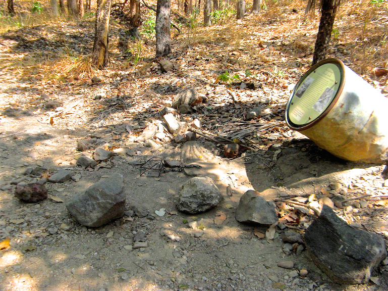
Fishing restrictions:

Interesting news from the NT:

From there we drove up to the Esplanade, the main touristy section of park lands along the foreshore and opposite the parliament buildings, and all looked much the same except for the plethora of blue parking pay machines which now smother the city at around 10m intervals, and at $2.40 an hour (no notes or 5c pieces) it’s no longer the welcoming place for visitors it used to be. On our last trip this area had free visitor parking. We tried visiting the visitor centre to find out what else had changed but there was nowhere to park there either. In frustration we headed north to the East Point Military Reserve where there are excellent free car parks and good walking tracks along the cliff tops with plenty of memorabilia to visit too.
Later we trundled though the busy traffic and hectic road works to Lee Point where we had camped in the caravan park there quite economically before. But horror of horrors, it’s now charging $50 per night for an unpowered site. I remonstrated that it was a ridiculous cost for a patch of land for a night and twice the price we had paid in Katherine only 2 days ago but we were told, “well you could drive out of the city and park on the road side somewhere”. So I explained the lady how to clinically dispose of her offer and we did drive out of town, and saved $50 in doing so, along with quite a few other travellers. On the way we called another CP and was told the same story, $50 a night, and more for a powered site.
Strike me lucky!, Darwin has priced itself out of the Value for Money criteria. Worse than that, fuel is 10-15c a litre more than in Katherine (and there’s a lot more competition here), and the whole of Darwin is undergoing rampant development with industrial and housing estates now going up in every spare hectare of land across the city. This makes it a hot, dry, dusty as well as frustrating place to be.
There are no RV friendly facilities in Darwin, as there are now in many other towns and cities, and the government has failed to grasp the economic benefits of the huge number of self sufficient wealthy travelling nomads. By way of example these signs have sprung up all over Darwin:

Given that tourism sustains the economics of the NT, it’s very surprising and sad that they are paying scant regard to the needs of tourists, to the point that we won’t be spending any of our tourist dollars in Darwin anymore, and we have heard the same story from other travellers. Presumably their eyes and cash registers are firmly pointed in the direction of China, and bugger the rest of us.
We did think Broome would be the economic low point of our trip but Darwin has firmly taken the lead, by a long way. Broome was actually very affordable as well as being a lot nicer, freer and more relaxing.
We stayed in the same place for several more nights, the slight inconvenience and addition fuel costs far outweighing the $250 in camping cost we’d otherwise have incurred.
28 Aug
Well I feel a bit better today. After a late start caused by talking for too long to a lonely old fellow in a small Winnebago (who had formed the same opinion of Darwin as we had), we drove back into Darwin and “lunched” on the Stokes Hill Wharf.
There are lot of plaques around commemorating the first bombing raids by the Japanese in February 1942 which killed around 300 people in the docks area and sunk 21 ships…

So it was a bit ironic to see a Japanese naval ship tied up alongside RAN ships on the wharf.

This is our outdoor cinema day, which I’d booked up earlier, so in the afternoon we awaited darkness by revisiting the MAGNT (Museum and Art Gallery of NT) which is icy cold inside and free and quite good. It still has the same exhibits as on our previous visit, the Cyclone Tracy exhibit, which is very good, and a wildlife section and a lot of indigenous artworks and some from the SA Asia region.
We pottered along past Mindl Beach which they were setting up for the sunset markets and back to the cinema carpark which (as all parking areas are in Darwin) is mercifully free after 5pm, Saturday arvos and all day Sunday.
The Deckchair Cinema is a 50 year old, volunteer-run, not-for-profit Darwin tradition. The earlier Star Theatre was destroyed by cyclone Tracy and replaced by the current outdoor theatre at the waters edge beneath the Esplanade. It’s surrounded by palm trees and shrubs to give it a sheltered aspect.

The deckchairs are metal and canvas affairs (they do provide cushions, plus we took our own), similar to the Sun Picture Theatre in Broome.

Meals, (like a “help-yourself BBQ” and which are provided each day by a separate fund-raising charity) and drinks can be bought and eaten at tables prior to the movie, or in your deckchair if you’re careful.
Films change every day and the film we saw was “Tracks”, a new all Australian movie recounting Robyn Davidson’s 8 month solo trek (with 4 camels and dog) across the western deserts of Australia from Alice Springs to the Indian Ocean in 1977. Her story was published in
National Geographic in 1978. We don’t know why it took 35 years to turn into a movie but it was very well done.

Since we had done almost the same trip last year from Alice Springs via Docker River and Warburton and along the Gunbarrel Highway right out to Steep Pinot on the west coast, it was quite meaningful and familiar, although quite a lot of cinematic licence was taken with locations (it was all shot in SA and the NT), the scenery, the story and her obvious love of her camels and dog Diggity was extremely effective. It does have some sad moments but overall a good experience in a very different movie environment. It got cool but not cold and there were a few external distractions, like a ship passing by with lights blazing, and a few mossies, but it was a good night out for $12 each. See the trailer
here.
Late at night we drove back to our Manton Dam campsite in the dark and along the way called Scott who is leaving for his European adventure/honeymoon on Saturday, meeting up with Tash who’s on a business trip in Croatia. It was the usual long call and halfway through our credit ran out, so he called back and then the signal disappeared as we drove out of range. But by then all had been said that needed to be said, and more.
29 Aug
Instead of traveling back into Darwin today, we (that is I) decided to divert up the Arnhem Highway to the Mary River NP for a couple of days where we knew we could get up close with large crocs, we’d been there before, in 2008. Then we could head back to Darwin on Sunday, refuel or what ever, visit the Mindl Beach markets in the late afternoon and make our exit from Darwin and head south.
However the Arnhem Highway is not the nice country drive it used to be, for a start the sides of the road are infected by commercial advertising signs for everything from
Water Tanks to
Bottl-O’s to
Dig Your Own Power Pole Holes, second there are a plethora or 3 of road trains and army vehicles roaring down a not very wide road.
We stopped for lunch at Fogg Dam reserve, built in the early 1900’s as a rice growing area for export to SE Asia, but failed to survive due the Asian’s developing their own rice industry.
This heron had caught something but it didn’t look very fish like, maybe a small eel:

Janet on a hot forest walk:

We are camped in the Mary River NP at Couzens Lookout, a free campsite overlooking a large billabong in the Mary River.
It was hot so we sat outside in the evening computing:
 30 Aug
There is a lot of wildlife here (but fortunately no other campers), kangaroos, noisy kookaburra’s, cape barren geese, pheasant coucals (see pic).

And a cormorant drying its wings

Under the Oka this morning is a pool of fluid, fortunately only radiator coolant. There’s been a drip from the thermostat housing for some time but now it’s worse so now it needs a new gasket, which I’ve got a spare one of. When the engine is hot the leak seems to subside so it’s not as bad as it looks. It’s only lost less than 2 litres of water so I can top that up daily.
But to make things easier I’ll leave replacing it until we are at a more civilised location lest something serious goes wrong which I can’t fix here, a small leak is better than an avalanche, and replace the gasket in Darwin or Katherine in a few days where help is nearby if needed.
Off to look for crocs this morning and we’ll return here tonight.
So we looked around the Mary River here at the lookout but there had been a lot bigger wet season than the last time we were here and the river level is a lot higher and there were no river flats for crocs to lie on.
We headed north and stopped off at Mistake Billabong for a lunch and look for wild animals but on the walk in it was me that made a mistake. There was a bitey fly buzzing around my head so I snapped off a small leafy eucalyptus branch as you do, for use as a fly whisk. Unbeknown to me green ants had constructed a nest on the branch, made of leaves bent over and glued along the edges, and they don’t like being disturbed, especially if being used as a fly whisk.

After a couple of waves of my whisk the bitey fly was quickly forgotten as I was covered in bitey green ants instead, inside and outside my shirt and up my shorts and all over the camera case I was carrying. I had to strip off and remove each of the hundreds of ants one at a time as they bit me, the camera case, my shirt and ultimately Janet who came to my rescue. It took a good 5 minutes but fortunately the bites are not venomous or long lasting, just annoying.
These are the little blighters:

And instead of dangerous crocs we saw a feral water buffalo. These creatures can also be dangerous but this one was on the other side of the billabong. I thought they had been almost eradicated in the NT, Crocodile Dundee style, since they cause so much damage to waterways, but obviously not.

After lunch we drove north to Shady Lagoon, where we knew from past experience is where to find crocs, lots of crocs, and we were’t disappointed.
At the viewing platform we could see at least 8 or 9 crocs sunning themselves at various places on the far bank, and a few more cruising around just beneath the surface.


It was at this very spot that in 2007 I dropped 2 rechargeable batteries through this grille on to the mud as I was changing them. Sadly they are no longer there but just like last time, I wasn’t intending to brave the croc river to retrieve them.

A while later we spied a large croc, probably 4-5m long and weighing 500kg, heading slowly towards the nearby boat ramp so we went round to check it out.

It cautiously approached the ramp, just like we did.

I walked tentatively towards him to about 10m away and he heaved himself a bit further on to the ramp and watched me. I bravely and sensibly backed away a bit.

Look at those interlocking teeth (which they are born/hatched with) with 10 tonnes per sq inch of crushing power.

We watched him (or her) for 10 minutes or so and he was definitely eyeing me up as a potential feed. I was a good 10m away up the ramp, but he obviously knew the boat ramp meant a potential meal, and this is probably why, at the very same spot. People are advised not to enter the water when launching boats, which this fellow did.

After we moved on he slid back into the river, a sure sign that we meant something to him. Perhaps he just wanted to be my friend?

Actually these are extremely dangerous creatures, they are Australia’s number one predator and not to be messed with. More people are killed by crocs each year than by snakes and sharks combined. The may look slow and fat out of the water but they can move at lightning speed when they want to, we witnessed that on our last visit when we surprised a croc laying on the bank. It surprised us too….
There’s a law in the NT prohibiting boats from approaching within 10m of a croc, and the same common sense applies to foot traffic too. While you’re focussed on one croc, another could be creeping up behind you…
Subsequently we went to Mindl Beach markets in Darwin where a young lady from the Crocodylus Park (where you can take home a “Crocodile BBQ Pack”) was showing off a small one year old hatchling, which Janet had a hold of (the young lady wasn’t allowed to let go of the croc as some people have be known to run off with them):


Actually they feel like a cold sausage, but all smooth on their underside (the valuable part, aren’t they all?). If it was in the wild, this one could have grown as large as our Mary River specimen (even at one year old it could snap your finger off, their jaw muscles have a mechanical leverage mechanism like bolt cutters). But sadly this one will have long since become handbags and shoes.
That night I invented a better way to keep my beer cool between sips, using second stubby cooler as a lid. Worked pretty well.
 31 Aug
Today we left our Couzens Lookout camp on the Mary River and headed 140km back for a last look around Darwin before departing south.
We “lunched” on the Esplanade where parking is free on Sundays, and walked around the many military memorials along the shady grasslands on the top of the cliff overlooking Darwin Harbour. Commemorative wartime plaques are still being erected there, the latest being in 2012 in memory of Canadian Signals and Communications forces who operated here in the latter stages of the war.
This the memorial to the USS Peary, sunk with the loss of 91 sailors during the first Japanese bombing raid on Darwin on 19 Feb 1942, the first ever raid on Australian Soil (other than the European invasion of 1788). At that time invasion was far from expected and there were only 2 fighters (US Kittyhawks) to protect the whole of northern Australia. They were both destroyed on convoy protection and their pilots were lost, but due to a news blackout of the raids, the bravery and sacrifices of the defenders was never disclosed or commemorated until after the war. Neither was the plan disclosed to abandon the northern half of Australia in the event of full scale invasion and defend only across the Brisbane-Alice Springs-Port Hedland line, roughly across the 23rd parallel.

Over the next 3 years a large number is airstrips and military facilities were constructed in WA and the NT and particularly around Darwin and many can still be visited although sadly some are now on private land and only informative plaques remain. A pity because they are useful camping areas where you can immerse yourself in history. Just recently the site of the secret Z Force commando regiment, whose exploits have never been fully disclosed to this day, was ploughed up for an industrial site. The NT Govt considered a plaque was all that was needed.

We paddled in the sea off Mindl Beach so technically we’ve been in the sea in Darwin, something you are not supposed to do due to deadly crocs, jelly fish, sharks, cone shells etc. but we did paddle between the flags.


We mingled with all the young and beautiful people in Mindl Beach markets where we sampled spring rolls and a fruit salad and Janet bought some more earrings, as normal.
But there were a few new stall types:
Eco-Nappies. Actual cloth nappies you don’t have to throw away. Well who’d have thought of that? But they do come in colours other than white.

And the
iSmashed.com stall where you can have your broken iPhone screen replaced in 30 mins for only $149. 2 guys twiddling miniature screwdrivers on microscopic screws from a magnetic pad, but there’s probably more to it than that.

Halfway through, everyone departed over the sand dune to the beach and just sat there looking.


At this, more photons from outer space. Moisture and smoke which hangs in the Darwin air always causes spectacularly colourful photons:


Our last Darwin sunset, for a while:

After the ball was over we drove back to our our Manton Dam Campsite for the night, which is on the way to Litchfield NP anyway.
We’d spent 6 days in the Darwin area at a camping cost of $0, but it did cost around $50 in additional fuel costs. So we had an extra $200 to spend on other things.
There are still good things to see and do in Darwin that don’t cost a fortune,
but caravan parks and street parking are not ones of them.
|
When we got to know the new Darwin a bit better there are still lots of good things to see and do there. We liked:
- Stokes Hill Wharf,
- The Esplanade,
- The Deckchair Cinema,
- The Museum and Art Gallery,
- East Point Military Reserve,
- Coolalinga Shopping Centre,
- The Mindl Beach Markets and
- Cullen Bay.
On previous trips we also enjoyed:
- The Aviation Heritage Museum,
- Casuarina Shopping Centre,
- The drive out to Gunn Point and Fright Point,
- Fannie Bay beach,
- The ferry to Mandorah or
- The drive around from Darwin to Mandorah to visit the 1945 Milady Liberator crash site.
1 Sept
This morning we took the Old Bynoe Road west to the Litchfield Park road to cut off the corner. It was so old some of it has disappeared and we had to do a bit of skilful navigating to get on the correct road.
We stopped to lower the tyre pressures for the 40km or so of gravel on the back road to Litchfield since it was a lot more corrugated than we recall from previous trips.
We called in at a couple of sites where magnetic termite mounds had been built, flat on the east/west side and thin on the north/south side to minimise the heat from the sun.


We checked one out and it was built exactly magnetic N/S within a degree or 2, to minimise solar heating. Moreover, the mounds were slightly curved, and leaned towards the west to further minimise solar radiation since the sun is more powerful later in the day. Damn clever these termites.
Photo taken at 10.30am. By noon the mound would be almost exactly in line with the sun.

Further on we stopped for lunch at Walkers Creek where Janet dangled her toes in the creek.

We arrived at the Wangi Falls campground in the early afternoon (only $6.60 each and excellent facilities, plus a pretty good water feature out the back), but by then it was fiercely hot, so a quick swim in the pool was called for.

Me relaxing in the warm water:

In the wet season the whole of this rock face would be covered in a raging torrent and hidden by spray (I’ve seen the photos), but it’s comforting that the park authorities are
fairly certain there are no salties in the pool now (like there was last year and they had to close the pool for swimming, 3 weeks after they declared it free of salties). But they still maintain crocodile traps in the creeks.

Flying Foxes (fruit bats) were roosting in the trees around the pool.


After our swim we had a $5 ice cream from the kiosk and chatted to a girl from Finland who was working there. She’d only been in Oz for a couple of months and was feeling the heat. She was cleaning out a freezer cabinet so we said “Why don’t you jump in it, you’ll feel at home?”. We repaired to the Oka for a cold beer since it was way past I don’t care when and I needed a cold drink.
Bower birds mimicked and whirred their noisy songs all around us.

We had a nice tuna salad outside tonight since it was so hot, followed by strawberries and cr ème anglaise (custard) with red wine (since I’ve finished up all the white stuff), and we played our Farm Day music and reminisced about music practices. Maybe the bower birds will start mimicking our Farm Day music?
Just on dusk, thousands of flying foxes left their roost around the pool and made their way silently overhead to wherever they go to feed at night. Smaller bats flitted around below treetop height catching some, but definitely not all the bugs which were/are annoying us.
Whilst sitting out in the still of the evening, a black feral pig clomped and snuffling its way noisily passed our campsite looking for food scraps. There was an advisory notice about it on the way in and rangers have being trying to catch it. But we caught an image of the beast as it passed by our campsite for a second time. They are heavy creatures and can be dangerous if cornered.
 2 Sept
We went for a morning swim in the falls again since it got quite hot quite early but it’s not as good as in the later afternoon. The sun casts shade over the falls and most of the lake, there are fewer people about and the water seems a bit cooler in the mornings.
After packing up we drove out to the highway and down a corrugated track to the Blyth Homestead. It was built as an outstation on the Stapleton Station in 1928 and housed 2 adults who eventually had 14 children there.


The mother schooled the children and was cook on the main property, the father who was fiercely independent, ran the rural aspects and the elder children ran the market gardens alongside the creek and a tin mine near the small homestead. It was a tough life and none of the children left the homestead or saw anyone else or knew what money was until their early 20’s, they just worked for their father almost as slaves and for no pay.
Mining tin was extremely hard work, they dug down 27 feet and then tunnelled outwards following the tin seam. Tin ore is heavy stuff, the large normal rock on the left weighs 22kg, the smaller lump of glittery tin ore in the centre weighs 43kg.
Then they had to break it up manually with large hammers, then pass it though several ore crushers and sluice the fine dust with water through hollowed out logs to sieve out the tin.
Still, their father had the right idea about useful scraps of old iron:

During the war they had a bit of excitement when a Japanese plane was shot down nearby and they got some useful info from it for the intelligence services.

We had lunch at the homestead, which was much easier than mining tin, and then moved on to the Sandy Creek (Tjaynera) Falls for an afternoon swim.
However, there was a tough little 1.7km walk to the falls so we were pretty hot when we got there and the water was colder but more refreshing than Wangi Falls.
Janet taking a dip in the pool:


Since it was getting late we decided to camp here but it’s not the best campsite around, for the same cost as the Wangi Falls campsite there is no rubbish collection so there are bags of garbage all around and only one loo with a cold water shower. But it will do for one night.
3 Sept
Not such a good day today. Visited the Tolmer Falls but they weren’t that impressive with little water flowing over them.

There is a nice rock arch though which water would come in the wet season with a substantial force.

We bypassed Buley Rockholes since there were a lot of tour busses in there and we’ve done it all before and headed out to Batchelor for lunch, and access to the internet for the first time in several days.
There was a message from Scott who had arrived in Split (Croatia) all OK and with Tash they’re starting their European vacation/honeymoon, so that was a positive.
After lunch we set out for some WW11 airstrips that we’d been to before for another look around and somewhere to stay. However I got extremely angry that they were now in private hands with locked and barred fences and gates so we couldn’t visit them anymore. So much for the NT government’s much proclaimed WW11 Heritage campaign. Their multi-coloured signboards still show Fenton Air Base as a W11 Heritage Site:

Fenton in particular was my favourite with a graveyard of broken and wrecked aircraft to fossick through and runways to drive down. Sadly this is a trend all over the NT with WW11 memorabilia being lost for ever.

And for good measure the countryside around here is shit as well, all burned out and looking terrible. Much the same all over the top end so no more top end for us for a while. We’ll stick to deserts. You can’t burn deserts.
With this frame of mind I wasn’t about to stay in any Big4 crapsite so we turned off the highway at Hayes Creek to an historic mining pub (Grove Hill Hotel) and are camped out the back for $Big4/3. Very outback as it happens with country style showers and loos in tin sheds.

And our wine stocks from Adelaide have finally run out after 6 weeks. I knew I should have filled another jerry can.
Tomorrow we’ll trundle down an historic mining area through the Bonnie Ranges to Pine Creek and thence to Edith Falls to camp.
4 Sept, my grandma would have been 132 today.
And down we trundled on a very smooth gravel road to Pine Creek and since we made such good time we carried on trundling to Edith Falls for lunch.

It’s quite a few years since we’ve been here and it’s quite nice so for $18 we are camping here for a swim or 2 in the pool. The falls have very little water flowing since we are getting towards the end of the dry season and a huge gravelly sandbar has emerged from the depths, swept up by wet season storms:

The water was cool and dark and you can imagine all sorts of creatures from the deep rising up to do unspeakable things to your appendages:

As it happens after my swim I was leaning on a bridge, as you do, looking at the Edith Creek:

When something caught my eye:

A crocodile trap had been subtly set up the creek. It’s either very encouraging or very worrying that they have to set up such things. At least it was empty, and that’s a good thing, I suppose.

There was a report in yesterday’s paper of a man being bitten by a fresh water croc only last month in Wangi Falls in Litchfield NP, where we were a few days ago. They had to close the swimming area while rangers caught and removed the offending creature. Last year they found a saltie in there too...
5 Sept
A cool night but there were a couple of small kangaroos with joeys feeding in the campground early this morning.


By 8 am the sun and the flies had both risen as we ate breakfast outside, rather quickly actually.
By 10.30 it was hot and we reached Katherine and sought out the laundromat. While the washing was well, washing, we went to refill a gas bottle. While the washing was drying we had lunch and when it was all folded and put away we headed for the supermarket for a week’s supplies and 220l of fuel.
Things I hate about Katherine (and many other places which do the same thing):
a) Having to pay to go to the loo in the shopping centre ($1).
b) Having to pay for a shopping trolley ($1 or $2 although you do get it back upon return of the trolley, but it’s still a drag).
c) Having to queue for 10 minutes to pay for groceries, when there are lots of empty checkouts. And the trashy magazines on the stands just make the time go even slower.
c) Having to pay for water at the visitors centre ($2 for 5 minutes on the hosepipe, easily 100 litres). Although we could have got it for free at the servo but it’s not so convenient.
[Interestingly, I spelled “ALthough” with a capital “AL” and the spell checker offered “Although” as an alternative obviously, but also “donut”. Why?]
Heading off down the highway we realised that we had missed out the bottle shop so our 1 can of beer and 2 cans of cider will have to last several days. Still, I did put a bottle of sherry in the fridge since sherry at 40º doesn’t have the same effect somehow. Might have to do the same with the port although we don’t seem to have much of that left now. We still have 1/2 a bottle of Serge’s red wine left which is also in the fridge. Is there a trend emerging here?
d) Having to wait until the bottle shops open in the afternoon and then only getting 1 or 2 litre casks at 5 litre cask prices, which we forgot anyway.
Camped tonight at the Leach Lagoon Rest Area, 50km SE of Katherine. However there is no sign of a lagoon here, which is
tanto montare to misleading advertising.
6 Sept
One of our favourite swimming spots in all the world is Bitter Springs creek in Elsey National Park just 50km down from our campsite.
The water there is incredibly deep, clear and warm (33º all the year round) and it’s in a natural tropical wetlands area of pandanus and palm trees. Steps have been added to reduce erosion of the creek banks. Because the water is high in minerals and low in oxygen very few creature live in it making swimming a real pleasure, and it’s free.
Me lazing around in the warm water:

You can swim/drift about 100m along the creek through a primordial swamp to a bridge and exit point. Janet found it too warm for a long swim.
The palms here are the kind that dinosaurs fed on, in fact you can still see their bite marks on the leaves.

After lunch we checked our emails at Mataranka and turned east on the Roper Highway heading for the Limmen NP about 200km away near coast of the Gulf of Carpentaria.
The road is a single lane piece of bitumen which I find more annoying than all gravel roads as you are continually slowing down and putting 2 wheels in the dirt to pass other vehicles.
Anyway, 70km down is a nice rest area (Mt Price) with a large mountain of rock in the centre that you can hide behind and be protected from other campers (there were none) and traffic noise (of which there was none all night).
What there was however, was a pair of donkeys who put up a terrible racket for about 10 minutes while we were eating dinner outside in the dark and scared us sh*tless.
7 Sept, my LXIX birthday
This time last year we were at an Oka gathering in Harrismith, SE of Perth, and the weather was cold and wet. Today we had our hottest day on this trip so far, the external thermometer read 40.1º but it felt hotter than that in the Oka. Fortunately the a/c is working fairly well and there are several lily lagoons along the road which make things feel cooler even if they’re not.
We stopped off for a look at Roper Bar, a man-made concrete causeway across the Roper River. Nice and calm now but impassable in the wet season.

A family of Aboriginals were having a fun day out in the water which is safe to swim in around the causeway.

We stopped at a lagoon we had camped near before for lunch and to check our emails.

This area is not noted for it’s mobile coverage but just near here, on the other bank of the Roper River is the Aboriginal community of Ngukurr and we piggy backed on to their Telstra network.
I had the usual gaggle of birthday emails from all the websites I subscribe to plus one from Charles and Fred in the UK and a message from Scott who is in Rome and just as we were leaving a call from Alan. Soon after we were out of range again so apologies to those who might have sent messages but we’ll collect them when we are next in phone range, probably Tennant Creek in a few days time.
We passed by a number of brand new campgrounds in the NP, none of which had any campers in and made for St Vidgeons, the ruins of a former Lomarieum (don’t know what that is but it sounds serious if it has to be as isolated as this). The usual Aussie disregard for authority was evident:

The main attraction here however is the nearby huge lily filled lagoon with plenty of camping opportunities (but no swimming due to croc risk), so since it was so hot today and there’s a nice cool breeze blowing here, we are camped alongside it.

Water lily leaves with turned up edges:

Tall water lilies on the far side:

A duck in cunning disguise:

Relaxing in the cool breeze on a very hot 40º day:

We took memorial photos of the birthday drinks, dinner (tuna salad) and dessert, just as the sun was setting:

Dessert consisted of strawberries and yoghurt for Janet, and strawberries, custard and slices of Mars Bar (because it’s my birthday and they were my pressie) for me.

The sunset over the lagoon was pretty special too.
 8 Sept
Today is Charles LXX birthday,
Happy birthday Charles, we celebrated your anniversary with an ice cold glass of sherry under a full moon on a warm evening in the Southern Lost City in Limmen National Park.
We left St Vidgeons still ignorant of the meaning of “Lomarieum” (the informative plaques had all been burnt out), and motored down the worsening track to the Towns River. There is an excellent campsite there and the river always looks beautiful and inviting…


From there to the Cox River Crossing the corrugations got worse so we stopped for lunch just past the crumbling causeway and 3 guys (1 English from Guildford and 2 Germans) in a petrol Pajero with no A/C pulled up and asked if they were still on the Savannah Way. Well there’s only one road in the area so we are all on it.

They were heading for Cairns but only had a flimsy paper map and were amazed at our moving map system. We had a chat for while about the availability of LPG in Borroloola and it seemed to us they were ill prepared for such a trip, one of the roughest tracks across the top of Australia, we’ve done it several times. Still, they were young and nothing much worried them.
The Cox River where they were going to do some fishing.

On the way further south, we came across these confusing signs:

It turns out we were crossing a mining company haul road from/to an iron ore mine. But this is in the middle of a National Park! What is happening in the NT? This is not the first time we’ve come across this on this trip (there are new mine sites all along the Roper Highway and there has been a uranium mine in Kakadu National Park for many years) and they seem to be putting economics ahead of any environmental considerations.

We called in at Butterfly Springs where we have swum before (the only place where it’s safe to do so) but this year the pool is almost dried up and the waterfall has long since stopped flowing.

There was a water monitor clinging to the side of the rock sunning himself:

We are camped tonight at the Southern Lost City, an amazing place of crazy leaning rock formations which we’ll have a look around early tomorrow morning before it gets too hot.
9 Sept
We did our morning walk and most of the area had been burnt out. However that was a bit different and allowed a better view of the rock formations.


After our 7am walk, the clouds were burned away by the sun and it started getting very hot so a shower was called for. The wire in the large antenna got very tangled up as I was lowering it and I couldn’t get it apart in the hot morning sun so I left it until later to sort out.
Then the A/C stopped working on the way down the track so we stopped to fix it at Batten Creek. The compressor fuse blew and a few minutes after I replaced it the replacement also blew.
I confirmed that the compressor was working OK and found that one of the connections on the pressure switch on the front condenser was causing the problem (something on that other wire was dragging the voltage down from 12 to 9 so it’s a heavy current partial short circuit which slowly blows the 30A fuse) but not the additional fan I had fitted, so I replaced the cable from the switch to the compressor and all was OK again, I thought, so we had lunch.
The original evaporator fans wasn’t working on that circuit so I assumed that might have been the problem but possibly not. A few minutes later the rear A/C didn’t seem to be working indicating that the solenoid allowing cooling fluid to the rear evaporator wasn’t functioning and then the rear fans stopped working as well presumably a fuse problem too, but maybe a thermal cutout issue since it was OK the next morning.
Rather than buggerise around any more we carried on using the front A/C only and one condenser fan, which was just up to the job, and I’ll investigate further tomorrow in the cool of the morning.
The Nathan River Road through the Limmen NP got gradually and very frustratingly rough and corrugated as we drove south and we could barely manage 30kph. And there were quite a few creek crossings and causeways to negotiate.

When we got to what I thought was the Carpentaria Highway and a bitumen road, I was sadly 50km out of place and it took another hour to reach the relative comfort of the Cape Crawford Road and Tablelands Highway.
These are sealed roads but only a single lane and very undulating to the point of seasickness. Eventually after 2 hours of lonely driving though reasonably attractive cattle country and “
hill covered trees”*, we reached a rest area only to find several other caravans already here, but here we will stay after a long gruelling day in the saddle. This road, although sealed, is very rough and narrow and not really suited to caravans. It’s also nearly 400km between fuel stops.
* Janet didn’t see anything wrong with this statement.
There was a nice looking big windmill along side the rest area with a water tank.

We sat outside but the cicadas were absolutely deafening, like severe tinnitus turned up 100dB.
10 Sept
The “nice looking” windmill woke us up several times in the night with it’s screeching and rattling as the breeze varied from nothing to light.
Fairly uneventful today if you exclude the indicators which stopped working. That turned out to be a fuse with dirty connections which I refitted yesterday. A quick clean up and all OK again.
There was the usual Aussie humour(?) along the way…

And a couple of reminders of just how big this country is:


Just endless vistas of dry Mitchell Grass from horizon to horizon.

The front A/C worked pretty well during the morning session but struggled in the 36º heat this afternoon. Tomorrow I’ll check if the rear solenoid is the faulty item and if not, I’ll rig up a connection from the compressor so we can use both systems again.
325km today over the single lane, undulating Tablelands Highway south to the Barkly Highway and a fairly crummy but just adequate rest area about 150km east of Tennant Creek.
11 Sept, anniversary of 9/11.
This morning I tested the rear a/c solenoid and it appears to be OK so I wired it in to the compressor circuit and both front and rear a/c systems now seem to be working, but I am keenly anticipating disappointment. The solenoid should actually be connected to the rear fan switch so it only comes on when the rear fans are on but that will have to wait until I can find the right wire.
The remaining 150km 0f the Barkly Highway were fairly forgettable but we were quite surprised by Tennant Creek. It’s a mostly Aboriginal town but unlike many similar towns, the locals were more friendly and approachable and many of them are working in supermarkets or similar.
Grog limitations are still annoying though, only low/mid strength beer before 3pm and no cask wine before 4pm, and nothing after 6pm. Anyway we got some beer and cider which will do us until we get to Alice.
We checked our emails and called Mark, all is well in Adelaide. We called Troy who is house sitting for us and arranged our homecoming on 20 Sept. We also had a message from Scott and Tash who are in Rome. They just went to St Peter’s Basilica and the Colosseum tomorrow and are loving their European vacation.
After refuelling and refooding at a very expensive (except for veggies surprisingly) IGA in Tennant Creek we drove down the very quiet Stuart Highway to a small track we found several years ago about 70km south of Tennant Creek, and are camping about 1k off the highway.
Very hot again today, 36º but the A/C is working fine, but I sense the temperature trend will now be downwards.
12 Sept
The drive today took us past the Devils Marbles, always a good place to stop and frolic amongst huge stone boulders.


It also took us through Barrow Creek, the centre of the sad Peter Falconio murder and Joanne Lees assault some years ago (2001 actually).
But has someone been reading my blog??
A couple of years ago I reported in these very pages that although Barrow Creek had a Telegraph Station as early as 1872 it didn’t have a mobile service in 2010. Well today, in 2014, I am able to report that Barrow Creek now has a new shiny phone tower and megawatts of solar power:
The 1872 Telegraph Station and its contemporary high tech wiring system:

The 2014 mobile phone tower and solar farm:

On the section of the Stuart Highway south of Barrow Creek, the speed limit has been de-restricted, in fact removed all together, it’s an “
open speed zone”.
So this road could be one of the very few places in the world where you can legally travel at 500kph, (or more if you had the technology) and it’s not an
autobahn or an
autostrada or a freeway
in Dubai, it’s just the main 2 lane connecting highway between north and south Australia. This section is around 40km, dead straight.


But as you accelerate though the 200kph point you are required to read this informative sign. We couldn’t even read it at 70kph.

Althoiugh, it does have several 30 or 40km long dead straight sections, it’s not all straight, and because of the speed potential, bends are supplied with copious arrows. The average is around 12 per bend, but this long slow bend has 33 double sided arrows to guide speeding motorists around the corner:

And continuing with the motoring theme, another notable thing of note that happened today was that our odometer passed the 700,000km point, of which we’ve done around 170,000 of them on our travels over the past 10 years. We’ve now lived in our Oka for nearly 3 years total out of the past 10, that’s over 1000 campsites on tracks which have criss-crossed the country.

Mind you the reading is a bit academic since I manually reset the readout to a random value when we had the odometer replaced in 2004 after we bought the Oka and it wasn’t working . The actual reading could be +/_100,000km from the current reading, and even that 100,000km estimate could be wrong too…
We are camped tonight at Prowse Gap rest area, a reasonably OK rest stop about 150km north of the Alice, and the temperature is dropping as the number of flies increases.
13 Sept
I made a pot of tea this morning as is usual, and I’m amazed how well I can consistently and accurately underestimate how much water is needed in the kettle. You’d think after all this time I would know and adjust my tap control process accordingly.
From our commendably average Prowse Gap campsite the drive into Alice was a lot more interesting than the previous 1000km. Some wild flowers were in bloom but not as many as previous years and the landscape was more hilly and tinged with green.
It was also noticeably cooler as befitting our no longer tropical latitude. We passed though the magic Tropic of Capricorn with barely a murmur.


After refooding, regassing, refueling and rewatering, we set off on the Ross Highway to Trephina Gorge for a day in a very nice area about 70km east of Alice in the East McDonnell Ranges..
The setting sun burnt up the rock face above Trephina Creek.
 14 Sept
And the sunrise also lit up the bluff:

As proposed we did the 3km cliff-top walk today and it was quite a view.
We are now almost exactly in the geographic centre of the Australian Continent and the sky hasn’t been this blue for a long time. It does’t have the impurities and water vapour in it that you get in tropical skies, just pure, unadulterated UV rays.

The gorge from the cliff-top walk.


After our hot walk we had a cooling shower and decided to stay here for the rest of the day since it was so peaceful and pleasant.
As we were preparing tea, a dingo trotted along the creek bed to an old campfire area, picked up something, probably a chop bone, wandered back to a patch of grass and sat down to chomp it. She did this a couple of times and even circled us as we were eating our tea outside.
She obviously knows where food is to be found, but feeding them is not encouraged or permitted as they can become demanding and aggressive, even though she did remind us too much of Bella.
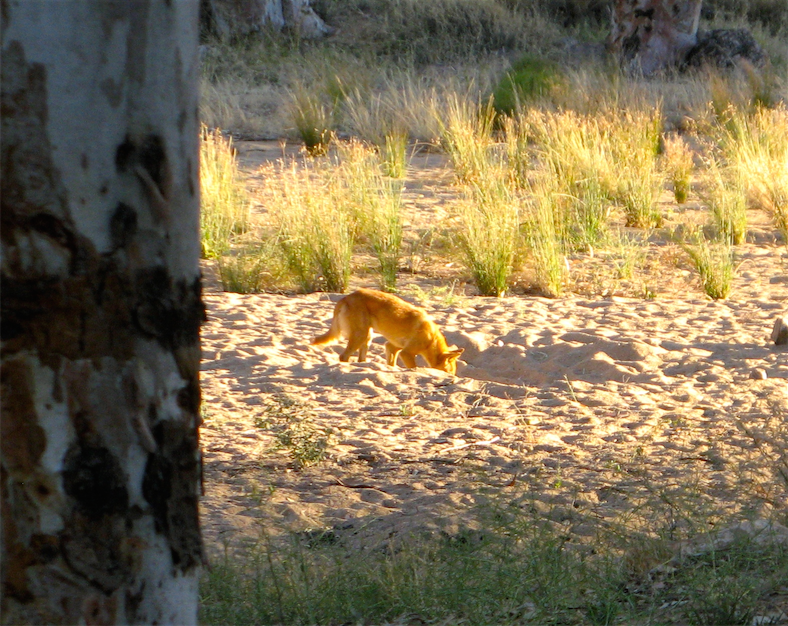


They may have the manner of a domestic dog but dingos are wild animals, descended from wolves, who have a well established position in the natural world as Australia’s dominant land predator. This status quo should not be disrupted since without them many introduced pests, particularly rabbits, would not be effectively controlled.
So it’s sad to see so many 1080 warning signs all over the country indicating the planned and systematic destruction of an Australian native species using strychnine, a particularly nasty poison.
Even worse is to see a tree adorned by the carcasses of dead dingos in trophy arrangement, which we’ve seen a few times. Imagine the outcry if you saw a tree full of the corpses of dead koalas?
The 5000km long dingo proof fence which runs from the Queensland coast to the Great Australian Bight in South Australia is a much more responsible approach at problem management in sheep country. Unfortunately 1080 poison is cheaper.
15 Sept
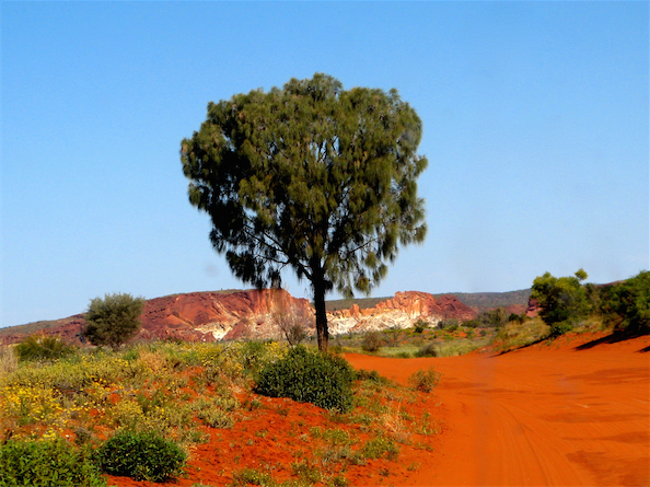
Leaving Trephina Gorge we went to see a nearby 300 year old Ghost Gum which is heritage listed. Ghost gums are common in the red centre, quite often on the side of red rocky cliffs.
This one is growing on a flat plain and is quite spectacular, they don’t normally grow this large.


On the way back, we called in to Corroborree Rock, an Aboriginal sacred site:


The surrounding hills are dotted with ghost gums as if they’d been planted.

Then it was back into the Alice, if she’ll excuse the expression, for more supplies and fuel, after which we bade her farewell and set off south, but not too far, about 100km, to Rainbow Valley.
This is an ancient but spectacular set of rock formations which must be one of Australia’s best kept secrets. It’s protected by quite a tough 22km corrugated 4WD track in, but there are also some good walks to do and a campsite to boot, if only the flies weren’t so friendly.


Along the boardwalk we startled a large lizard soaking up the warm sun.

The track to Rainbow Valley passes though a large grove of Desert Oaks and a carpet of wild flowers, but not as colourful or prolific as previous wetter years.

 16 Sept
Time now to start heading south seriously if we are to be home on Saturday. The SA border at Kulgera is the first step.
We stopped at Erldunda to check emails but there were none of note. Quite a bit of traffic here but most was turning west towards Uluru.
Passing the first and last pub in the NT at Kulgera and into SA, we met more quarantine signs than “Welcome to South Australia” signs, but at least we got a bit of warning on this one.

The traffic was almost non-existent for 80 odd km and the country appeared to be completely
terra nullis, so much so that I contemplated emulating a certain Lt Cook and claiming this land a new country, called
SOD OFF (South of Darwin On the Finke Floodplain), or maybe
SOD ALL (South of Darwin All Lost and Lonely). For a brief moment I did consider
Foetid Utopian Colonial Kingdom but I feared the spelling might prove too difficult for some citizens who might resort too easily to the abbreviated form.
We saw
no caravans at all and only one motorhome this afternoon. Did they know something and were staying up north in the warm?
We passed 2 empty rest areas whereas normally at 3pm they’d be chockers with caravans vying for the best of the worst locations.
After 320km today we have stopped at the Agnes River rest area where there was one camper trailer and a big bus towing a small 4WD, and camped near the nonexistent river amongst the maximum number of flies. Actually all rivers and creeks in northern Australia are real rivers, they are just upside down, dusty dry on the surface but deep down they are still moist, which is from where the river red gums extract their water through the dry seasons.
17 Sept
411km today, basically down the very lonely Stuart Highway through Coober Pedy and into the arid treeless plains of mid South Australia.
Coober Pedy was the same flat dusty terrain covered by neat mountains of white spoil from the opal diggings.


We topped up our water tank from their very professional 20c per 30 litre slot meter public water pump (which is much better than their previous hose hanging on a wire fence model) and then carried on since we’ve seen dusty outback towns before.
Leaving Coober Pedy, not a single “
Thank You for visiting Coober Pedy” sign to be seen, every sign was facing the other way.

We camped last night at the “Major” Ingomar rest area, although quite why it’s so defined is a mystery. It has no toilets so the desperate have littered the rear of the site with paper products, it’s very exposed on the top of a bluff and isn’t very scenic anyway. No matter we (I) were knackered after 411km so it was fine for us, and we were the only occupants.
18 Sept
Up with the larks or what ever to carry on down the Stuart Highway first to Glendambo (Population: People - 3, Sheep - 22,500, Flies - 2,000,000) for lunch and to check our emails, and then on to Lake Hart.
This is a very pretty salt lake where there’s a 4WD a track we discovered several years ago from the new to the old highways and where camping is quite secluded.

The so called poached egg flower (Myriocephalus stuartii) which abound and all face the sun at the same time. They are paper daisies with everlasting (relatively) papery flowers.

We wandered down to the lake, and in the process crossed the Ghan/Indian Pacific rail line which skirts the lake edge. The lights were red and no trains came, so we walked along the track to tempt fate but fate wasn’t paying attention, fortunately.

There were emu and kangaroo prints in the salty edge of the lake.


A stick and a moth frozen in ice and snow? No, captured in salt.


With a few clouds around, the sunset was quite spectacular. Yes, I know they are only bloody photons, but they are very colourful photons, nonetheless.

 19 Sept
Our last day on the road, we should be home tomorrow morning.
2 freight trains came past early this morning, from different directions. I wonder how that happens? There must be a nearby passing loop or railway roadhouse they can stop at.
Unlike yesterday, today is a blazing blue sky day with a burning sun. Even a rusty exhaust system has a summery glow to it.

And the lake was glistening in the morning sun.
 20 Sept
Camped last night in a small reserve at Clements Gap near Crystal Brook. It’s our normal secluded campsite, in a 10 sq km reserve of bushland in a huge arable landscape.
We arrived home knackered just after mid-day and the sun was shining from a clear blue sky and the temperature was around 22º. Good for Adelaide at this time of year but a lot less than we had been experiencing.
We wandered around in a bit of a daze, the garden looked pretty good really (it always does under a clear sunny sky) and not too many weeds.
We did a bit of unloading, a lot of washing and gradually things became more familiar.
Then we were back to normality once again after another good trip. 2 months, 9,000km and a major desert crossing.


