


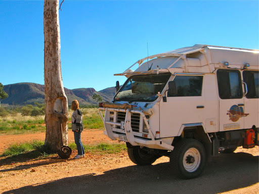
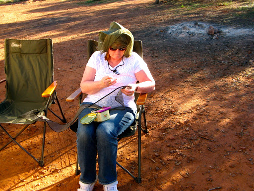
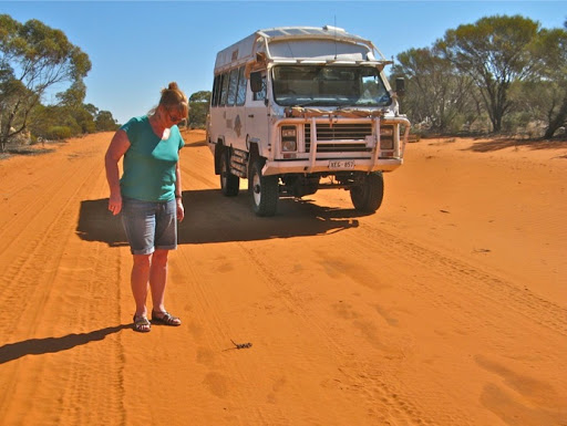
We are heading off soon across WA to Perth, but the departure has been delayed somewhat by an injury to my calf muscle.
I fell out of the Oka from the drivers seat when I missed the grab handle and fell heavily 1 1/2 m to the ground. First time I’ve ever actually done that but it always was a distinct possibility that’s been around for several years and I’ve had a few close calls.
The only evidence of the accident was a tiny graze on my little finger as it hit the ground, although a bruise did appear on my heel about 5 days after the event and now my left leg is aching in sympathy.

Anyway we are continuing the planning and packing as best we can until it heals up and I no longer need a mental Zimmer frame to get around. One week on and the leg is improving but still needs strapping so it doesn’t ache too much and I still have a pronounced limp. Yes, I know, L-I-M-P, pronounced “limp”. Still I think we will leave in the next day or so and carry on my physio on the road, so to speak.
We are heading up to Yulara, across the Great Central Road to Warburton, up the Hunt Oil Road to the Gunbarrel Highway and across to Willuna. there we’ll head across to Meekathara and the WA coast and down to Perth to meet some friends.
We need 2 permits to travel this route, one in the NT from Yulara to the WA border, just past Docker River, and another for the Great Central Road from the WA border to Warburton and the Gunbarrel Highway. These are easily obtained on-line from the Central land Council and the WA Department of Aboriginal Affairs websites, respectively. They take from a day or 2 to a week for normal transit and refuelling permits but longer if you want to visit specific communities.
There is an Oka owners Group gathering in WA in early September which we hope we will can attend.
How we’ll get back from Perth is AOG at the moment (Any One’s Guess). We’ve done the long Eyre Highway several times but alternatives are hard to find. Previously we’ve been via Esperance to Balladonia on the western end (4WD track) and then the Eyre Peninsular or Gawler Ranges on the SA section, to add some additional interest to the home run.
Across the Nullarbor there are not many options to the main highway although there are quite a few attractions along the route. Depending on the season, the Eyre Highway can be very windy and/or surprisingly wet during the winter months. It is not as busy as we had expected, given that it is the main interconnecting route between the eastern states and Western Australia, mostly travellers and grey nomads but fewer road trains than anticipated.
We first travelled the Eyre Highway back in 1975 when it was still a gravel track (on the SA section) and it was even lonelier back then. Communications and facilities have improved somewhat since then but it is still a very long lonely journey (2700 km from Perth to Adelaide), longer with side trips, and can take from 5 days to a couple of weeks.
18 July
Alan’s birthday today, Happy Birthday.
Also it would have been Janet’s dad Joe’s birthday today, he would have been 95.
We are all packed up and leaving home this morning.
It’s been very windy and wet overnight so we’ll have to check the tracks north before venturing far off road. We were intending to travel the Oodnadatta Track on the way to Yulara but that’s not our main objective so we might have to skip that this year, we’ve done it many times before anyway, and stick to the highway.
Once north of a line joining 2 points, the weather should be a bit warmer, drier and more stable. I just hope my slowly mending leg muscles can withstand the long days driving ahead. Might have to break out Janet’s L plates.
Finally left home around 11 to fuel up and headed north in atrociously windy headwind conditions, nearly got blown across the road a few times.
Oka going fine and after a lunch stop in Pt Wakefield, we are camped at Mambray Creek about 50km south of Pt Augusta. The wind has abated a bit but it’s cloudy and dull. Radio conditions are very crackly, even with the big antenna up. Strong signal from Alice Springs but even stronger crackles making a conversation difficult, and we are too close to Adelaide base. We can hear their callers but not them.
We have started compiling a TWF list (things we forgot) for a shopping trip in Pt Augusta tomorrow.
19 July
Riveting stuff today, went shopping in PA for the TWF, bought fuel, lot’s of fuel (and got 15¢ a litre discount too) and headed north up the Stuart Highway. Only 900km to the NT border.
Scott reckoned our blog is riveting stuff so far, so I just gave him even more riveting news, "mum's in the back making a cup of tea".
The Oka is going fine although it struggles against strong headwinds. Maybe I should drive backwards?
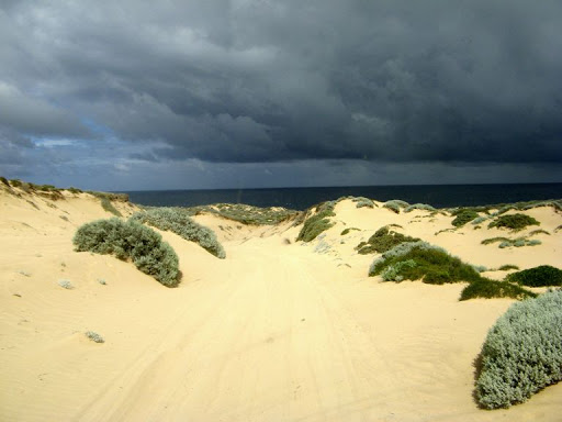
We are camped alongside Lake Hart, north of Pimba/Woomera, about 500km north of Adelaide. Good signal here.
It's cloudy, gusty and showery but reasonably warm, 18º.
We did see an interesting sign on a fence, which was completely untrue:

And if you were one, you would want to be careful climbing over that fence.

And we saw a rainbow:
Things can only improve tomorrow.
20 July
The day started nearly cloudless but gradually deteriorated into another showery day and stayed that way until we reached Coober Pedy. There we topped up one diesel tank and both water tanks from their new water pay pumps, 20¢ for 30 litres since it all comes from desalinated bore water. Cheap and more satisfying than liberating it from dubious sources.
We passed a burnt out car with a sign on it, “For sale. Best offers”.
The 200km before and after CP are devoid of trees or shrubs more than 20cm high, not good when you’re looking for a bush to duck behind. Lucky I only had one cup of tea with my lunch.
We are camped about 1km off the highway alongside Pootnoura No 2 Channel, a dry creek in an area almost totally devoid of water courses. It’s close to the Ghan line but there seems to be no trains on a Saturday. Yesterday there were freight trains every half hour or so, day and night. Weekend penalty rates must be too high, that, or because all the trains turned left at Tarcoola and headed for Perth.

Our nice “Pootnoura No 2 Channel” campsite:
900km since leaving home and we are just getting back into the swing of things.

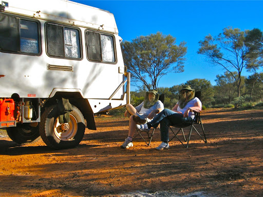
Janet, having cooked tea, is now relaxing and waiting for the kitchen hand to do the dishes:
No phone service here so this will be a retrospective update. Completely silent here too, no people, vehicles, trains, wind, surf, insects or wild animals to break the silence, just a bright nearly full moon.
21 July
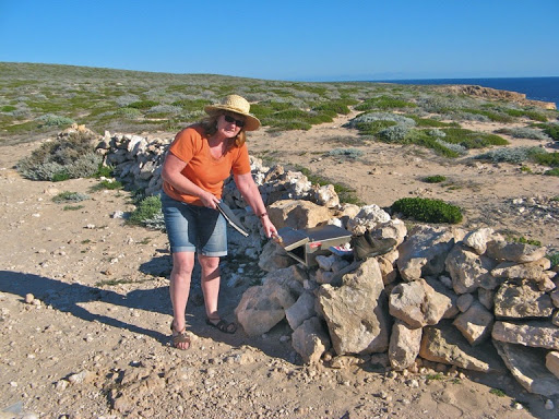
Fairly pleasant day and my leg is getting better microscopically, to the point where I am now psychologically fit enough to build a dry stone wall, if only my muscles saw things the same way. But the complaints per hour chart is trending downwards…
We had a long and tiring day today, 490km to our campsite under singing desert oaks on the Lassiter Highway approaching Uluru. But we had a trifecta of problems which beset us at lunchtime.
We stopped in a crappy rest area for lunch and I noticed a few drips of water under Oka. So I put some mats down and crawled underneath to investigate but I could see nothing damp or obviously wrong. On the way out Janet was brushing some grass and leaves from my back that had stuck to my jumper when there was a “ting” on the ground a meter away. One of her rings, her mum’s wedding ring, had come loose from a finger and flown onto the gravel and disappeared. We crawled around for a few minutes with hope fading when she suddenly saw it a couple of meters away glinting in the sunlight.
That was a relief, so we went back inside and looked at the water meters and one tank read empty. Bugga. That’s strange, we filled them all up yesterday in Coober Pedy and we’ve only had one shower each. I checked the tank and sure enough it was empty, but where did all the water go? A 100 litres is a lot to lose and you would think it would be noticeable. The tank is inside and there was nothing on the floor so the answer is probably some loose connection in the pipework under the car from when I replaced a pump recently, but with no water in the tank, none leaks out to reveal the leak. We’ll have to wait toYulara to refill it so I can find the source of the problem.
Fortunately I have wisely spread our water over 4 tanks so the loss of one can’t be catastrophic, just inconvenient, and I guess it’s better to happen now than on a remote desert track. Our fuel is also spread over 3 tanks for the same reason.
So with that problem identified but yet to be resolved we set off, or tried to.The engine wouldn’t start. Some of the dashboard lights didn’t come on and the injector pump was disabled. Bugga again.
I took the dashboard electronics panel off and searched for the problem when all of a sudden it all started working again. I hate intermittent faults, but fortunately I spotted a screw terminal from which a wire had slipped out and when I reinserted it and tightened the screw the problem was resolved. I tightened all the others as well just in case. That might also explain a couple of events last year when the engine suddenly cut out on rough tracks.
All in all, half an hour more fun than expected for our lunch break but it could have been a lot worse, and we still managed nearly 500km today, arriving as the sun was setting from a cloudless blue sky.

Tonight after dinner and a couple of glass of wine, we held a refresher course on how to make an emergency selcall on the HF radio and how to enable the EPIRB in case of “grave and imminent danger”. The first enables us to make immediate contact, day or night, with emergency services or the Flying Doctor and the second would initiate a search and rescue mission if were in dire straits and had lost communications.
22 July
Arrived at Yulara at lunchtime and got an unpowered site for only $36, what a rip off. And there’s no water taps within cooee distance either.
Still we can do the washing, shopping, refuelling and fixing the water leak in relative comfort under warm sunny skies, the 2nd in what we hope will be a long line of cloudless days. (The record is 44 days straight last year without seeing a cloud).
On the way we stopped by at Curtin Springs which advertises free unpowered camping and sure enough they have a hugh flat area for free camping with toilets and $3 showers. We might have stayed there but they have no laundry (or easy water supplies for campers) and the facilities were barely adequate. We have better facilities in our Oka. Nevertheless it is a brave try at outback hospitality of “the type you hope for but seldom find” as their sign says and compared with Yulara, it’s much better value.
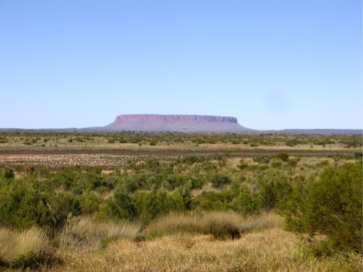
Just prior to Curtin Springs is Mount Connor which is always an inspiring sight. Pity it’s on private land and the only way to get closer is by a tour flight.
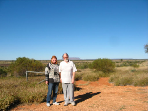
A blurry self portrait to show that we were actually there but the clouds were not.
What’s not so inspiring is the 200km thereafter of burnt out sand dunes where the beautiful desert oaks have only just survived, as in this low res Crashcam photo.

However the water tank issue has been resolved, as I'm sure you would all come to expect. However it turned out to be my fault which I'm equally sure was unexpected. Water had been seeping from the internal tank which is above the floor to the main external tank which is below the chassis, which then filled up and overflowed.
How could this happen? Well I have change over valves so that either pump can be fed from either tank to either of 2 outlets, drinking or domestic water, but if they are left in the wrong configuration, both can be connected to the same tank creating a short circuit and causing the leak as experienced. It took a matter of nanoseconds, spread over 24 hours, to realise this and adjust the valves accordingly, back, in fact to the positions they had been in for the past 8 years, until I recently replaced one of the pumps and obviously caused the mixup on reinstallation. My mental acuity is not in question, not by me anyway.
My to do list now includes a non-return valve in the main tank circuit so that it can’t happen again.
Back to riveting stuff, we topped up the fuel tanks (at an imposing UK type level of $2.22/l ($1.50 at home)), bought more food, just in case the spares for our reserve spares run low, topped up with water and refilled a gas bottle, which the refiller kindly reminded me was expiring soon and would need to be replaced, and of course the mightiest task of all, the washing, done and dried in wonderful sunny conditions.
23 July
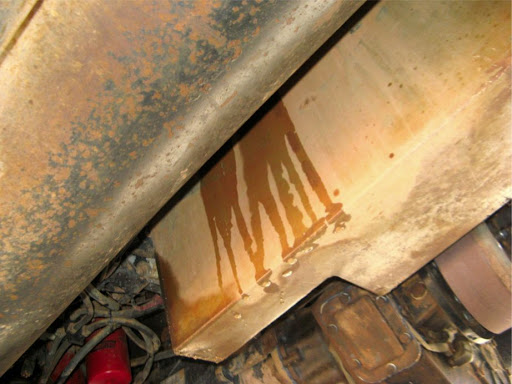
Very chilly night but another glorious cloudless blue sky day, blighted only be the discovery of a small water leak from the engine. Like all leaks, fluids eventually makes it’s way down the side of the engine, via the injector pump and oil filter to drip off the sump. On the way they collect dust and oil and all seem to look and smell like diesel when they hit the ground.
On this occasion, it wasn’t green diesel or green oil, it was green glycol radiator coolant. I traced it back to the thermostat housing or the radiator hose which connects to it. To be on the safe side I tweaked up all the bolts and hose clips, dried things off and after a few km, the leak had stopped. That’s a relief since I'm on the lookout for a diesel leak from the injector pump which would look just the same.
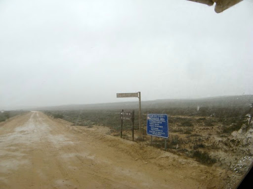
So after that shaky start we set out though the Uluru NP checkpoint, and waving our permit for the Great Central Road we were waved though at no cost. We did our obligatory circuit of The Rock, which after 35 years of visiting is still an awe inspiring sight.


Especially close up.

After which we set off for Kata Tjuta (The Olgas), 50km to the west and another spectacular sight, even from 50km away across the spinifex plains.


After a cursory comfort and viewing stop there we turned on to a major gravel track known as the Great Central Road (GCR) which leads 1000km to Laverton in WA.
It quickly became obvious why we rely on a comprehensive moving map navigation system with highly detailed ordnance survey maps. Our Garmin navigator failed miserably to identify even the largest and well known of the outback highways, let alone any smaller tracks.
It’s only use to us in this region is as a digital speedo and our moving map system has one of those anyway. Should be useful in Perth though.
We had a brief HF communication with Dave and Pauline in Perth at a nice lunchspot on the GCR. Nice to know we are remote but still in communications with the outside world.

200km of reasonably corrugated and sandy gravel later we reached Docker Rover, locally know as Kaltukatjara, and the only approved campground in this area.

Last year we reported that this place has the potential to be an excellent campground, the location is spectacular, nestled in a large grove of desert oaks between red sand dunes, with concrete fire pits, and numbered and separated campsites. If only the toilets weren’t all broken and some of the water pipes actually had water in them. Sadly we have to report that although the toilet sheds seem to have been painted, still nothing works and there’s even a sign saying if the loos are broken, go and dig a hole.
It’s a shame that nothing has changed since last year, and we are the only people here, just like last year, although a late camper bus arrival did spoil that stat.
24 July
Another cloudless day, the 4th in a row and a bit warmer than usual in the early morning. Our late arrivees were away very early so we are still the only ones here. Plenty of chorusing dingoes overnight and a very bright full moon. Maybe they are connected?
Problem Report:
The drinking water tap is very noisy, the pipes must be rattling against something. Later in the day the rattle went away, presumably something fell off as it’s all quiet now.
The gas thermostat on the fridge seems to be ineffective and remains on full all the time. Better that than not working at all but the 240v ac thermostat is fine.
The 17inch LCD for our moving map display went intermittent. I took it apart and reconnected some of the likely connectors and it seems to be better now...
End of report
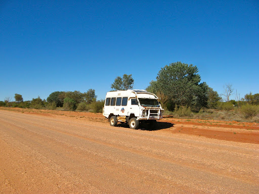
The GCR in WA is a lot smoother than the NT section and cruising at 80kph is possible despite the gravelly conditions.
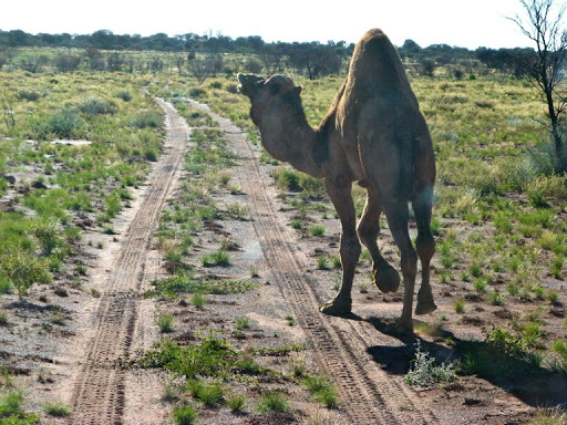
We saw our first camel today, a young scrawny one but still a camel.
We’ve also see flocks of finches and budgies and a couple of wedgies.
We haven’t seen a kangas or perenties (or any penguins for that matter).
We stopped to look at Len Beadell’s plaque on a tree which he blazed in 1960, at the junction of the Sandy Blight Junction Road (which we drove in 2008), only it’s not at the junction any more, the track has been realigned by 9km as an access road to an Aboriginal community.


Further on is the curiously named Schwerin Mural Crescent, a range of attractive hills named by Ernest Giles after the Princess of Schwerin, wife of Prince Vladamir of Prussia.

We stopped by at the Giles Meteorology Station where, just like last year, nothing stirred, no movement or sounds of any kind. We had a look around the visitors centre and then at the only new item on display, a gigantic shoe. WTFFFFF???

The GCR then becomes a long straight but smooth track for a couple of hundred km so we stopped for a break and look around.
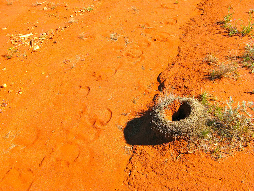
Camel tracks and a large ant or lizard hole.
We are camped tonight at an Aboriginal built camping area called Yarla Kutjarra about 80km east of Warburton. Quite a nice facility compared to their average offerings and very politely signposted too. However it is warm and sunny and there are a few flies around.
Janet did some repairs to a fly screen. Here’s Janet, the sewer, in action but for some reason she doesn’t like that title.
Tomorrow, since we are now in WA, we set our watches back 1 1/2 hours so there’s going to be a huge break between breakfast and lunch.
Then we go to Warburton for fuel and locate the start of the Hunt Oil Road, about 100km further on, a narrow track built by oil exploration teams in the 1960’s and pretty much abandoned since then. It runs 250km north through the Gibson Desert from the GCR to the Gunbarrel Highway, on which we turn west and head 600km to Willuna.
We have track plots and waypoints from people who have done the Hunt Oil road before and we are hoping it won’t be quite as challenging as the Eagle Highway we travelled last year with Dave and Pauline. At least with them last year we experienced some of the same difficulties (overgrown tracks and deep wash-aways) as we might encounter this year so we are forewarned and somewhat forearmed. We have a very capable vehicle which we sometimes underestimate, but even so, our philosophy is that we won’t go into anything we aren’t quite sure we can get out of.
25 July
We completed the 90km to Warburton this morning but only after rigging up a new power supply for the large LCD display. My earlier comment that I'd fixed it was somewhat premature. It turned out the the LCD display does not like an un-isolated 19v power supply (ie minus side connected to ground). I discovered this several years ago and designed an isolated version. Subsequently I replaced that with a more efficient supply, which was not isolated but seemed to work OK, and has been going fine for several weeks, until last night.
Anyway, I've reverted to a small plug pack PSU driven from our inverter and our problems have gone away, (for the time being?). Fortunately the WA time difference gave us an extra 1 1/2 hours to play with so we lost no actual on-road time.
At Warburton we refilled with fuel at $2.30/l and water, checked our emails with the only phone service in this vicinity, updated our blog and carried on down the GCR, surprised to find that the next 40km (out of 1000km) were bitumen. No good when you’ve let your tyre pressures down for sandy gravel tracks.
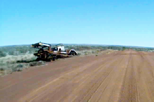
We passed an abandoned truck in the middle of the road missing only one rear wheel but otherwise intact, and then a burnt out car transporter, complete with car.
We located the turning to the Hunt Oil Road and realised that we had stopped at this junction for lunch several years ago, we recognised the camel bones that were piled up on the side of the track.
The first 20km of the track were easy, flat, wide and smooth. However it was not to last and shortly we came across our first obstacle, the track washed away by a creek.

There was a diversion track around the muddy creek which was the first time we’ve used 4WD on this trip so far.
We are camped a further 10km up the track with only 230km left to go.
More fun no doubt tomorrow, and yes this was our 5th straight day without seeing a cloud.
26 July
Another blue sky day and a bit warmer than yesterday.
Good desert campsite, with colourful garden plants growing wild here. Plenty of camel tracks around but no sightings yet.

The morning travels were interesting but the afternoon was unexpected, (read more later).

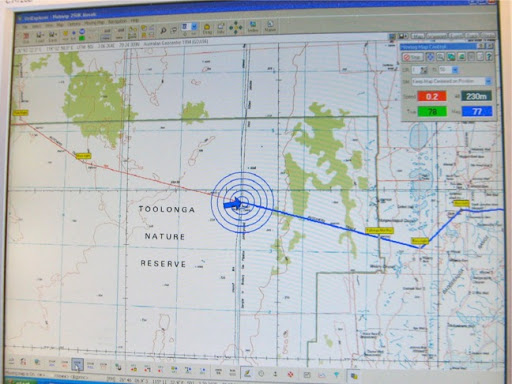
Our location in the Gibson Desert.

Part way up the track we located an working bore with a hand pump and good tasting water.


Signposts are a bit rare and indecipherable hereabouts.

A tyre staking waiting to happen.
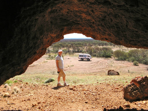
The oil exploration company set up their 1960’s base camp in a lovely location at the base of a rocky knoll full of caves. We had lunch here.


Later a camel wandered across the track, presumably a juvenile male ejected from his herd and wandering alone.
The afternoon didn’t go quite according to plan.
For a start it became cloudy, thus ruining our run of cloudless days, and then, close to Alexandra Spring we met a diversion off the main track, which we learned later was to avoid a dangerous wash-away. That diversion took us across a suspicious looking swampy area where a previous vehicle had be come bogged. I took a look around and judged I could pass by that soft area a meter or so to the left.
Unfortunately I was wrong.
Through poor judgement and bad fortune (for who would expect a swamp in a desert?), my chosen route was also very soft and we slid sideways into the same trench that the previous vehicle had ended up in.
Bugga, and thrice bugga.

Our crashcam video camera recorded the “Oh Sh*t” moment for posterity. Not only did we fail to proceed forwards but we also failed to retreat backwards as well, both drivers side wheels were bogged down to the axles with the other wheels spinning on the soft surface. In fact the diff’s were on the ground and we were leaning at more than 15º.
Ironically, everything inside and outside the Oka was working perfectly, we just couldn’t move.
So we were well and truly bogged and it took us 8 hours of back breaking work over nearly 24 hours, but we got ourselves out (or you wouldn’t be reading this). The full saga is in the “Unbogging our Oka” blog entry, but in a nutshell we had to:
- Stabilise the Oka so it couldn’t slip further overnight,
- Cook, eat, sleep and worry all night in the Oka leaning at 15º,
- Establish a base camp so things didn’t get too scattered,
- Lighten the Oka by unloading all the heavy weight, spare wheels, tools and equipment,
- Dig out the soft soil around the bogged wheels ,
- Build solid foundations so that jacks wouldn’t keep sinking into the soft ground,
- Raise both driver’s side wheels by about 1/2 m, one at a time, using 2 jacks (one to raise the body and one to raise the axle/wheel),
- Fill the void under the wheels with rocks collected in shopping bags from a creek bed 50m away,
- Build a pavement between the wheels for them to follow without sinking in again,
- Drive out,
- Put everything back in the Oka.
All of these took a lot of effort (except the drive out) and we were all by ourselves, far from any available help, but we did it.

In fact we were just packing up when we heard the sound of a car engine, the first we’d heard in 2 days, and 3, 4wd’s arrived from in front of us. We waved them down to prevent them suffering the same fate as we had and they walked over to see what our problem was. They helped us with reloading the spare wheels, since we were almost out of strength by then. They also surveyed the track to find a solid route for us back on to the main track and insisted on staying until we were on our way again, which was very commendable.
Following our debugging exercise, we carried on up the track about 40km and had an early camp, a celebratory beer, left-overs for dinner, and an early night to recoup our lost sleep (we slept about 10 hours straight).
28 July
Beautiful morning again with the Oka on a level elevation for once. It was a still quiet morning but with a host of birds singing strange songs we hadn’t heard before. I stood outside and waved the camera around recording the sounds but also videos of the sky, the ground, sideways bushes etc. We barely saw a bird though.

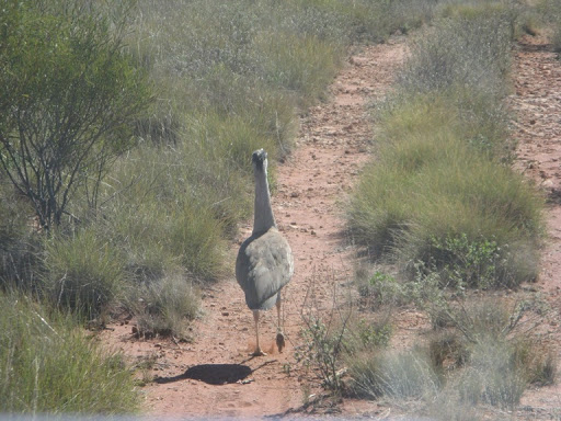
We did see a camel and a bustard, both of which refused to get off the track.
We passed by the site of a burnt out Nissan which had apparently parked on some spinifex with a hot engine. There was very little now left which is sad because it is a memorial to Mike Kendall who presumably died in the fire.

So after 4 days and 250 eventful km on the Hunt Oil Road we suddenly arrived at Geraldton Bore. This was originally drilled in 1989 at the junction of the Gunbarrel Highway by the CRA Exploration Company. A hand pump with excellent water was installed in 2007 by the Geraldton Bore Historical Society.

We are camped here tonight and did a load of washing as there is plenty of good water, but it does seem a bit mundane ofter our recent excitements.

The Hunt Oil Road in retrospect.
The Hunt Oil Road is not a very difficulty track (notwithstanding our recent problem), the surface is mostly hard lumpy sand/fine gravel with stretches of very rocky surface, all of which restricts you to 20-25kph most of the time but with stretches of up to 40kph. There are numerous wash-away’s but only a few are serious enough to get out and have a look at before preceding, slowing down and crawling over them is usually the best solution. A few more difficult sections have diversion tracks. There are very few corrugations, no deep sand and no sand dunes, and the spinifex never gets above around 40cm high.
There are however a lot of overgrown sections where bushes will scratch and tear at your vehicle, and damage or pull off any external attachments (wing mirrors, lights, wipers, cables, fly screens etc) protruding from the sides or underneath of the vehicle. Large tracts of land around the track have been burnt out in previous years and are still recovering. Burnt bushes are particularly damaging and you should not travel with windows open to avoid facial injuries.
The track is fairly flat and whilst is was dry and sunny when we travelled it, you would not be wise to travel within a few weeks of heavy rain. The soft section we encountered is around Alexander Spring, about 6 km north of Mt Worsnop.
Don’t travel the the Hunt Oil Road if you value your paintwork. Similar advice applies to the David Carnegie Road (DCR) and Eagle Highway which we travelled last year and are more difficult.
Overall we didn’t find the track all that scenic (apart from the mining camp and caves area at the north end of the eastern track), and being mostly flat, it was not as interesting as the DCR and Eagle Highways.
29 July
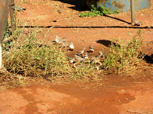
We refilled with lovely Geraldton Bore water (which was quite warm out of the ground, 16 meters down) and then left the bore to the flocks of finches who were queuing up for a drink.

I checked the rear diff oil as it also lubricates the rear wheel bearings but it only took a thimbleful. All that crawling underneath for nothing.
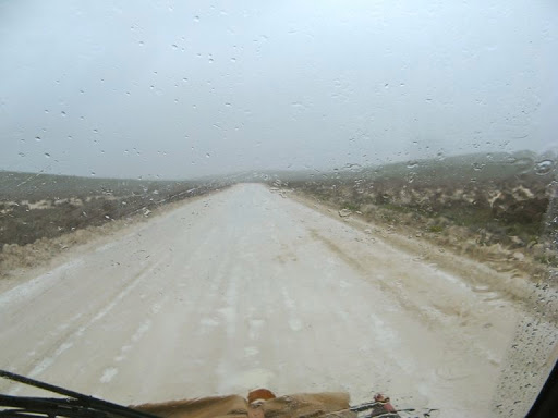
The Gunbarrel Highway west of Geraldton Bore was very rough and corrugated for about 30km.

Once it reaches the borders of the Shire of WiIuna, where they have obviously done a lot of grading over the years, the track improves greatly. No grading this year though and there were large areas of water lying on the track from rain a few weeks ago.
Fortunately recent travellers had created bypass tracks around the worst of them, and between the wet sections the track was smooth and relatively fast, up to 60kph in places, but mostly the best we could manage was around 40kph.
The scenery is typical Gibson Desert, with green shrubs and small trees smothering the dryness of the red desert sand. But the wild flowers were pretty where the water had lain, so it doesn’t look much like a desert.

One exception is Mungilli Claypan, in its own nature reserve, formed from the run off of several small creeks. With recent rains, it makes quite a pretty picture for a desert environment, but you wouldn’t want to drive too close to the edge.

Nearby is the junction where we crossed the Gunbarrel Highway with Dave and Pauline last year heading north up the Eagle Highway (the most difficult track we have tackled).
We stopped for lunch and some obligatory photos at the junction and left a note in the visitors book next to the sign.

Same spot last year for comparison (this year I had a pulled calf muscle).

We climbed Mt William Lambert (514m) for a look across the desert which was astounding in its sameness, wall to wall treetops.


Later we climbed Mt Nossiter which, although 4 m higher, should really be called Lump Nossiter since it has none of the shape of a true hill.
We have now left the Gibson Desert behind and entered the Little Sandy Desert, and Len Beadell, who built the Gunbarrel Highway, didn’t like crossing sand dunes so this part of the track winds back and forth between them rather than go straight up and over them.

We were very surprised to come across a cricket oval carved out of the desert sand with this strange scoreboard alongside the track. It shows a mining helmet and a skeleton of presumably earlier opponents. We assume the oval had been built during the time when mining exploration were rampant in this part of the country.
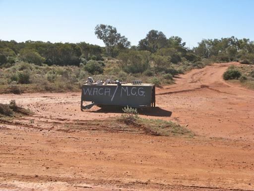

The Oval, which has obviously needs better ground-staff.
We are camped tonight in the exact centre of WA, 30 km east of Carnegie. We managed 170km today across rough tracks and only saw one set of travellers, but we ran out of time to make it all the way to Carnegie Station so we pulled up alongside the road in stony desert country and enjoyed a glass of wine and a nice sunset. One vehicle per day seems to be the norm in this area.

W
e contacted Dave on the radio and he told us he had made email contact with Alan and they all had colds. Not good timing, just before they head off on their trip. However, being able to keep in contact is a good thing, deserts don’t seem to figure on Telstra’s investment programs.
30 July
Good clear night in a stoney desert environment. No vehicles passed by which is no surprise. Cool so porridge for breakfast.

30km west of our campsite is Carnegie Station, the first cattle station reached when travelling west.
We called in and met John, who is caretaking the campsite with his girlfriend for a couple of months. He rushed out to greet us as they hadn’t had any visitors for several days. It was too early for us to camp but John said we could use the camp kitchen for a cup of tea or lunch and seemed disappointed that we didn’t need any diesel.

We made use of the camp kitchen which is far better than usually found on farm stay facilities. We had a look around, a cup of tea and made a donation to the RFDS for use of facilities.

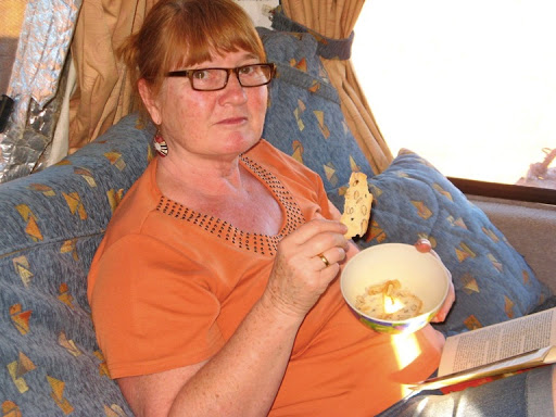
Janet having a cup of tea in the Carnegie Station camp garden.

The well appointed camp kitchen where everything is on an honour system, including food supplies.
The signpost at Carnegie to confirm how far we’ve come, but Willuna is still 350km away, and the WA coast a further 400km.

The Carnegie-Willuna road is very much better than the earlier Gunbarrel sections and we stopped for lunch at a station campsite used by jackeroos while mustering, along side the Harry Johnson Waterhole.

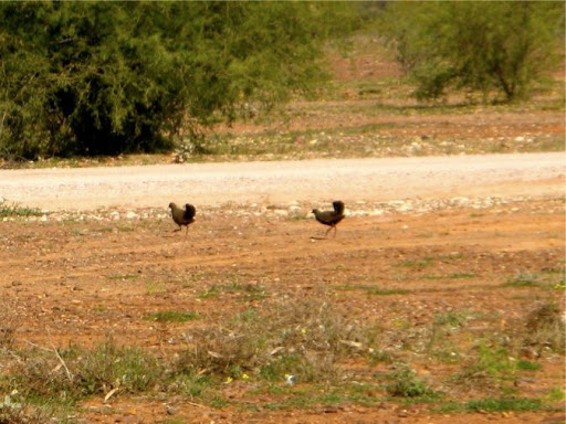
Brush turkeys were scurrying about as we had lunch.
Just after lunch we were stopped by a jackeroo in a beat up old ute. He asked us to wait while they mustered a mob of cattle across a creek. No horses or dirt bikes, just half a dozen old utes and a helicopter.

We are camped tonight 130km east of Willuna on a side track off the road. We lit a hot campfire to burn all the rubbish we had accumulated over the past week or so, retaining only the glass and cans we should not discard in the outback as they don’t rot down and can damage cattle hooves.
31 July
Wall to wall morse code birds this morning. Different rates and notes but all using the same sheet music. And very orderly, like a well managed conference call.
Willuna is an aboriginal town with all the attributes thereof. A large, new and expensive municipal precinct consisting of a hospital, school, works dept and shire offices all surrounded by a military style chain link security fence and the original falling down dirty, scruffy local pub and houses. There is a nice new outback supplies supermarket cum 24 hour fuel outlet, as Willuna is the starting point for the Gunbarrel Highway east, and the Canning Stock Route north, and neither should be attempted without all the supplies needed.

Surprisingly, even after 6 days since Warburton, we didn’t actually need any supplies and decided to wait until Meekatharra, 180km west before restocking.

Our dirty Oka at Willuna.
Willuna does have a Telstra mobile service so we checked our emails and updated our blogs which had got way behind after 6 days Telstra-free. Now all the world can read of our misadventures on the Hunt Oil Road.
We motored on west, ever westwards, and are camped off the track (called the Goldfields Highway) about 80 km east of Meeka.
1 Aug
Meekatharra is a lot bigger town than Willuna whilst still being a slightly untidy. Huge road trains roll though the middle of town taking supplies to major mining ventures further north.
It has a couple of shops and pubs, several fuel outlets and a range of the usual services. Not a bad place to restock if you are, like we were, running short of Vita-Brits.
We checked our emails and the cricket scores, and looked up the road conditions ahead on the various shire websites. All seems good and we are into our 7th cloudless day since our bogging day.
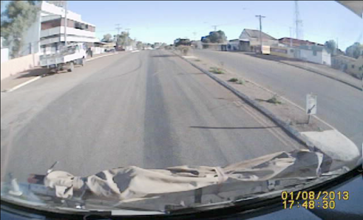
The busy main street of Meeka, as seen by our crashcam recorder.
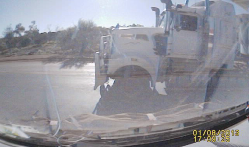
Also caught by our crashcam was this close call with a large road train while pulling out of a fuel stop. Meeka’s empty streets are not always empty and obviously I checked and stopped before pulling out but it’s very easy after weeks of not seeing any traffic to lose concentration.
Meeka has, as all outback towns have, a “heritage trail” leading around items of interest about the town and it’s, well, heritage really.
The name Meekatharra for example was a contraction of an aboriginal word “meekadah” or “water in a hollow”, and the Meeka Creek does indeed run though the town.

And there is the usual theme park, filled with rusting relics of a once busy gold mining area.

Corrugated iron is well in evidence, as in the quaint old Picture Gardens which are still in operation, a sort of drive-in that you have to walk into.
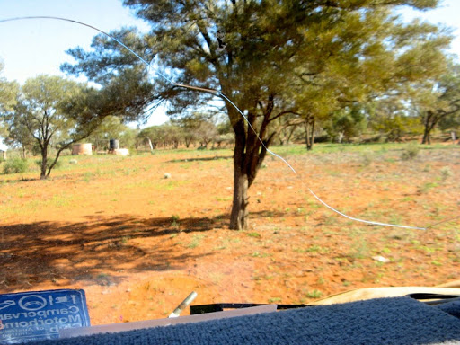
A few days ago a small crack appeared on the left side of the windscreen and each day it grows a little more and will soon reach the drivers side. Bugga. The windscreen is only a few weeks old and we haven’t had any stone strikes this time to cause it, we’ve hardly seen any vehicles, 1 or 2 a day on average.
After mis-reading the map and heading NW from Meeka instead of NNW, we retraced our steps and found the correct track towards Mt Gould.
We are camped about 40km out of Mekka on a deserted side track.
2 Aug
Racked with enthusiasm this morning I did a bit of maintenance before we left, all of which was completely ineffectual.
I confirmed for example that the air conditioning was indeed not working, due to the gas having run out, desperate spending a small fortune last year on a new compressor, repaired pipework and pressure testing. Fortunately we are more in need of heating than cooling on this trip.
I tried and failed to locate a leak in our on-board compressed air system which causes the compressor to cycle unnecessarily. Not a critical thing, just annoying.
And I looked at the small water leak on the thermostat housing and ultimately decided to do nothing, that way I can’t make it worse.
I did however finally fix a padlock on the rear gate which refused to click shut and required copious amounts of WD40 to free it of all the dust which was clogging it.
The NNW track from Meeka took us 170km to Mt Gould, a former gold mining site which is half way up a mountain. Environmental vandalism it would be called these days as the top of the mountain had been mined out and the tailings scattered over the centre of the hill giving it a silvery appearance.

None the less, it still looked quite attractive and complimented well the Police Station and Lockup which had been built by local land “owners” in the 1880’s to curb the theft of sheep by indigenous people.
How unreasonable of them to kill and eat sheep introduced by European invaders who stole their land, denied them their water supplies, drove away the wildlife they depended upon and then hunted them like vermin. If I'd been them, I think I would have been tempted into lawlessness (not their’s of course) as well.


The cattle trough out the back of the police station.

And the still attractive Mt Gould, despite its mining operations.
One of the historical relics we passed along the road was this charcoal shaker, developed during WW11 to generate the fuel to power motor vehicles. Apparently they burnt mulga wood, then shook it in this device to remove the non-flammable minerals in the ash and then used the pure charcoal in a furnace on the vehicle to produce wood gas for the engine. Clever stuff.

We are camped out the back of the old Mt Gould police station tonight ready for the Berringarra track tomorrow along the Murchison River.
3 Aug
Extremely windy and blustery night which held fears for the washing (that I did) which we hung out yesterday afternoon. Happily, the Oka sheltered the washing line and all was fine except they had wrapped themselves around the line a couple of times. More riveting stuff, but still another cloudless day at the old jail and no one seen for almost a day. Where is everybody?.
The track from Mt Gould to Beringarra was supposed to follow the thick red line on our map via Colyada Well, but instead it went off into la-la land, which had us worried. We rechecked our starting point and the red line track on the map had ceased to exist and the new track did eventually take us to Beringarra. Presumably the original track ventured too close to the Murchison River and has been realigned further away.


Milly Milly Station obviously treasures it’s young. But on a later sign it says “beware of horses, cattle and children”, in that order.
From Beringarra through the Milly Milly Station area, there was a lot of water lying on and about the road and it looked like the Ganges Delta . Fortunately not much was across the road so we didn’t get our tyres too muddy.
It did strike me as ironic that all the creek and river crossings were all dry, but the track was wet. How can that be?
One of the reasons became clear when I asked Janet to lower her window and take a pic of a flood sign. She managed to do both at the same time, but it was clear that the Murchison River was quite able to spread across vast tracts of flat land, where the water takes a lot longer to dry up than in the river bed.


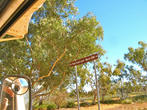
As further evidence, we are much lower than the 2006 flood peak on the river causeway.
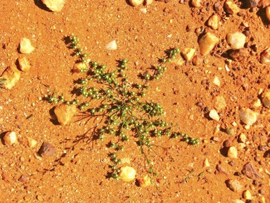
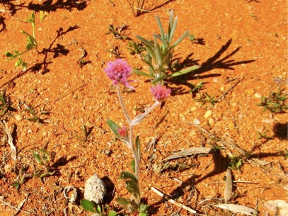
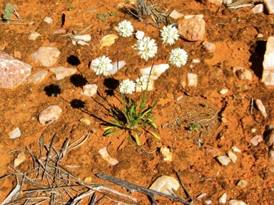
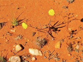
After the Murchison flood plain the countryside became much more interesting and a stop for lunch revealed over 20 species of wild flowers in just the few meters around our parking spot.


Not all of them are photographically attractive but here are just a few:


Just after our wildflower extravaganza, we spotted a medium size perentie crossing the track. He/she was a bit lethargic, having presumably only recently awakened from hibernation. I know how that feels. We also spotted some kangas and emus but they were much too quick for the camera.


At the end of the cross country track we turned down the Mullewa Road to the Murchison Settlement. The Shire of Murchison is apparently the largest shire in the world which doesn’t have a town in it. The shire offices are tacked on to back of the local pub which is now the Murchison Oasis Roadhouse, for want of a better sounding name. No matter, they do manage to keep the roads in their area in pretty good state considering none of them are bitumen.


Janet on the steps of the Oasis.
We are camped tonight at the start of our last track west, Butchers Track, which runs 150km across the Toolonga Nature Reserve to the NW Coastal Highway.
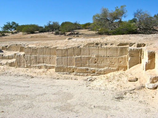
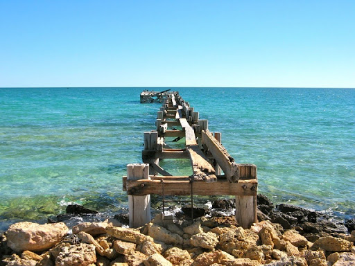
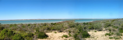
The end of that track is the Overlander Roadhouse which is only a stone fish’s throw away from Hamelin Pool on Shark Bay and our first sight of the sea since Port Augusta. If you think you are getting old, then think of the stromatolites which live in Shark Bay which are reputed to be 4 billion years old.
Janet celebrated by finishing off some of Eli’s famed Italian Almond Biscuits, known as “Biscuito Almondo” in Italian. Sound logical to me and Eli didn’t know the real name either.
4 Aug
I tightened the alternator belt before leaving to avoid the annoying squeal when it starts up. All good now.
The Butchers Track has turned out to be a wide smooth gravel/sandy track equally as good as the Mullewa Road. We were expecting 2 wheel tracks across another desert.
The Toolonga Nature Reserve is pretty much wall to wall full of the same plants, flowering acacias and a few pink flowers. Interesting but it’s the same for 100km with no variety and no stopping places.

We did find an odd road sign. Do we have a Kiwi sign writer or is there really a WA word “Bund”? I was half expecting the next sign to read “Crust” or Cattle Grud”. But maybe I'm wrong, there is a word Bund which means causeway or embankment in Asian countries so maybe Bund as used in WA refers to the humps built across the track for flood control purposes.

The only point of interest in nearly 60km of straight track has been a high pressure gas pipeline crossing with a strange sign. Was in built/maintained by Polish construction crews?
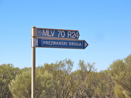

Our pipeline stopping point.
Towards the end of the Butchers Track I screeched to a halt and turned around, I had nearly squished a Thorny Devil. However I need not have worried, these little creatures consider themselves to be impervious to all threats, including large white motorhomes, and had not moved.
We stopped to admire him or her. We’ve seen them before but not often, and this one was a bit darker than previous sightings but just as endearing. They won’t even move if you prod them or lift their tails.


Eventually we moved on and left it to take it’s chances with the next vehicle, which will probably be along tomorrow or the next day....

The Butchers Track ended with some confusion. We looked for the Old Butchers Track which is a spur north off the new track and purports to lead directly to the rear of the Overlander Roadhouse. We searched, as others before us had done, but could not find it. The Old Butchers Track has ceased to exist, it is an ex track!!
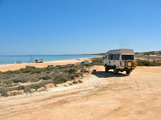
So we carried on left along the prescribed track to the NW Coastal Highway and our first sighting of bitumen for 2,200km, and the sea for a lot longer (about 3,800km).


The highway was reasonably busy compared with our previous tracks but with tyres raised to highway pressures once more, we made quick time to the Shark Bay turn off and thence to Hamelin Pool.
There is a superb recently opened station stay facility at the Hamelin Station which it’s only a stones throw from the stromatolites (about 4km). $24 for brand new facilities and all you could wish for.

It has the only ablutions block that I've ever been tempted to photograph.
There is also a very pretty fresh water lake near the campground.
Happy Hour is from 5pm so this afternoon is for relaxing and tomorrow we’ll do a tour of the Hamelin Pool stromatolites, shell beach and other attractions “one of only two places in the world with living marine stromatolites, or ‘living fossils’” according to the guide book.
5 Aug
Our ears are being continuously pounded by haunting bird calls, to the point of being extremely annoying. It’s from a Chiming Wedgebill (Psophodes Occidentalis) or as we called it the “squeaky wheel bird”.
Have a listen to this and you’ll hear why. Could you could stand it for hours on end? Chiming Wedgebill


Visited Hamelin Pool stromatolites, colonies of single celled animals which can survive in the extremely saline sea water, as found in Hamelin Pool and the Bahamas and no where else.,
Eons ago, before the internet, (4.5 billion years), stromatolites (layers of cyanobacteria commonly known as blue-green algae) ruled the world and gave off small bubbles of oxygen into the then mostly carbon dioxide atmosphere. Over long periods this oxygen increased to around 20%, near the currently level, and is what allowed all other life forms to evolve on the earth. So they were pretty important creatures.

The boardwalk out to view the stromatolites.

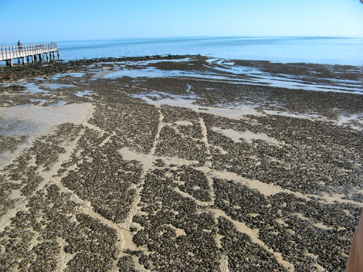
Early pioneers carted wool in wagons over the stromatolites to waiting ships, not realising their importance, and created cart tracks across them which will take 100’s of years to recover.


Gazing in awe and wonder.

A welcome swallow diving across the stromatolites to its nest under the boardwalk.
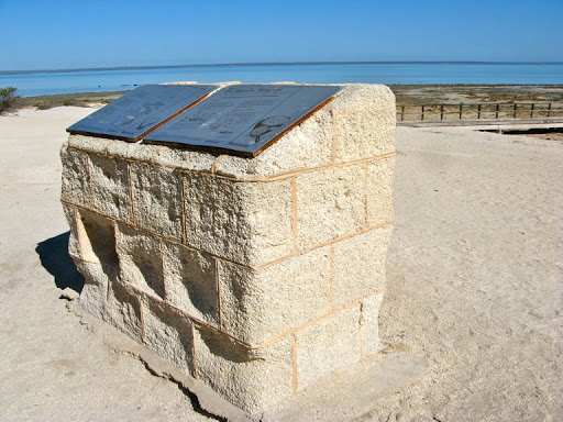
The interpretive plaques standing on blocks of shell carved from the beach.
Shell Beach, where the stromatolites are found, comprises 100% pure shell, the tiny Cardiid Cockle which is one of the very few molluscs that can survive these waters.
Rainwater gradually leaches out the chemicals which bonds the shells together. These used to be cut into blocks as building materials and the remains of the quarry closely resemble the site of an ancient Egyptian monument.


The shells are only a few mm across so there a lot of shells on this beach.
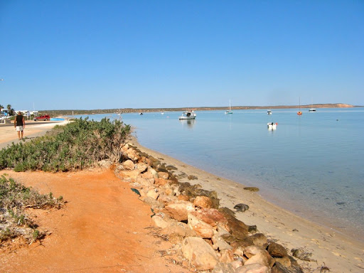
After the stromatolite and shell beach experience we headed up the Peron Peninsular to Denham, stopping on the way at Nanga Bay for lunch.


Denham is a very pretty little seaside town but nothing moves. The water is so calm and flat that you can see the reflections of people silly enough to enter the cool water.


Denham church was built in the 1880’s using sea shell blocks, but the 21st century pointing takes away some of the authenticity.

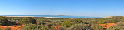
On the way back we stopped to photograph Hamelin Pool in the later afternoon sun.
6 Aug
Today we made a momentous decision. Tomorrow we will take the challenge to get to Steep Point, the most westerly point on the Australian mainland. It’s about 140km NW from Hamelin Pool up the west side of Shark Bay and the last 30km might be a bit difficult with soft sand. However the people next to us in a Nissan Ute did it OK yesterday and we can't be outdone, can we?
So I rang the ranger and booked a campsite for tomorrow and he used to own an Oka as well so we have something in common. But today we went 50km up the coast to Gladstone, an area of beach campsites, tranquility and calm blue/green sea. In the summer months the sea grass beds are home to 10,000 dugongs raising their young, but right now they’ve gone north to warmer waters.
Gladstone Jetty has seen better days as a wool exporting terminal


The rotunda doesn’t allow nearby camping of ANY kind, but what about a Nanna Nap?

7 Aug
Today we reached the most westerly point on the Australian mainland, Steep Point on the far west (obviously) of Shark Bay. But it was no walk in the park.
The first 120km on Useless Loop Road (yes, these are their real names) was corrugated gravel, fair enough for our Oka. Then the track entered the Edel Land (Proposed) National Park and got progressively more demanding until it reached the sand dunes of the Steep Point NP.
It was a most scenic drive passing Disappointment Bay, Useless Inlet, and a number of other green/blue lakes and inlets.
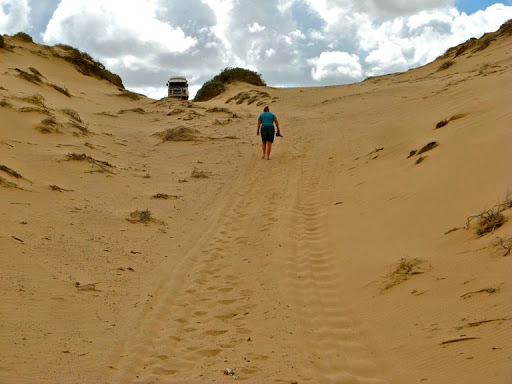
The final 30km to the ranger station took the best part of 2 hours over difficult sand dunes, along a beach drive and via the ranger station to our campsite on Shelter Bay.


After a quick lunch and look around our camping area, we set off for the final leg to Steep Point itself. It was only a further 7km but took nearly an hour, the track was even more difficult than getting here and we missed our turn at the lighthouse and had to backtrack 1km. In fact we stopped 100m short of the westerly point sign and walked the remaining distance since the track became so chopped up we might have damaged something.
Nevertheless, we and our Oka were the most westerly people/vehicle on the mainland at that point.


Janet is heading off to be the most westerly person on the continent, but we chose not to put the Oka through this last difficult descent..


We duly noted our achievement in the visitors book.

There is a very convenient “Fotopol” post erected near the sign which you can attach your camera to, to take self portraits. I couldn’t work out how to take a photo of my camera attached to the pole.
8 Aug
The night was a bit breezy and being on the beach the wavelets kept sploshing about which made sleeping a bit difficult.
Anyway it started as a warm sunny but windy day on Shelter Bay.

After chatting to Pam the ranger, we set off south to try some side tracks to the west coast Zuytdorp Cliffs.
The track to Thunder Bay was difficult due to the narrow and steep sand dunes but we got most of the way there. We were stopped once again about 100m from the edge by a soft sandy hollow between sand dunes which I wasn’t convinced we could climb out of, so we parked at the top on some hard sand and walked the rest of the way.

The seascape was spectacular with crashing waves over shelves of rock.


But while there the weather started turning rotten and Thunder Bay certainly lived up to its name.

So we abandoned further attempts at getting closer to the coastal cliffs and blowholes on this trip and headed back to the main track while the weather was still fine.
We waited for an hour by the False Entrance track junction so see what the weather would do but the rain got heavier and the hills disappeared in low cloud and mist so we had to retrace out steps out of Steep Point.
120km of dark, slippery gravel later on the Useless Loop Road and we were back at Hamelin Pool and on to firm bitumen again. We shall have to try again one day, Steep Point is hiding some great locations.
An exciting but very trying day. But the Oka seems to have survived the trip intact but very dirty.
Since we have now completed our trek as far westwards as it’s possible to go, we have started another blog entry for the southwards trip down to Perth.