7 Sept
There’s something odd about today but I can’t recall what it is. Ah, yes, I don’t have to do household chores today and I can have Vegemite sandwiches for lunch if I really want to.
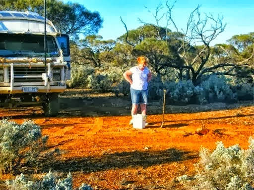
I had a good birthday with 20+ emails from every web site I had ever subscribed and of course calls, messages or SMS’s from the rellies too. Nice to know that even when we are remote from civilisation we are still remembered.
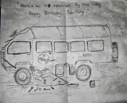
Janet made me a bespoke birthday card in the absence of any nearby shopping experiences. It shows me in my natural habitat surrounded by spanners and a can of WD40.
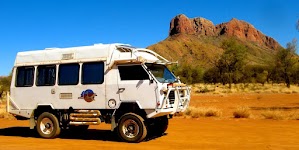
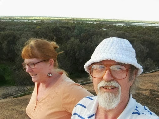
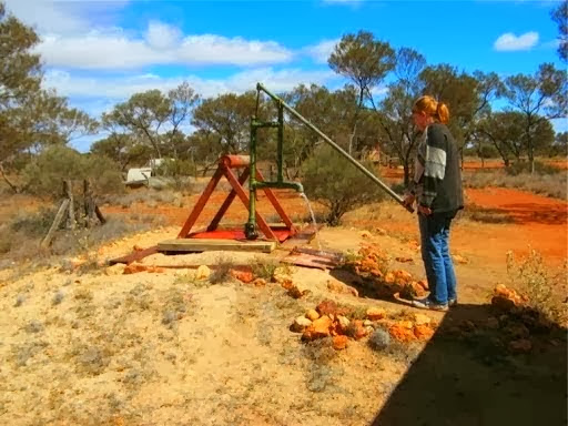
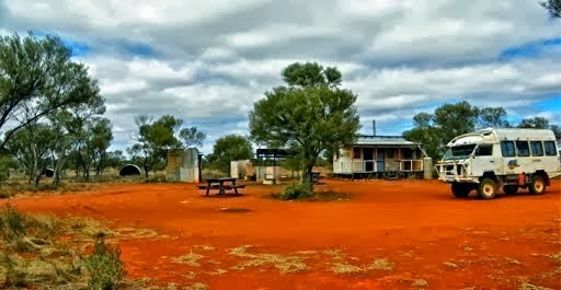
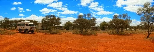
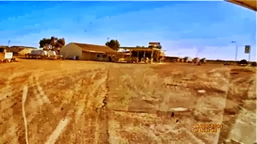
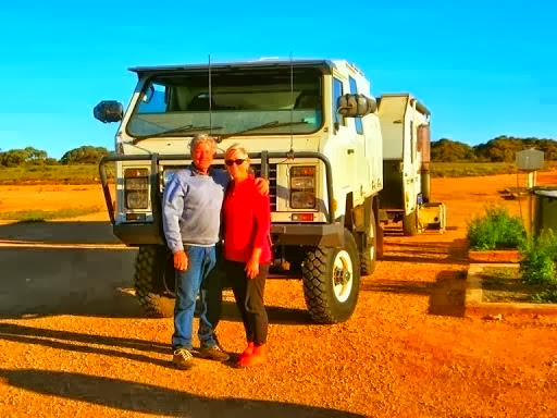
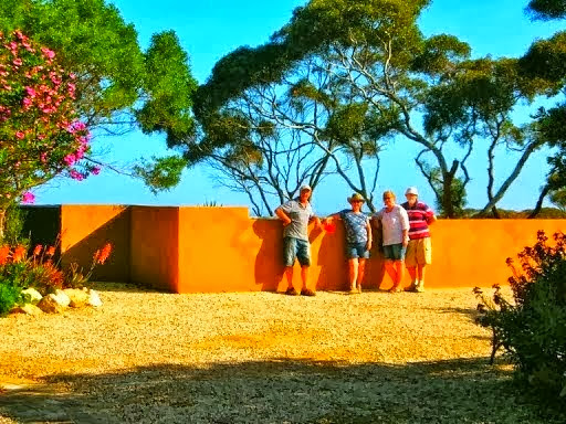
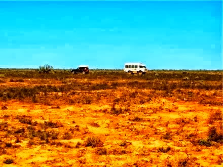
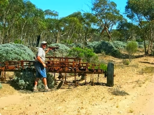
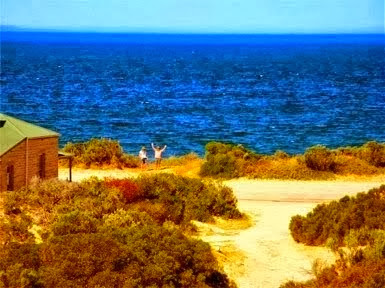
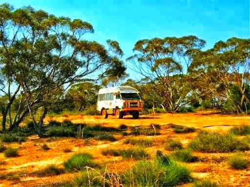
My real birthday treat was the Oka gathering at Harrismith at the farm of Brett (outyonda). It was really good turn out with 13 Okas plus around 25 people. There are a few photos emerging on the Oka website and I've added a few below.
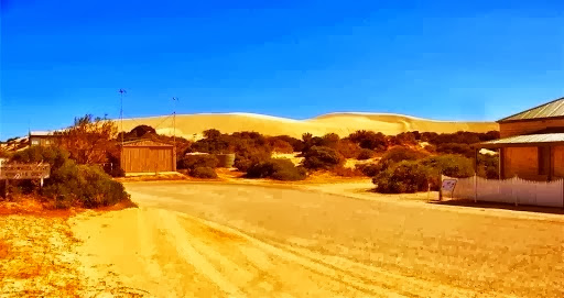
Harrismith is a very small town in the eastern wheat belt of WA, east of Katanning, north of Dumbleyung, south of Southern Cross and west of Lake Grace. Brett (outyonda) was the host and had laid on a huge pile of firewood and a large BBQ made from an old wartime sea mine.
The farm is 22,000 acres of wheat, canola and sheep and Brett also has several yabbie dams and can sell up to 25 tons a year. He also runs outback dirt bike tours (Outyonda.com) as a hobby and uses 3 Okas and a Lada as support vehicles.
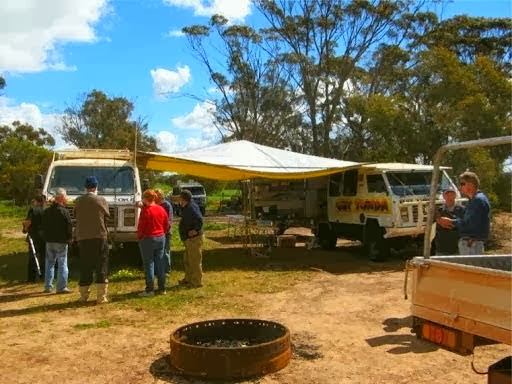
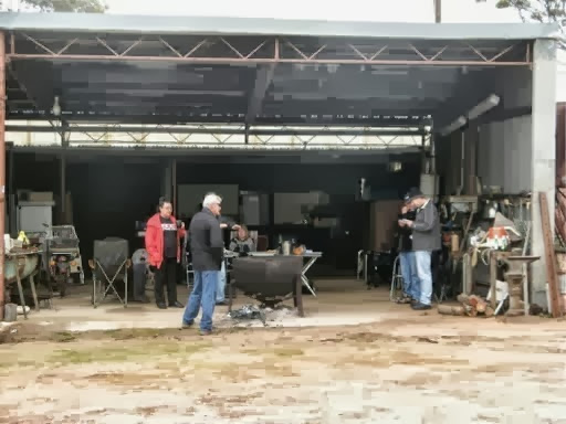
Saturday morning started fairly slowly since it rained heavily and none of us knew each other except by web site user name but that was soon overcome by Janet issuing name tags made of masking tape and by the evening BBQ we were all acquaintances if not good friends.
It was actually fortunate that the weather wasn't too good on the Saturday, as it meant we had to crowd around together inside Brett’s shed and get to know each other. No splinter groups or hidden agendas.
We got on pretty well with everyone and really enjoyed the 2 days.
Even though most of the discussion was Oka related, all the ladies got on well together as well and Brett took several groups around the farm in his 1932 truck, including yabbie catching in the dam. His small fluffy black dog “Nugget” goes everywhere with him.
Here is Brett gently unloading his Lada from a trailer.
Brett unloading his Lada from David and Janet on Vimeo.
8 Sept
It’s Charles birthday today, so yesterday was the one day in the year we are both the same age. Happy birthday Charles.
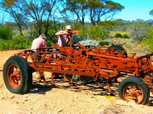
On Sunday morning small groups were walking around looking at and under Okas and probing various technical issues. It was amazing how similar the Okas were but also how totally different they are.
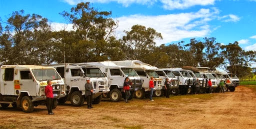
We were scattered around the farm but were coerced into a line up for the obligatory group photos.
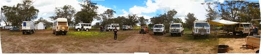
After the line up for photos (which took an hour to organise), people started leaving for Perth or wherever after a most enjoyable and educational weekend.
Being Charles birthday today, I sat up late compiling a happy birthday message to him (he’s in the UK so it’s still his birthday for several more hours). It’s been 4 years since we had a joint birthday bash and suggested it was time we arranged another one, somewhere in the world.
9 Sept
Since it was quite late after all the photo shoots, we stayed on with Brett and another couple for Sunday night, and another BBQ, before leaving to continue our journey east.
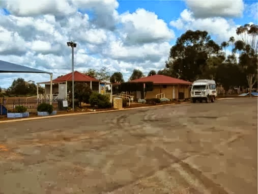
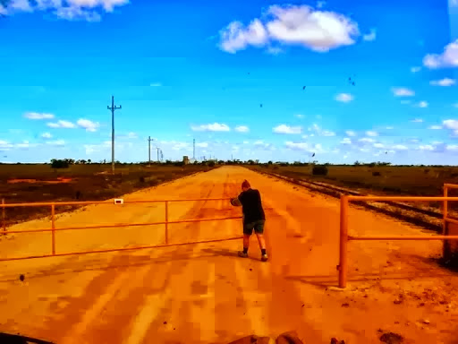
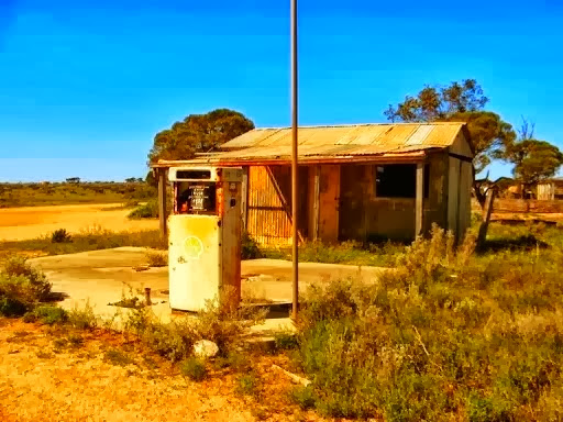
Today’s drive took us through the endless wheat belt country and a myriad of small towns. One of the best was Kulin, an RV friendly town and a really open and relaxing atmosphere, a far cry from the average location where you are immediately hit with no this or no that signs which can be very off-putting.
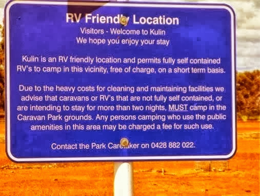
Since it was welcoming, we filled up with their free water, checked out their extremely clean facilities and did some shopping in their supermarket. We would have bought fuel too but their pump was out of action. We have no problem in spending a bit of money in small country towns, even if their prices are a bit higher, when our visits are appreciated, not just tolerated.
As if to prove this, when we were having lunch outside their nice park, a lady “Knock Knock”ed on our door and said she was a council advisor on tourism and how did we like their town facilities? So we told her how much it meant to travellers to be appreciated and treated fairly and not shoe-horned into overpriced caravan sites or rejected as unwanted gypsies.

We asked her to pass on our congratulations to the council for their far-sightedness and confirmed that it was a 2 way street; make travellers feel welcome and they will stop and spend a bit of time and money. Too many “No This or That” signs and we won’t even stop.
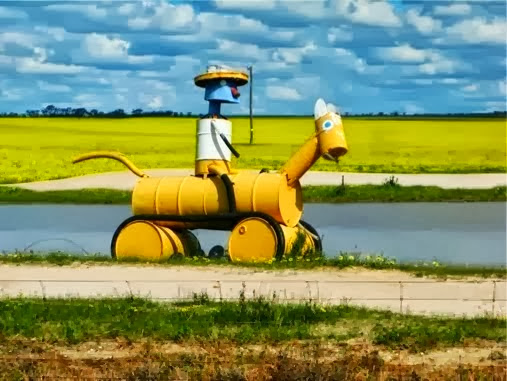
One of Kulin’s claims to fame is the Tin Horse Racing Carnival, the origins of which have been lost in the mists of time, at least beyond the recall of the sweet young girl on the shire council’s counter. I had gone there because of a poster in the toilet block (stay with me on this). It had said “if you like our town, call in the shire offices for a sticker to put on your caravan”. Which is how I came to be in the presence of the sweet young counter girl.
The sticker turned out to be 1m by 1m in size, designed more for the side of a bus than a small caravan but I said I could probably adapt parts of it. Sadly she said they didn’t have any yet anyway, so to make the most of my time investment, I asked about the origins of the Tin Horse Racing Carnival and that’s where I came in.
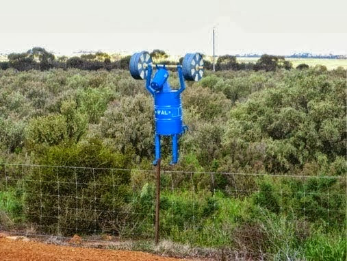
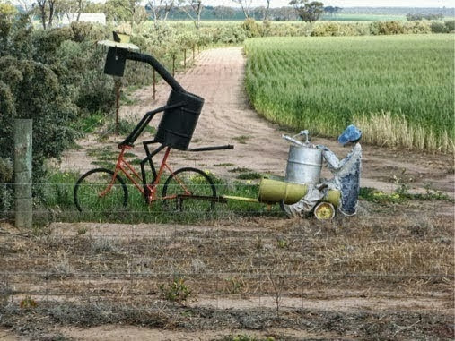
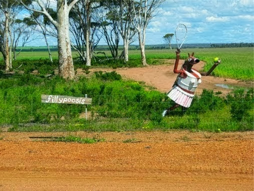
On the way out of town on the Tin Horse Highway, and towards the race course about 10km away, there were scores of amusing “sculptures” of tin horses made from old oil drums distributed alongside the highway. Here is a sample:
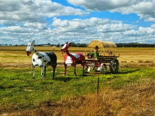
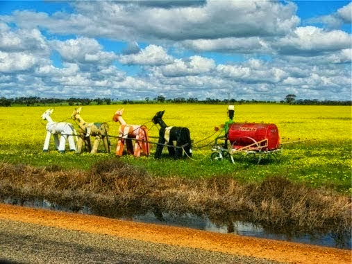
So we actually enjoyed our couple of hours in Kulin, a town we’d never heard of before but is now part of our travelling history.
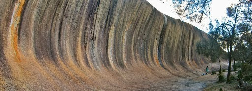
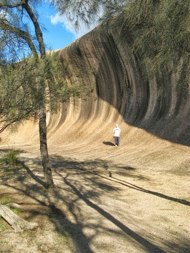
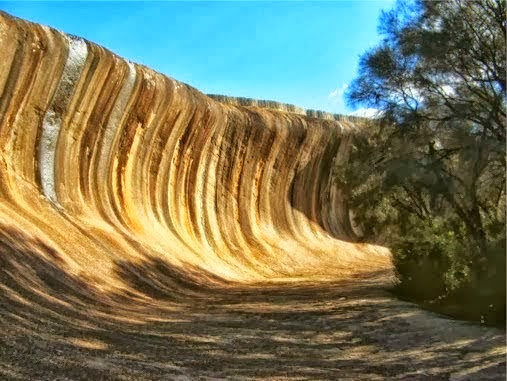
Later we went to see Wave Rock again in Hyden for an hour or so and it hasn't changed much in 25 years, it’s still a spectacular sight.
What has changed though is the approach of the local community which is totally the reverse of Kulin. Quite apart from the overt attempts at exploitation of tourists (who wants a lace museum or a toy soldier museum when you’ve come to see one of Australia’s scenic wonders?), the entrance to Wave Rock appears from the signs to be via a caravan park which covers all the area alongside the rock and ruins the ambiance with the commercialism of a kiosk and caravans parked everywhere.
At the entrance to the rock, there is a ticket machine which says “$10 per vehicle and display the ticket on the windscreen”. Hang on, Wave Rock is a National Park which has free entry, how can they be charging an entry fee? We nearly got caught as many others had been, since the $10 is only a (rip off) charge for using the caravan park car park. You can park for free a 100m up the road at several National Park picnic places and still walk along all the scenic parts of the rock quite freely. It is a huge con-trick by the caravan park owners.

It was getting late in the day so we left Wave Rock and it’s exploitations and headed east towards Norseman to look for the Holland Track, a cross country historical gold-mining track to Coolgardie.
10 Sept
After a night in a very pleasant bush parking bay we drove towards the Holland Track when the unexpected happened.
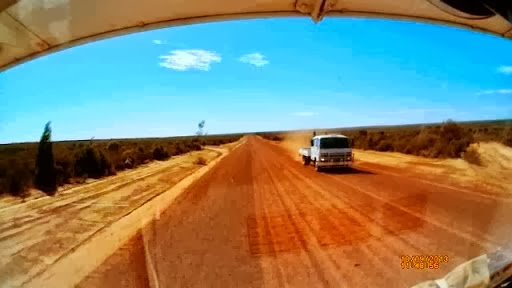
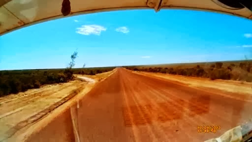
We’ve had many stones hit the windscreen flicked up by on-coming trucks, but never before have we captured the event on video.
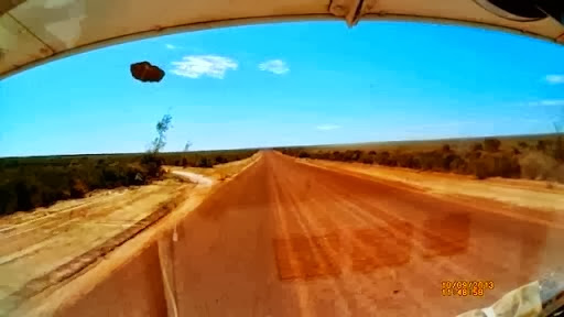
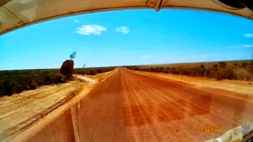
A small truck passed us and we waved, as is usual in the Outback, but a few moments later a large stone, actually a small meteorite, came hurtling towards us. It hit the scuttle just under the windscreen, bounced back into our path, up to the sun visor where it rattled around for about 2 seconds before falling on to the windscreen and bouncing off sideways. And all of this was captured on our crashcam recorder.
All of this was over in the blink of an eye (around 2 seconds actually) so I extracted some stills from the movie.
It’s bounced back off the Oka (which is why it appears smaller) and into the path of the sun visor.
And now luckily it just drops downwards.
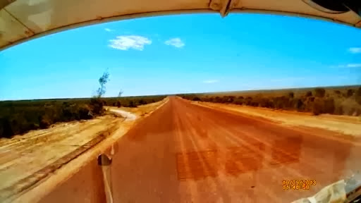
“Snicko” confirmed that it hit the windscreen just out of range of the camera.
If a stone that size had hit the windscreen directly it may have shattered completely, since it’s already badly cracked.
Stone strike sequence slowed down to 1fps.
Stone Strike Video at 1fps from David and Janet on Vimeo.
Stone strike at normal speed.
Stone Strike Video from David and Janet on Vimeo.
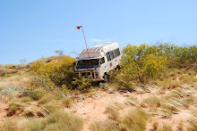
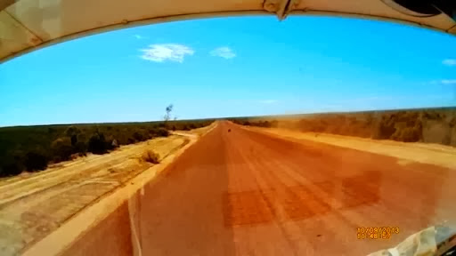
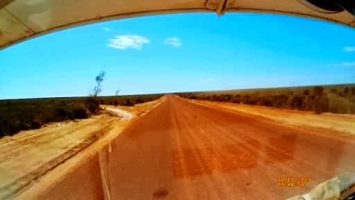
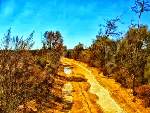
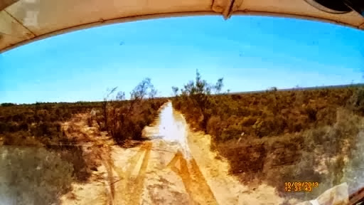
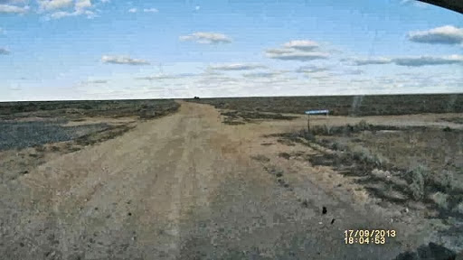
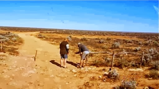
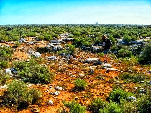
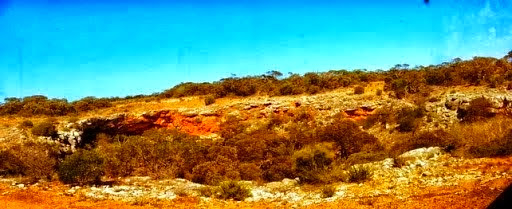
Next we came to the Holland Track. This is a narrow sandy track, stretching 500km from Broomehill in western WA to the goldfields of Coolgardie. It was developed in 1893 by John Holland and his team with 5 horses and a dray to provide access to goldfields by gold miners who flooded into the area. Now it is used as a 4WD track so we set out to see if it was navigable at this time of year.
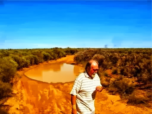
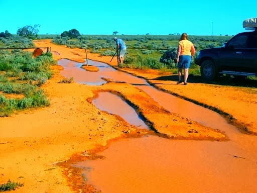
We were only attempting half the track but only 100m into it we came upon our first mud hole. We sploshed across it OK, but they became bigger and more frequent and the first 15km took well over an hour, so reluctantly we decided to turn around a seek out a better way. To carry on it would have taken us at least 3 days to complete, assuming conditions didn’t get worse.
An early scare.
Things got worse.
We had a near disaster on a bypass track as the Oka nearly sunk in.
And this was the final straw, we did get past this one but decided enough was enough and we backtracked through the same mud holes again to the Hyden to Norseman road. One bogging per trip is enough.
After 15km each way and nearly 2 hours on the Holland Track we concluded that this time of year is not a good time to try this one and resolved to try again another time.

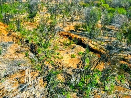
Somewhere along the track one of our hub retaining rings got bent out of shape.
So we stopped to re-inflate the tyres and have lunch as Janet washed the mud off the windscreen and door handles.
As we were doing this, who should pass by but Brett, whose farm we stayed on for the Oka gathering at Harrismith only last weekend. He was supposed to be in Sydney today ferrying some new trucks back to WA but something delayed the process so he was on his way to Esperance instead. We were over 200km from his farm so it was a pure coincidence that we should meet up again so soon.
Brett, not in one of his Okas, on his way to Esperance.
However, he told us that a group of motorcyclists had called in last night. They had attempted the Holland Track the day before but only got halfway when they too turned around and backtracked as the track became impassable, even for motorbikes. So at least our decision was ratified by another group.
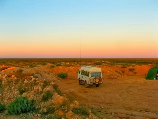
Brett also told us of a good camping spot at the McDermid Rock near the Victoria Rocks turn off and that’s where we are tonight, about 125km south of Coolgardie.
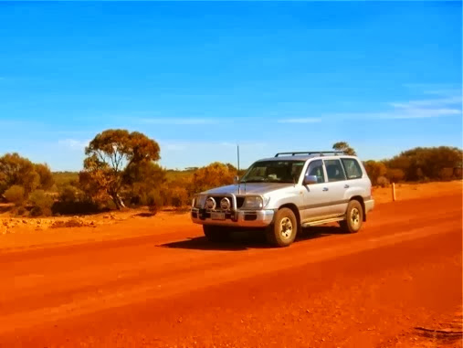
As you can see from the photos, the blue skies have returned as we’ve moved inland and it got quite hot. We both changed back into shorts this afternoon.
11 Sept
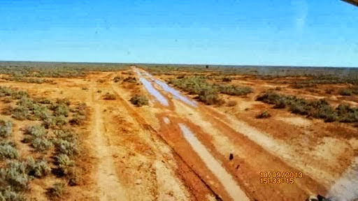
The Victoria Rocks road to Coolgardie (a gravel track) was fairly uneventful although a bit sploshy at the southern end.
We called into see our Oka man Robin at Coolgardie and had a cup of tea with him and a chat. It’s good to see he is as fit as ever for his age (77) and his Girl Friday/stand in Manager, Aleshia, is keeping a good eye on him.
Later in the day we arrived in Kalgoorlie and after a quick shopping trip we camped on a patch of bushland north of the town.
12 Sept
Still in Kalgoorlie preparing for the return to Adelaide which will be in the next entry. Food, fuel (180 litres), gas, water (150 litres), medications and the washing all done in one day. I even tightened up the steering rod bolts this morning.
Tomorrow up to Leonora via Menzies and maybe crossing paths with Dave and Pauline who are heading up the Great Central Road via Leonora.
13 Sept
A leisurely 240km drive from Kalgoorlie to Leonora and camping at Malcolm Dam.
On the way we stopped for lunch at Menzies, named after an early American miner who made his mark there, a John Menzie.
We reported previously on Menzies and the town hall clock tower that was built in 1890 but didn’t actually have a clock until 109 years later, in 1999, but Menzies was a huge gold mining town in the 1890’s until the gold ran out 10 years later.
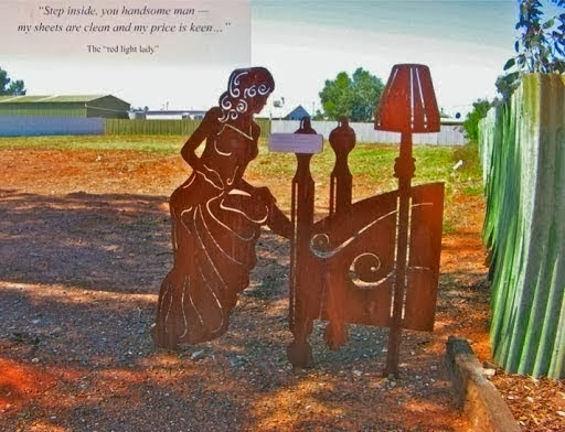
However, gold mining wasn’t the only industry thriving in the gold fields...
There are many similar sculptures all over town, cleverly made from sheets of rusty steel.
14 Sept
Had an early morning email from Dave and Pauline. They weren’t that far away from us and we said we’d meet up later in the morning in Laverton.
As these things sometimes happen, we drove out of the Malcolm Dam track an hour later and had to wait for another vehicle, which turned out to be Dave and Pauline. We had a quick meeting on the side of the road and then convoyed the remaining 110km to Laverton to refill with water.
Then they departed up the Great Central Road towards Chuckalolly Road House (actually Tjukayirla but I can’t pronounce that) and we set off across the Anne Beadell Highway.
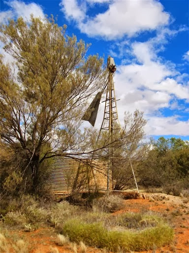
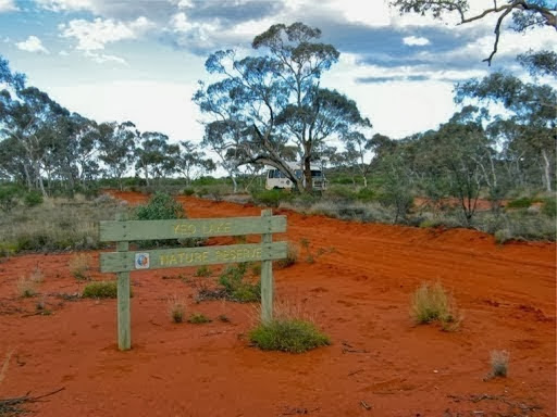
The first 120km were OK but the final 50km to the Yeo Lake Nature Reserve in the Great Victoria Desert took over 2 hours since the track became deep sandy corrugations. We were heading for an old abandoned homestead which is set up for travellers to stay but we didn’t quite make the final 25km. We found a nice campsite just inside the reserve and stopped here since I was buggered from all the corrugations.
A lunchspot by a tumbled down windmill was a relief from the pounding corrugations.
At the appointed hour we tried making radio contact but we were too close together (around 155km) and our signals bounced over the top of each other. However another network member heard our attempts and relayed our “all is well” messages between us. He was at the Border Village on the Eyre Highway, about 700km away, and it’s good to hear the radio network working effectively.
15 Sept
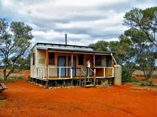
An hour after setting off this morning we reached the abandoned 2 room homestead which we last visited in 2008. Nothing much had changed and the well still worked so we filled our tanks.
It’s a ghostly reminder of the conditions early station owners had to contend with, 900 km from Perth with no communications or facilities, in order to scratch a living from the unreliable and unforgiving climate on the verges of the Great Victoria Desert.
40km east of Yeo Homestead is Bishop Riley’s Pulpit, why so named, we have no idea, but it’s an impressive outcrop of rock in an otherwise fairly flat landscape.
Actually the rock is probably named after Bishop Charles Owen Leaver Riley D.D., the first Anglican archbishop of Perth, longest serving Grand Master of the Freemasons WA Lodge, and co-founder of the University of Western Australia. See here or here, or here for his details. He was a frequent traveller in his WA diocese in the late 1890's, spreading The Word with "simplicity and flashes of brilliancy".
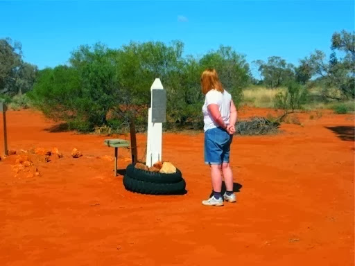
Midway along the Anne Beadell Highway is a small memorial to Anne Beadell, after whom the track is named. She was the wife of Len Beadell who built all these roads in the 50’s and 60’s, and passed away a couple of years ago.
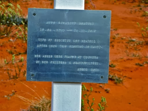
By a strange coincidence, we almost bumped into her daughter, Connie Sue Beadell, after whom the Connie Sue Highway is named, who was travelling down her own highway the day before we did the same thing. It must be a strange thing to have a highway named after you and then drive down it.
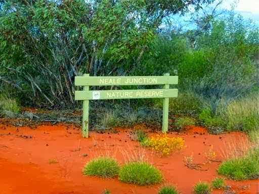
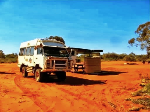
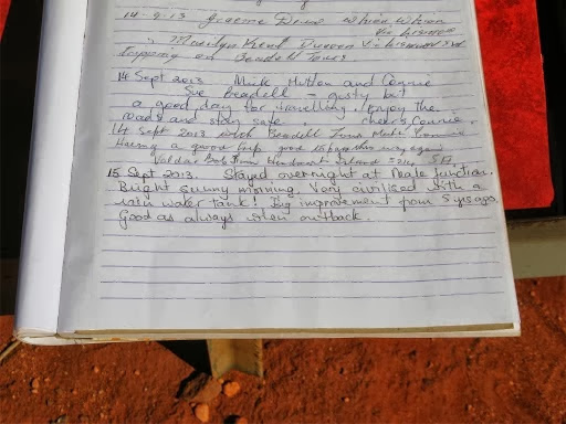
We finally reached the Neale Junction Nature Reserve, tired and cranky, after one of the most difficult days of driving we’ve had in years. We only covered 170km but it was over one of the most corrugated sections of track we have come across. We were shattered and so was the Oka but I've always maintained that the Oka can stand far more bad roads than we can and this was true today. We got in the back had a cup of tea and a glass of wine, not necessarily in that order, and our minds and bodies soon recovered. Everything in the Oka just worked as expected. Nothing was broken, loose or falling off.
Earlier in the afternoon we met a well equipped 4WD coming the other day, the only people we’d see in 2 days. We stopped to compare notes about track conditions and then continued on our ways. Just the normal interaction between travellers on a remote track.
Then a bit later, a small Apollo motorhome roared past us while we were stopped. Now firstly you don’t pass by a stationary vehicle in the outback without first ensuring the occupants are all OK, secondly, small rented motorhomes like that have no business being out on such a outback track, particularly this one which is one of the most remote and difficult tracks in the country. We know, we’ve done all 1500km of it before. And thirdly, their hire agreement would not have permitted travel on ungazetted roads like this track; they are unlikely to have the necessary recovery, communications or safety equipment on board and these vehicles are usually hired to overseas visitors who have little or no understanding of the conditions or risks in outback travel.
We just hoped they had the sense to realise this and take the first exit to a populated area, Warburton, 300km to the north, which fortunately they did, we could tell from their tyre tracks.
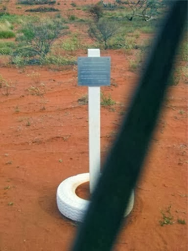
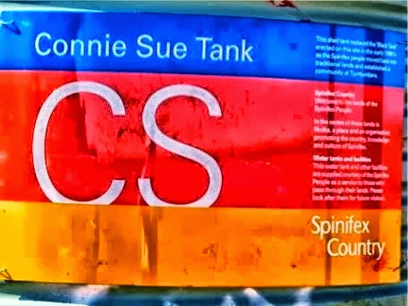
At Neale Junction, where the Anne Beadell and the Connie Sue Highway’s intersect, a newish camping areas has been established with toilets, and more importantly a water tank.
Next morning, after our showers, we topped up with nice clean rain water.
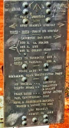
The plaque placed there by Len Beadell in 1962 shows just how remote this area is. The distances on the plaque are in miles and there are no facilities in between. Note that Connie Sue (and their dogs) is mentioned on the plaque. This was the only time she travelled as a small child with her mother, on father Len’s road building trips.
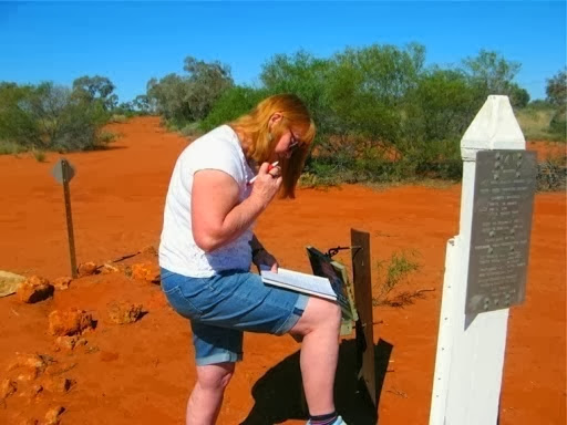
Janet, thinking hard about what to write in the visitors book. The previous entry, the day before, was by Connie Sue Beadell herself after whom one of the tracks is named. In all the excitement, Janet forgot to sign our names so we shall have to remain anonymous for ever.
16 Sept
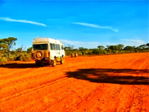
Turning south down the Connie Sue Highway, (500km to Cocklebiddy on the Eyre Highway), we were surprised to find the track was a smooth as a baby’s behind and we made excellent progress covering 250km today at 55-60kph (compared with yesterday’s 170km at 20-25kph). This track is one of the few north-south tracks and not as frequently used, which probably account for its smoothness.
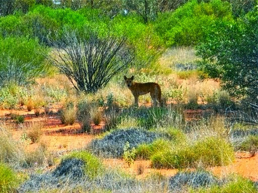
One of the inhabitants ran across the track in front of us and stopped to check us out. Guess who it reminded us of?
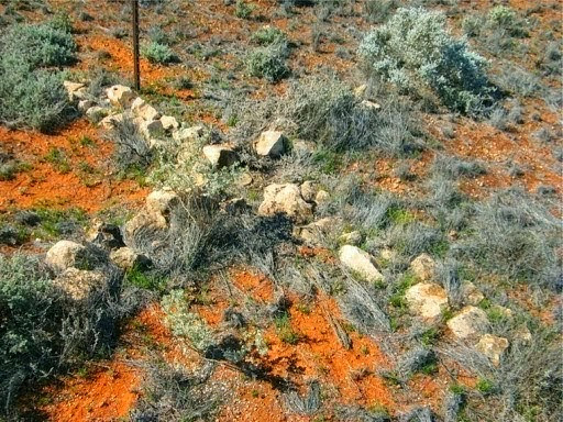
All along the track were these small crosses made of white stones and looked like memorials. However they turned out to be locations for surveyors bench marks.
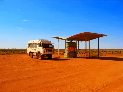
At the junction with the Aboriginal Business Road, there was a shelter and water tank, thoughtfully provided by the local Spinifex People in an otherwise barren and waterless desert.
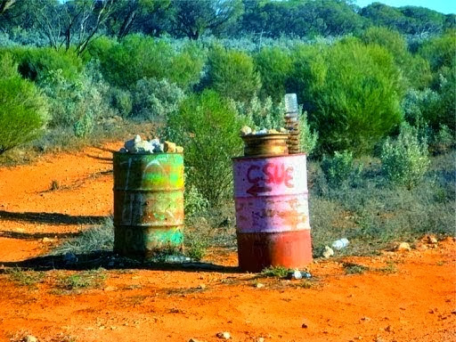
75km down this wide gravel road we came to a small junction.
Faced with the choice of the big wide track on the right or the narrow one on the left, which would you take?
Well, you’d be wrong, and we nearly missed the little arrow under the Connie Sue abbreviation on the oil drum too. Our moving map system also agreed with the little arrow.
Just down the start of this narrow track (which will lead 120km to Rawlinna on the Trans-Australia Railway line), there was a small campsite so Janet, always the pyromaniac, built a small fire to burn our rubbish.
It is a nice warm, sunny and calm evening but when I checked in on our HF radio, the operator said that Perth was having severe storms and gale force winds and it’s heading east.
We may have to batten down the hatches tomorrow if it reaches this far inland, we are over 900km from Perth. I’ll take down the antenna in case of lightning over night and close up all the vents. If the track gets a lot of rain we may be delayed a day or 2.
Incidentally, we’ve covered over 8500km in 2 months since leaving home on 18 July and you may wonder what we do in the evenings when there’s no TV or internet?
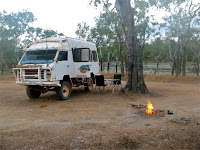
Well, we log in to our HF radio base so they know where we are and that all is OK, we download the day’s photos, write up our blog, have dinner, drink wine, do crossword puzzles to keep the mind keen and fresh, drink more wine and read books. Right now I'm reading A Short History of the Second World War. I'm 3/4 of the way through it and I still don’t know who won. I'm tempted to read the last page to find out but that might spoil the surprise.
Warning, WW11 history lesson follows:
What was a real shock though was that, despite the $quillions spent and the enormous resources in men and materials set against the enemy in Operation Overlord, the final outcome wasn’t as clear cut as the history books might suggest.
Apart from the surprising resilience of the German forces, there was a lot of egotistical in-fighting amongst allied commanders and even General Eisenhower’s overall command was at risk at one point. It was the threat of potential subjugation of western Europe posed by Russian forces, advancing from the east, that finally drove the allies to forge ahead and complete the job.
It was the stress of this European campaign coupled to the forthcoming battle for Japan that contributed to President Franklin D. Roosevelt’s death on 29 March 1945. His ill-health had been deliberately hidden from public view so as to not affect the progress of the war.
End of lesson
17 Sept
A bright, cloudless, sunny and early start to the day and none of the storms or winds have arrived here yet. Since we are 1000km east of Perth we really should be in a new time zone, the sun rose at 5.30 this morning and in these desert regions, it rises with a bang. One minute it’s twilight and next minute the suns rays hit you with the aforementioned bang, warm and bright. Of course, only one of us was up to witness this event, the rest of the team was still in bed complaining about the noise and bright lights.
Despite earlier enthusiasm, violent winds from the west roared in at 7.32am, bringing with them (why are winds plural?) thin clouds which scudded across at a tremendous speed. Not rain bearing but maybe the portent of some nasty weather. Winds I don’t mind much but mud I don’t like. Fortunately the remainder of this track is mostly across the rocky limestone of the Nullarbor Plain so mud shouldn’t be too much of a concern. But I have been wrong before, believe it or not....
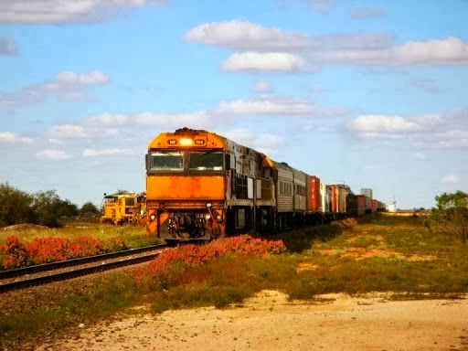
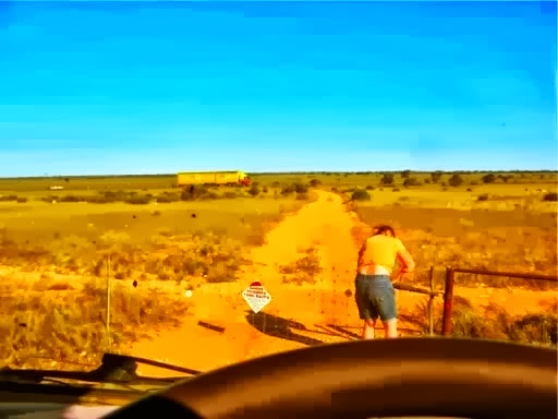
You had better believe it. The narrow track got gradually rougher and more difficult and the final 100km to Rawlinna took over 4 hours of frustratingly picking our way over crappy station tracks which had been chopped up by animal hooves, but even then we couldn't find a track into town. We knew Rawlinna was now a mining and railway town so were confident of a warm welcome from a community buzzing with activity . As we approached the town there was a fence across the track but no gate. Instead there was a side track leading to a gate to some cattle yards. It looked like we were going to be loaded into a truck as hamburger contents, but I spotted a some newly laid gravel with truck tracks on it, and I just knew trucks needed a road so we opened the gate and drove for miles around brand new trucking roads to the entrance to the town of Rawlinna.
Only one more yellow gate and we were in the town and pulled up alongside the famous railway station.
The Trans-Continental Railway track looking west.
I shouldn’t really do that since this happens several times a day, and there are no fences or warning signs.
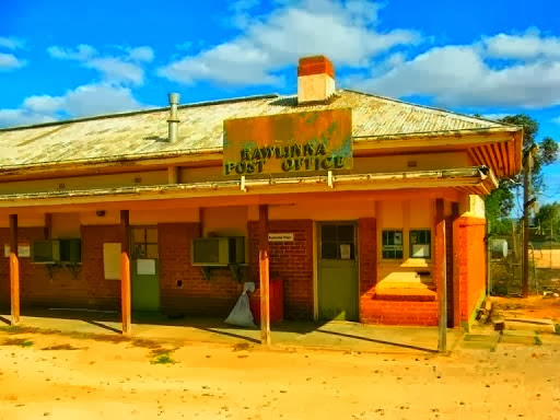
The famous station sign.

But now the fun started since the town was completely deserted. We searched around and explored the deserted railway station, primary school, telecom building, water and power supply yards. Nothing and nobody.
Then we saw this sign in the railway station:
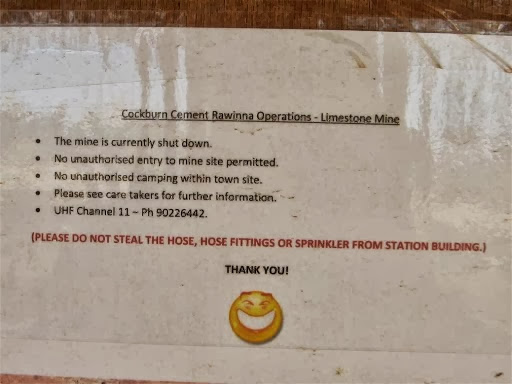
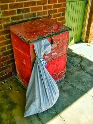
Even allowing for the wrong spelling of the town name and the levity in the final comment, the reason for the lack of people was clear; the mine was closed. The only signs of life was a bag of mail on the platform awaiting a passing train to stop and deliver it to Kalgoorlie.
We wondered how a town with zero population could write so many letters...
But they did have a 5 bar Telstra network (courtesy of the railway company for the benefit of track maintenance staff) so we checked emails and updated the blog and checked our stocks and shares (joke).
Ultra-modern telecom equipment
A Time Capsule was buried here in 1985 by local school children. The 25 year point has already passed and we wondered if there would be anyone left to dig it up after 50 years in 2035.
So after completing our exploration of the no-horse town, and watching 2 huge freight trains crawling along the Trans-Australia Railway line (in opposite directions on a single line), we sought out the track south to Cocklebiddy, but there wasn’t one. We tried every track and road within 5km of the town and there was no track south or even an inkling of a sign to one.
On our final pass of the truck parking bay we finally saw someone, and here he is, the population of Rawlinna:
We stopped him and he said “You look lost”, which was fairy accurate. We asked how to get to Cocklebiddy and he said you could go through Rawlinna Station (ignoring the private property and no entry signs) but that track was confused, rough and difficult. Instead he recommended going down the railway access track to Haig, a minuscule siding 80km east of Rawlinna, and then turning south 120km on a small track to the Eyre Highway, coming out 10km east of Cocklebiddy. Yes, the track was narrow and rough to start with but improved later and that’s the way he would suggest.
So the thick red line on the map was to be rejected in favour of a longer, thin, dotted red line on the map. Well why not?
In passing we asked him if he was the only person in town. “Oh no,” he said, “there are 2 others”. I also asked how the trucks got to Rawlinna if there was no road, and he said from Kalgoorlie, 400km away along the railway access track (which is permitted in WA).
So finally we had the answer to how to get into and out of a town we couldn’t get into or out of. As we were leaving town we saw another vehicle crawling along, and armed with our new knowledge, we stopped and said “You look lost”.
Bill and Judy, in a LandCruiser with a roof top tent, had come up the aforementioned railway access track from Kalgoorlie and were now seeking a way to Cocklebiddy. Well we now had the answer.
In a convoy we covered the 80km of excellent quality railway track to Haig in little over an hour. At Haig, there was nothing, not a thing, completely zilch, except a sign pointing to the Eyre Highway, which is just what we needed.
The complete zilchiness at Haig, save for the blue sign to the Eyre Highway, 120km south.
It was getting dark now and we spotted a gravel scrape a couple of km down a narrow track and pulled in there for the night, out of the cold, howling wind.
After dinner B&J came over to the warmth of our Oka to chat and compare notes.
18 Sept
Up at the crack of dawn to see a freight train stopping in the early morning sun., presumably to allow an other to pass.
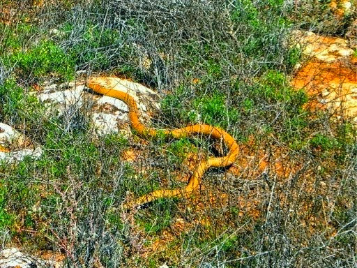
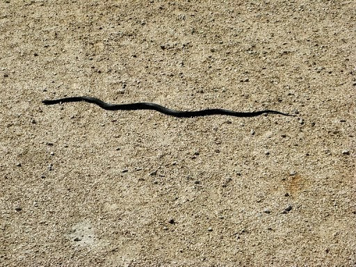
Today was another trying day. My prophesy of taking “only a couple of hours” to reach Cocklebiddy was out by a factor of 3, it actually took us nearly all day to cover the 120km. Admittedly that did include several comfort stops, coffee and lunch stops, a myriad of gates to open, a sinkhole to explore, a large snake and a fossil search.
The track started off very rough and rocky and remained so for most of the day.
The final 40km were less rocky but much more boggy, due to last Saturday’s rain. This is an arid, treeless limestone plain where it never rains, except last Saturday.
A gate fixing lesson from the expert.
We were going to get our feet wet on this one.
A beautiful lunchspot, blue skies, a tree, a water feature and a pile of firewood. Where did that come from in an area completely devoid of trees?
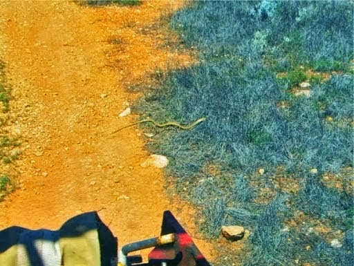
A wriggler on the track. It turned out to be large and very dangerous king brown snake.
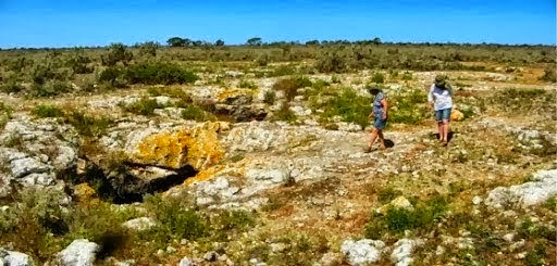
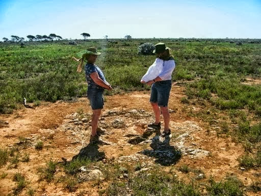
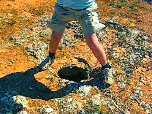
Janet saw a small sinkhole which turned out to contain a small blowhole, around 75km from the sea. That makes it a very long underground cave (can caves be anywhere else?) and we trod very carefully lest this be the day this small cave suddenly became a large sinkhole.
More interestingly, we discovered quite a few fossils in the surrounding limestone, some of which accidentally found their way into our car.
One last frustratingly difficult gate and we reached the Eyre Highway.
But when we finally did reach the highway at around 3.30, there wasn’t even a road junction for us to depart on, the track just suddenly ended at an oil drum 5 m from the highway. After enduring 5 days of seriously bad tracks we did kind of expected something better than this.
Anyway we were not to be done out of our trip to Cocklebiddy and mounted the road verge and did the final 10km on smooth bitumen.
Cocklebiddy Roadhouse:
We met Chris and Shirley James there heading back to Queensland in Oka 096. Shirley didn’t want me to mention her orange socks, so I won’t.
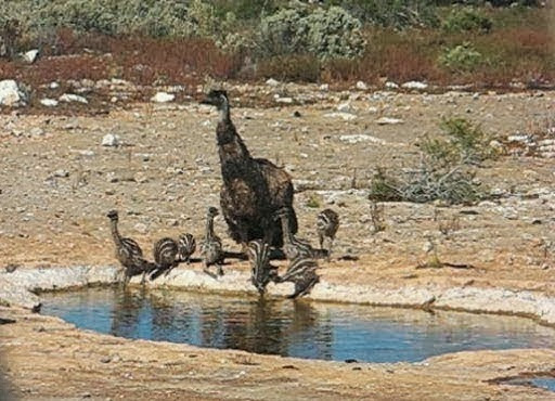
We camped a bit further back off the Eyre Highway down a side track where there was a nice natural swimming pool. The next morning, an attentive father emu brought his clutch to a water hole for a drink.
19 Sept
On the way back towards the SA/WA border, we descended the Madura Pass, along what was the beach many millennia ago. It’s now 40km from the sea but the cliffs are still there.
After refilling our water tanks at the Mundrabilla Tanks (which are fast disintegrating and it’s difficult to foresee any government being willing to expend $squllions for the benefit of a few grey nomads), we climbed the Eucla pass back up the olden day cliffs to Eucla where we had a hard earned cuppochino in the nice hotel native garden.
Both we and Bill and Judy had driven the old Eyre Highway back in the mid 70’s when the SA section was still a gravel track. And as it happens that section of the highway is still navigable and makes an interesting alternative to the bitumen if you’ve done that boring section a few times.
12km further on from Eucla is the SA/WA border and the Old Eyre Highway starts directly across the new highway from the Border Village motel.
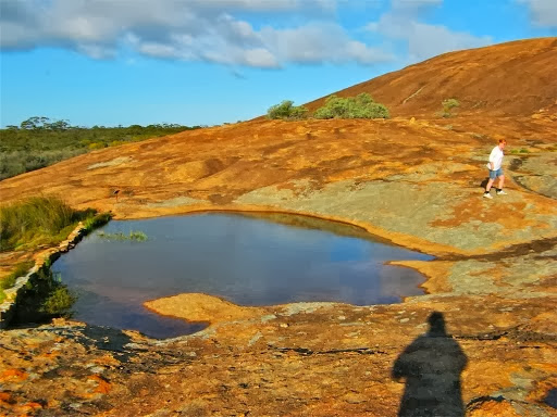
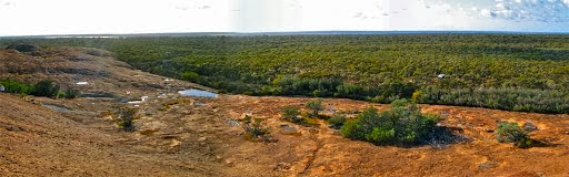
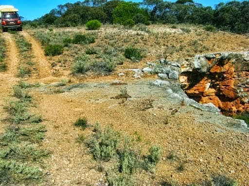
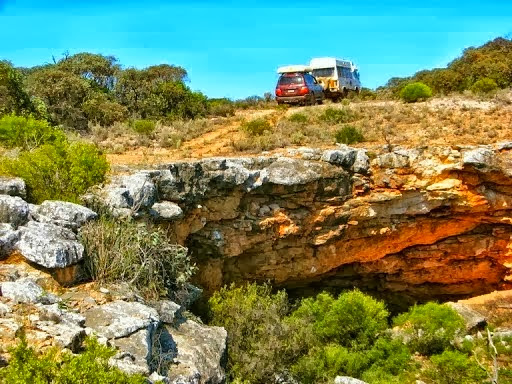
A few km up the old rough but navigable track, we spotted an un-signposted “feature” on the map and turned on to a very squeezy, winding overgrown track 3 km to a some awe-inspiring sinkholes, around 50m across.

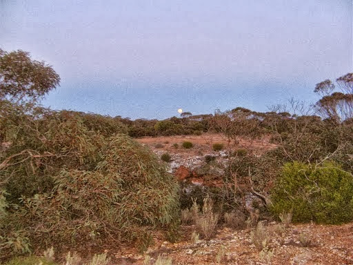
We made a great bush camp nearby while the full moon rose over the sinkhole.
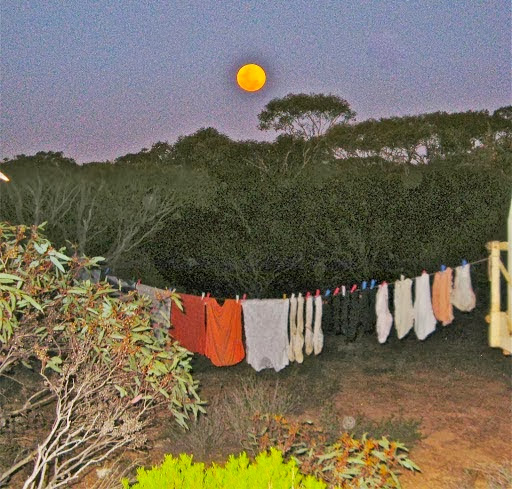
We did a bit of essential washing and hung it out to dry by moonlight. It didn’t work but it makes a good photo.
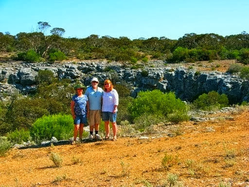
Next morning we took a drive around to the other sinkhole which could scramble down into. It was slightly scary having to drive over a wide overhang with a heavy Oka.
We made it back safely for a “thorn between 2 roses”memorial photo.
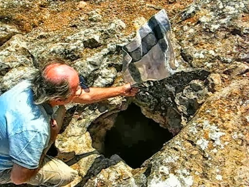
Back on the main track we found a good blowhole which I proved with the help of an old tea cloth. Note, must get a haircut while I still have some.
Further up the track we sought out and found some other caves on the plains.
Looking, looking...
Found it.
Judy found a quandong tree in fruit in the shelter of the cave.

Halfway along the Old Eyre Highway is Koonalda Homestead, once a thriving roadhouse. It has an extensive graveyard of old cars that didn’t quite make it up the track.
We used to have one of these!
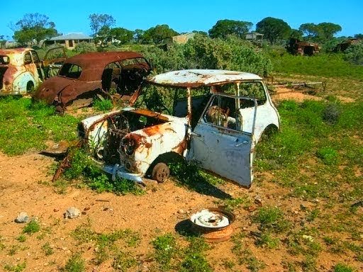
In 1975 we probably bought petrol from this pump. Oh what memories.
Out back of the homestead is a very powerful blowhole which the ladies amply demonstrated. Unfortunately they held on to their tee shirts to avoid any embarrassment.
I did the same thing with my shorts.
The first section of the Old Eyre Highway ends at the Nullarbor Roadhouse where the old and new highways merge.
20 Sept
We hadn’t planned it but the next section of the old highway is also still intact. It continues on from the Nullarbor Roadhouse and runs inland though the Yalata Aboriginal Reserve to Nundroo. Judy checked with the roadhouse manager and confirmed that it was navigable and that no permits were required, so we agreed to give it a go, but before that, there were a couple of other things to see around the Nullarbor area.
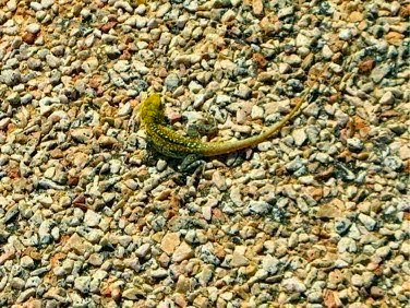
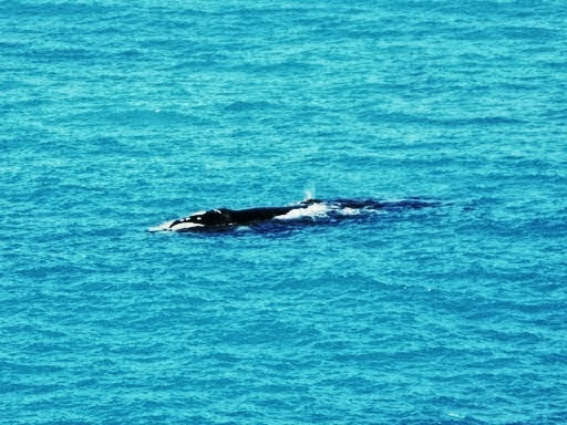
We took a trip out to the Head of the Bight where there were plenty of whales frolicking about.
But the first 2 creatures we saw weren’t whales, the first was a large brown snake heading across the car park, carefully guarded by a ranger lest any tourists got too close.
And the second were some small lizards picking flowers off the ground cover.

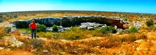
Bill and Judy told us about some caves that were accessible from a track at the back of the roadhouse so we set off up there.
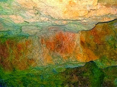
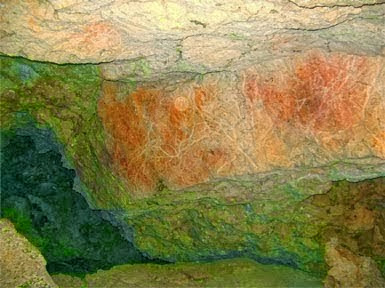
There were 3 caves in the Murrawijinie Cave system 10km north of Nullarbor. The first 2 were impressive but inaccessible sinkhole caves.
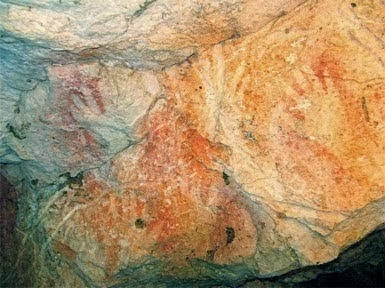
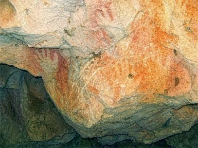
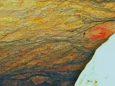
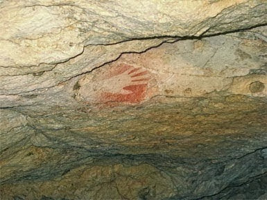
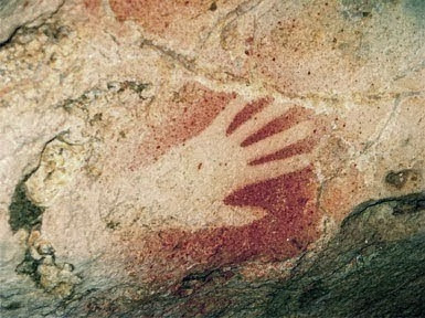
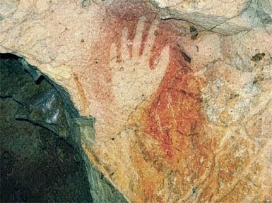
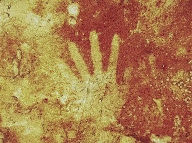
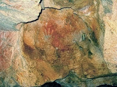
The third cave had a sloping rock filled entrance which I scrambled over and explored inside. Although I couldn’t see them initially, eventually Aboriginal hand paintings emerged from the gloom, a large number of them. I called Janet to change into some sensible shoes and come down to look. It was worth the effort.
Our conclusion that the Nullarbor is far from just a flat plain to be driven across as quickly as possible, it’s actually a huge area which demands exploration. It is not at all how John Edward Eyre described it. “A hideous anomaly, a blot on the face of nature, the place one goes to in bad dreams”.
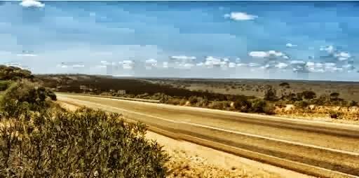
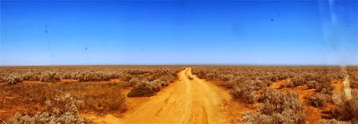
At 250,000 sq km, the Nullarbor Plain is twice the size of England and bigger than the whole of the UK. It’s also the largest single slab of limestone on earth and, on the surface at least, it certainly is a big, wide, flat expanse of nothingness.
Carrying on down the “new” Old Highway we passed through Ivy Tanks, an old roadhouse just NW of Yalata that we remember calling into in 1975. Sadly it’s now a complete ruin with rubbish everywhere and not even a flat space worth camping on so we moved on a few km and camped on the highway since we had seen no one else at all on either sections of old highway.
21 Sept
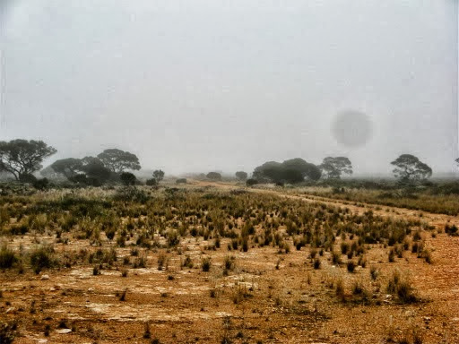
We woke today to a soggy misty morning. Everything was wet until the sun came out and burned the dew away to a very warm sunny day.
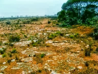
The white limestone looked like a sprinkling of ice and snow.
Later we completed the Old Eyre Highway through Yalata to the new highway a few km west of Nundroo Roadhouse. The old highway actually parallels the new one for many more km, in fact all the way to Kimba at least, criss-crossing the new highway several times, but there’s no point in driving that section since it leads nowhere else interesting.
On the final leg from Yalata, we came across a long abandoned scarrifier on the side of the track which B*ll (who shall be nameless), fancied the seat from, so a few minutes with a hacksaw and it was off. There were also a few loose chains and a spanner just hanging from it which were also saved for posterity.
The amount of BHP steel angle and iron oxide on the scarifier was most impressive. The steel spoked wheels should have been in a museum too.
The dingo-proof fence crossing
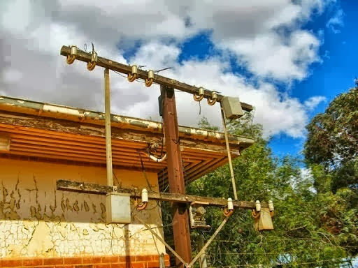
We also “found” a large number of old 19th century telegraph poles and wire laying on the roadside. They had all been cut down and abandoned and most of the antique insulators had been smashed.
We did discover a couple of unbroken ones which we saved for posterity, and one complete pole and insulator which accidentally roped itself securely to my bull-bar for the trip to Adelaide.
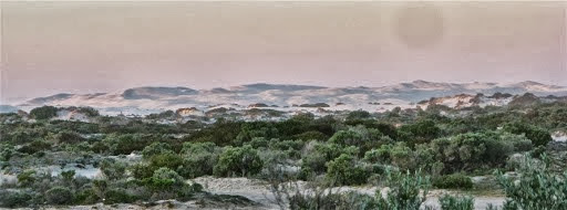
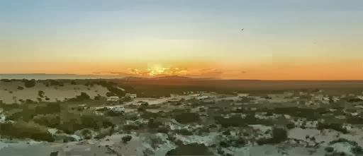
Later we joined the highway again and made our way to Fowlers Bay on the coast for some seaside R&R and camped at the local conservation park where we enjoyed some excellent sunset photos of the huge sand dunes which are slowly engulfing the small town.
22 Sept
Fowlers Bay. Funny, I thought that was yesterday so something is obviously wrong with my calendar.
23 Sept
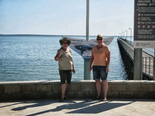
Ceduna
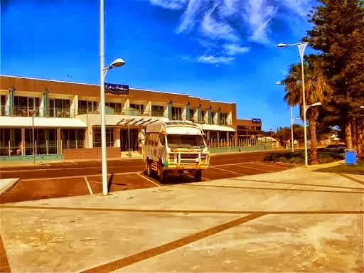
Our Oka living it up outside a new million dollar hotel in Ceduna, which was empty of guests.
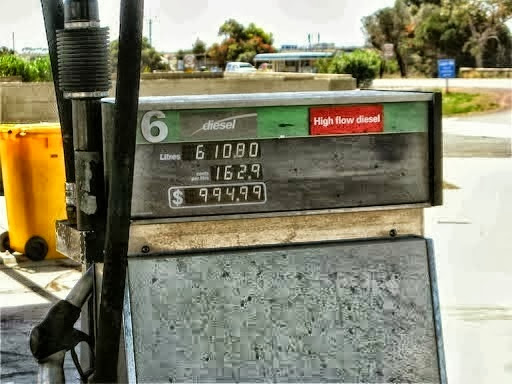
Someone had a large fuel bill.
We camped at a very nice campsite (but fly blown since it was hot and sticky today) that we had used in previous years at the Old Perlubie School Site and had a good campfire.
24 Sept
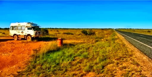
Bill and Judy came with us as far a Minnipa where they peeled off to visit some friends and see some of the Eyre Peninsular. We carried on and camped next to Lake Gilles, a very nice salt lake 10km east of Kimba, although this year it was partly filled with water.
Our Oka in its natural habitat.
25 Sept
We had a leisurely breakfast and then started off late from our Lake Gilles campsite after photoing the reflections in the flat lake water.
But by the time we reached Port Augusta, where, for the first time, we didn’t need to stop for any supplies, we realised we could easily make the final 300km and get home today instead of another overnight stop.
On the way down from Pt Augusta we witnessed this good bit of truck driving. He didn’t catch me up on the overtaking lane so he just sailed on by regardless.
On the Stuart Highway from Pt Augusta to Pt Wakefield. We are doing 90kph, but what do double white lines mean now?
Good bit of Truck Driving. from David and Janet on Vimeo.
After negotiating the peak hour Salisbury traffic we arrived home tired at 5pm after a 500km drive. Everything looked pretty much as we had left it, except that nature had been at work as usual on the garden and paddocks.
Epilogue
At 9 weeks and 11,300km, it’s been one of our shorter but more memorable trips. Major experiences have been:
- Uluru, Kata Juta and the Great Central Road
- Parts of Len Beadell tracks:
- The Gunbarrel Highway west from Geraldton Bore to Willuna,
- The western end of the Anne Beadell Highway from Laverton to Neale Junction (we’d previously done the whole of the Anne Beadell Highway in 2008),
- The southern section of the Connie Sue Highway from Neale Junction to Rawlinna and then across to Haig on the Trans-Aust Railway and down to Cocklebiddy.
- Hunt Oil Road between the Great Central Road and Gunbarrel Highway (including getting bogged for a day near Alexandra Spring),
- Shark Bay and Hamelin Pool stromatolites,
- Steep Point, the most westerly point of the Australian mainland and quite challenging to get to over 40km of sand dunes,
- The Dutch shipwreck coast,
- A great overnight visit to and around Tony and Fleur’s farm near Mingenew,
- An excellent week with Dave and Pauline in Bullsbrook,
- Meeting up with Bernard, our cousin-in-law in Perth,
- The cold and wet Margaret River area of WA,
- Cape Leeuwin, the most south-westerly point on the mainland,
- Tall timber country of Karri and Tingle wood forests along the south coast of WA,
- A weekend Oka Gathering at Brett’s farm in Harrismith,
- An interesting week with Bill and Judy exploring the unsealed highway sections of the Eyre Highway across the Nullarbor Plain,
To revisit our blog sections, use these links:
Westwards from Adelaide to Shark Bay