


Introduction
We have just completed a fascinating but sometimes exasperating trip to Cape York and Thursday Island then across the Gulf of Carpentaria to Western Australia.
3 1/2 months, 14,000 km, 2 boggings, 1 wheel bearing and 1 alternator bearing (on the same day), no punctures but a leaking power steering unit.

Our 2010 anti-clockwise trip route
The scenery was mostly great, although there were long stretches of nothingness between the good bits, and we had a catalog of annoying but small faults to rectify along the way. Mostly they were electrical this time, with a couple of mechanical ones thrown it. But considering the terrain we have covered and the pounding the car has taken, they, or something like them, are only to be expected.
On Cape York there are 2 ways of getting to the tip. The original Overland Telegraph Track (OTT), which is a direct but difficult route established in the 1870's, but never maintained, or a longer, more winding, but easier and prettier by-pass route. And in case you are wondering, no, we didn't take the Overland Telegraph Track to the tip, for 2 very good reasons:
- We had no wish to take unnecessary risks with our Oka, there would be plenty of creek crossings and other challenges which we really had to do, and
- There were far too many other people clogging up the narrow tracks to the crossings with their 4WDs and camper trailers (7-8 queued on each side), churning up the water and turning the banks to slippery mudslides. It just wouldn't have been fun.

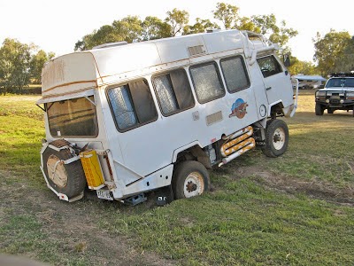
A ute tries a creek on the OTT. This is not our idea of fun

Elizabeth Creek on the Lawn Hill to Booroloola road. This was much more interesting, but just as challenging, but we crossed it without trouble, just a bow wave.
So we remained mobile for the most part and started writing these blogs in Kunnanurra before starting the long trek south to cold wet Adelaide.
Adelaide to Queensland |
Our trek from Adelaide took us to Broken Hill and then almost due north through Tibooburra into outback Queensland heading for Mareeba and the Peninsular Development Road to the tip of Cape York.
Well we turned left at Broken Hill and took the gravel road up to dusty Tibooburra. Then a day in the Sturt National Park and into Queensland to Noccundra which is not a town, just a pub.

Confusing road sign. Left and right I understand, but down?
Just before Quilpie we passed through Eromanga, which has the largest oil fields on the mainland and its own oil refinery. We filled up with genuine Aussie fuel at a remote unmanned and seemingly deserted fuel pump. However there were CCTV cameras around and the office to pay was about 500 m away in the centre of the oil refinery. It must hold the world record for number of arrowed "Office" signs along the way.
In Quilpie their water comes from artesian bores at 70ºC. None of the houses have hot water systems, they all have water cooling systems instead. Same applies to Blackall and other outback towns which rely on artesian bores.

Road Trains in the main street of Quilpie.
We spent the day in Quilpie and then headed north to Blackall. The weather was blue skies and sunny there, warm during the day (shorts and tee shirts) but very chilly at night.
Brownie Points, 3 pluses and a minus
Yesterday on the rough gravel from Tibooburra to Noccundra, we stopped to help a young German couple with a flat tyre on their 4WD. I fixed the puncture in 30 seconds and put the spare on for them since they couldn't get the jack under their car (I suggested they dig a hole for it next time, which they hadn't thought of), and happily off they went, to Perth from Cairns in a week!
Only 500m later there was a broken down Commodore on the side of the road. "Edward" (not his real name to hide his embarrassment, but similar) had 2 shredded tyres and his spare was soft. He should never have been on those roads with that kind of vehicle. We fixed his spare but couldn't do anything about the shredded tyres. So we had no option but to take all his details and leave him there while we drove another 120 kms to the nearest phone at Noccundra. He had supplies for a week but no outback car sense. He said the car had been serviced but the spare was bald, and going down.
We called the RACQ and gave them his location and details and they arranged to send a tow truck 240 km from Thargomindah to help him. Hopefully that all happened, but we had no way of knowing.
It was thus that we earned 2 set's of brownie points, but wait, there were more.
The Lost Earthmover
On the way to Eromanga, we were stopped by a huge earth mover/scraper who was lost. He was looking for the Jackson oil field but didn't know where he was or where it was. He was presumably too embarrassed to call in on his radio (imagine the shame), so we used our moving map navigation system to explain where he was and where he had to go and he went away happy.

The "Lost" Earthmover
Hopefully, someone will stop for us when we have a problem, and they did, when we reached Blackall. Our brownie points were then even.
Bogged in Blackall
After helping a couple of stranded motorists and a lost earth-mover the other day, we got bogged in a rest area in the middle of Blackall, in full view of all the caravanners.

It didn't look soft...
We crossed the rest area and went across what I thought was a small sandy dip across the park. Unfortunately it turned out to be the outlet for a small creek to the Barcoo River. The front wheels went across fine but the rear wheels went down to the axles. No amount of 4WD would get us out.
We would have extricated ourselves using our recovery gear and a lot of hard labour, but before we could start, a good Samaritan appeared with a Landcruiser and with a bit of towing assistance we drove out quite easily. He said he had almost done the same thing himself and was on his way to help us even before it happened.
How would we have got out by ourselves? We would have used our hub adaptor and hi-lift jack to directly raise the rear wheels off the ground. This would have meant digging out and stabilising a flat section of ground for the jack plate to stand on. Then we'd have laid rocks, branches and/or sand mats down under the wheels to provide a firmer base and just driven out. (We subsequently did almost exactly this when we got bogged in wet mud in Alice Springs towards the end of the trip). If that had proven difficult, I would have changed the rear wheels for the some which had a more aggressive tread pattern. But it was much simpler just to be towed out.
As a result of this experience, I moved some of our recovery gear (hub lifting adaptors, wheel brace, D-shackles, snatch strap, critical spanners/sockets etc) to places accessible from within the Oka, since I would not have been able to get the rear hatch open easily in this situation to get things out. I would have had to remove the gate, which is very time consuming.
This is also another experience where a winch alone would have been of negligible assistance, the nearest tree being 100 m away (and digging holes to bury wheels or anchors is a difficult last resort). So I'm still not convinced of the benefit of carrying 100 kg of winch around the country for the very few times it would actually be useful. Better (in hindsight) not to get into difficult situations in the first place. Note to self: Read my own words.
So we are now even in brownie points, but we were to earn more points on a later incident west of Katherine, a shredded trailer tyre, again.
From Blackall we went due north from Isisford to Ilfracombe and then west to Longreach. Most roads up here are either black soil roads (smooth when dry, gooey sticky impassable messes when wet. Currently they are dry but not worth the risk).
The road to Ilfracombe is a single lane bitumen road but rougher than some gravel roads. There are tons of creek crossings but they are all dry except during or just after rains. There is a lot of water from the recent floods lying alongside the tracks but very little still across the roads.

This track ahead is still very much closed. Luckily a by-pass track has been built to the right.
At Ilfracombe there is a mile long machinery museum along side the road with huge numbers of old tractors, cars, carts, steam engines etc. Well worth the diversion but we'd seen it all before so I wasn't allowed to stop. We stayed in Hughenden for a couple of days because everything is shut on a weekend in Queensland and especially a public holiday version.

Under a huge windmill at Hughenden.
But the weather is warming up a bit during the day but very chilly at night. There are even frost warnings for some places. We stayed in Muttaburra last night, a very small scruffy outback town. It's only claim to fame is that a world famous dinosaur fossil was found there in 1963 and is called the Muttaburrasaurus.
This whole area of outback Queensland is famous for dinosaur fossils, and every town has its own local variety. Of course the originals are not here, they have been purloined for the Queensland Museum in Brisbane, but they are graciously allowed to display replicas in the towns where they were discovered. How nice of them.

Me with a Muttaburrasaurus
We camped alongside a very nice creek near Einasleigh, Queensland, 200 km north of Hughenden. No further dramas since the "Bogged in Blackall" situation and we are about 2/3rds of the way to the Cape. We've done about 2800 kms. The Nextg phone works well (with a tall external antenna on a pole) even if the data rate is a bit slow. After Hugheneden we spent a day at Porcupine Gorge and then headed north along the Kennedy Highway.

Us at Porcupine Gorge

Me overlooking Porcupine Gorge

Road Train on the Kennedy Highway. It got a bit dusty.
Savannahlander |
As we drove north we kept seeing signs to towns like Einasleigh and Forsayth and knowing that friends Mike and Margaret are doing a train trip in the area later this year we investigated further.
Well, we saw the railway line on the map as we went up the Kennedy Development Road to wards The Lynd Junction and diverted towards Einasleigh. There the railway line crosses a superb wooden-looking (actually steel) bridge just outside the town across the Copperfield River.
It looked like a trial run for the Bridge over the River Kwai and has recently been reconstructed, but no sign of Alec Guinness anywhere so we don't know why. (Postscript, we learned later that the bridge had been seriously damaged in severe floods in 2002/3. The water was above the track level and the bridge was bent sideways, hence the reconstruction work).

Railway bridge over the Copperfield River
Einasleigh is a lovely neat, quiet, little town (if you stand still in the middle of town it's totally silent and nothing moves) and assuming the train stops there long enough to disembark, a 200 m walk to the pub would be good, and only 200 m further on is the magnificent Copperfield Gorge. Just the place to walk off a pub lunch. Easy to access and made of a huge sheet of lava with a very pretty river carved into the middle of it over which the bridge goes. A really nice area.

Copperfield Gorge
From there the road follows the railway line fairly closely to Forsayth where it ends. Along the way the rail track seemed very overgrown in places and looked like 2 pieces of galvanised fencing wire draped along the ground. But I suppose Queensland Railways know what they are doing?

The "galvanised fencing wire" near Mt Surprise

The end of the line at Forsayth.
Forsayth is bigger than Einasleigh but not as pretty and a bit more dusty. Don't know if M&M are staying there or going straight on to Croydon by bus/coach or private jet. The road to Georgetown is mostly gravel and a bit rough and dusty in places. Plenty of cool drinks will be required, it will be hot in October, it's getting pretty warm here now.

Looking back towards Cairns
According to the sign, the Savannahlander (or Savannah Lander, as one sign says, as if it's some sort of space craft) starts in Cairns but has a spur up to Chillagoe from Almaden. There are some very good caves in Chillagoe.
I took a few relevant photos of the line and Einasleigh and Forsayth railway stations.

Einersleigh Railway Station
As it happened, one night we were camped on the Old Savannah Way about 20km north of Mount Surprise, at the exact spot where the road crosses the track, and it was Friday and as it further happened, tomorrow was Saturday and the Savannahlander was due to leave Mount Surprise and pass that very spot around 8.30 in the morning, I was up with the Lark (or Brolga, as they are called up here) to take even more pics.

There didn't seem to be a fitting caption for this photo.
Sure enough, the Savannahlander did pass by our campsite at 8.45 am, in fact we saw it stopped for lunch at 12 noon at Almaden station when we got there, and again at 3 pm at Dimbulah where we actually got their first, all without any advanced planning.

It's coming.

The Svannahlander passes our campsite, right on schedule

Savannahlander and us at Dimbulah
From Dimbulah it's only a short drive to Mareeba where we stopped for a few days to prepare for our thrust up to Cape York.
No comments:
Post a Comment